
Cycling in Lajen
Discover a map of 80 cycling routes and bike trails near Lajen, created by our community.
Region portrait
Get to know Lajen
Find the right bike route for you through Lajen, where we've got 80 cycle routes to explore. Most people get on their bikes to ride here in the months of May and July.
7,997 km
Tracked distance
80
Cycle routes
865
Population
Community
Most active users in Lajen


From our community
The best bike routes in and around Lajen
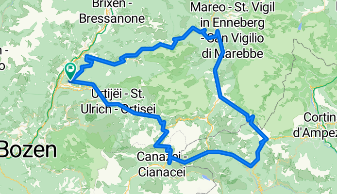

Dolomiti Ronda Grande
Cycling route in Lajen, Trentino-Alto Adige, Italy
- 329.7 km
- Distance
- 8,889 m
- Ascent
- 8,889 m
- Descent

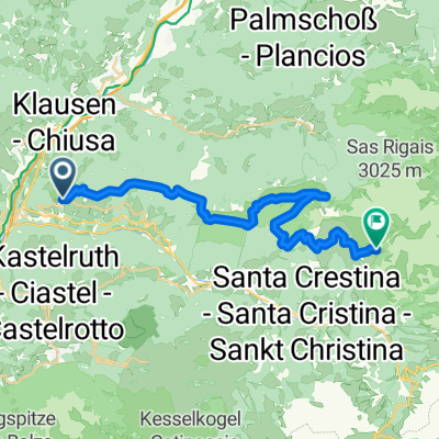
Sellaronda von St. Peter aus
Cycling route in Lajen, Trentino-Alto Adige, Italy
Sellaronda von St. Peter aus
- 91.4 km
- Distance
- 2,969 m
- Ascent
- 2,882 m
- Descent

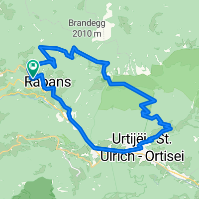
seiseralm
Cycling route in Lajen, Trentino-Alto Adige, Italy
- 56.8 km
- Distance
- 1,951 m
- Ascent
- 1,951 m
- Descent
Discover more routes
 IT-ST-Ulrich, Sella Ronda
- Distance
- 91.1 km
- Ascent
- 2,485 m
- Descent
- 2,481 m
- Location
- Lajen, Trentino-Alto Adige, Italy
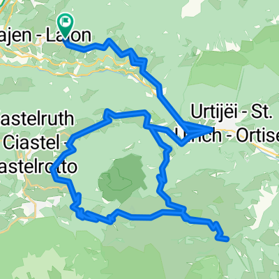
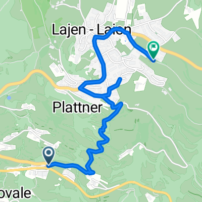 Gornegg-Lajen 001
- Distance
- 2.4 km
- Ascent
- 276 m
- Descent
- 12 m
- Location
- Lajen, Trentino-Alto Adige, Italy
 seiseralm
- Distance
- 56.8 km
- Ascent
- 1,895 m
- Descent
- 1,895 m
- Location
- Lajen, Trentino-Alto Adige, Italy
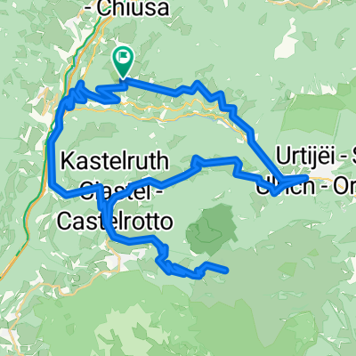
 St. Peter-St. Ulrich-Raschötz-St. Peter
- Distance
- 23.2 km
- Ascent
- 1,123 m
- Descent
- 1,123 m
- Location
- Lajen, Trentino-Alto Adige, Italy
 Lajen 04 27.5 Albions
- Distance
- 27.4 km
- Ascent
- 972 m
- Descent
- 970 m
- Location
- Lajen, Trentino-Alto Adige, Italy
 Laion - Grödner Joch - Campolongopass - Livinallongo del Col di Lana
- Distance
- 56.5 km
- Ascent
- 1,552 m
- Descent
- 1,156 m
- Location
- Lajen, Trentino-Alto Adige, Italy
 Ronda Trentino - 1. Tag
- Distance
- 27.5 km
- Ascent
- 1,795 m
- Descent
- 854 m
- Location
- Lajen, Trentino-Alto Adige, Italy
 Lajen 03 55.5 Seiseralm Pufels
- Distance
- 55.5 km
- Ascent
- 2,066 m
- Descent
- 2,067 m
- Location
- Lajen, Trentino-Alto Adige, Italy