
Cycling in Balzo
Discover a map of 35 cycling routes and bike trails near Balzo, created by our community.
Region portrait
Get to know Balzo
Find the right bike route for you through Balzo, where we've got 35 cycle routes to explore.
1,312 km
Tracked distance
35
Cycle routes
123
Population
Community
Most active users in Balzo


From our community
The best bike routes in and around Balzo

Montegallo-sent.mietitori-Forca di Presta-Rifugio Le Cese-Castelluccio
Cycling route in Balzo, The Marches, Italy
Da Balzo ci si dirige verso Astorara e, proseguendo dopo Il bivio per Colleluce, ci si immette sul Sentiero dei Mietitori, arrivando a Forca di Presta. Passando davanti al Rifugio degli Alpini, si prosegue per il Rfugio Le Cese e, successivamente, il Rifugio Perugia. Si torna leggermente indietro e si prende a dx un sentiero che attraversa tutto Pian Piccolo fino ad incrociare la SP di Castelluccio. Si oltrepassa entrando nella Piana di Pian Perduto aggirando sulla dx Castelluccio, sbucando Sulla SP 47. Si gira a sx e si risale a Castelluccio
- 39 km
- Distance
- 1,069 m
- Ascent
- 526 m
- Descent

Montegallo-Forca di Presta (asfalto)-giro dei Rifugi su sterrato-Piani su sterrato-Castelluccio
Cycling route in Balzo, The Marches, Italy
Da Albergo Vettore di Montegallo si raggiunge Forca di Presta su asfalto. Passando Davanti al Rifugio degli Alpini INIZIA lo sterrato Che ci porterà al Rifugio Le Cese, il Rifugio Minti del Sole fino ad incrociare lo sterrato Che Scende a Pian Piccolo. Lo percorriamo e raggiungiamo asfalto che sale a Forca di Presta, attraversiamo e sempre su sterrato percorriamo Pian Perduto, sbucando dietro Castelluccio. Lo raggiungiamo percorrendo la SP 47/2
- 36.6 km
- Distance
- 1,132 m
- Ascent
- 532 m
- Descent

Zona A • La Valle di Pilato, laghi esclusi
Cycling route in Balzo, The Marches, Italy
- 4.8 km
- Distance
- 237 m
- Ascent
- 637 m
- Descent

Discover more routes
 Montegallo - Castelluccio
- Distance
- 21.3 km
- Ascent
- 1,136 m
- Descent
- 581 m
- Location
- Balzo, The Marches, Italy
 Piano Grande
- Distance
- 61.6 km
- Ascent
- 1,598 m
- Descent
- 1,607 m
- Location
- Balzo, The Marches, Italy
 PdMTB-18-S1.3
- Distance
- 10 km
- Ascent
- 103 m
- Descent
- 1,142 m
- Location
- Balzo, The Marches, Italy
 Italia 2018- Stage 11: Montegallo - Fiastra
- Distance
- 76.2 km
- Ascent
- 1,712 m
- Descent
- 1,949 m
- Location
- Balzo, The Marches, Italy
 GAS_Tappa3: Amandola_Montegallo
- Distance
- 32 km
- Ascent
- 598 m
- Descent
- 1,156 m
- Location
- Balzo, The Marches, Italy
 USCERNO-MONTEGALLO-ARQUATA-FORCA_CANAPINE_CASTELLUCCIO_FORCA_DI_FRESTA-MONTEGALLO-USCERNO
- Distance
- 82.3 km
- Ascent
- 1,885 m
- Descent
- 1,885 m
- Location
- Balzo, The Marches, Italy
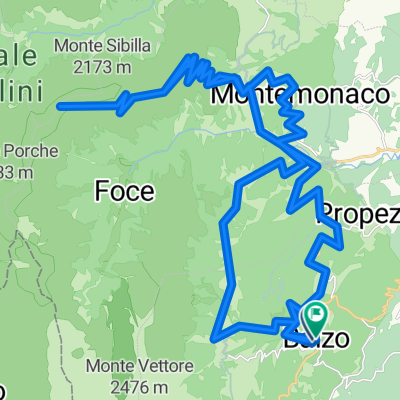 monte sibilla
- Distance
- 58.1 km
- Ascent
- 2,005 m
- Descent
- 1,996 m
- Location
- Balzo, The Marches, Italy
 Da SP151, Montegallo a SP151, Montegallo
- Distance
- 2.3 km
- Ascent
- 176 m
- Descent
- 181 m
- Location
- Balzo, The Marches, Italy