


Cycling in Sankt Katharinen
Discover a map of 37 cycling routes and bike trails near Sankt Katharinen, created by our community.
Region portrait
Get to know Sankt Katharinen
Find the right bike route for you through Sankt Katharinen, where we've got 37 cycle routes to explore.
2,522 km
Tracked distance
37
Cycle routes
3,534
Population
Community
Most active users in Sankt Katharinen
Handpicked routes
Discover Sankt Katharinen through these collections
From our community
The best bike routes in and around Sankt Katharinen
up and down
Cycling route in Sankt Katharinen, Rhineland-Palatinate, Germany
- 59.4 km
- Distance
- 772 m
- Ascent
- 772 m
- Descent
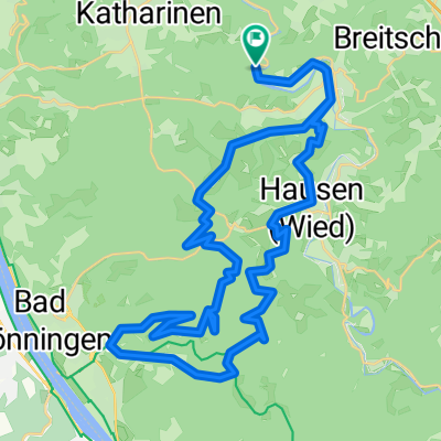
kleine runde
Cycling route in Sankt Katharinen, Rhineland-Palatinate, Germany
- 20.1 km
- Distance
- 332 m
- Ascent
- 332 m
- Descent
kleine runde 2
Cycling route in Sankt Katharinen, Rhineland-Palatinate, Germany
- 36.4 km
- Distance
- 592 m
- Ascent
- 530 m
- Descent
Oberhoppen-Manrother See-Oberlahr-Neustadt 37km 490Hm
Cycling route in Sankt Katharinen, Rhineland-Palatinate, Germany
- 39.1 km
- Distance
- 671 m
- Ascent
- 674 m
- Descent
Discover more routes
- All routes in Sankt Katharinen
- Round trips
- Relaxed
- Gravel
- Road
- MTB
- Trekking

 Arnsau 2016 MTB - West - 39km 900hm0
- 39.2 km
- 908 m
- 908 m
- Sankt Katharinen, Rhineland-Palatinate, Germany
 Asbacher Straße, Sankt Katharinen (Landkreis Neuwied) nach Asbacher Straße, Sankt Katharinen (Landkreis Neuwied)0
- 10.5 km
- 205 m
- 205 m
- Sankt Katharinen, Rhineland-Palatinate, Germany
 up and down CLONED FROM ROUTE 8460420
- 59.4 km
- 772 m
- 772 m
- Sankt Katharinen, Rhineland-Palatinate, Germany

 Arnsau 2016 MTB - West - 43km 900hm0
- 43.5 km
- 933 m
- 933 m
- Sankt Katharinen, Rhineland-Palatinate, Germany
 Von Sankt Katharinen bis Hausen (Wied)0
- 17.1 km
- 368 m
- 338 m
- Sankt Katharinen, Rhineland-Palatinate, Germany
 Wiedbachtal-Holzbachtal-Sayntal-Rheintal und zurück0
- 99.5 km
- 997 m
- 946 m
- Sankt Katharinen, Rhineland-Palatinate, Germany


