
Cycling in Meiners Oaks
Discover a map of 31 cycling routes and bike trails near Meiners Oaks, created by our community.
Region portrait
Get to know Meiners Oaks
Find the right bike route for you through Meiners Oaks, where we've got 31 cycle routes to explore. Most people get on their bikes to ride here in the month of August.
579 km
Tracked distance
31
Cycle routes
3,571
Population


From our community
The best bike routes in and around Meiners Oaks

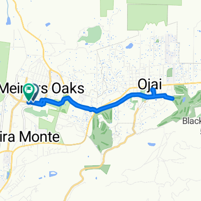
Wheeler Ojai
Cycling route in Meiners Oaks, California, United States
- 57 km
- Distance
- 1,673 m
- Ascent
- 1,674 m
- Descent

r206 ROAM CLONED FROM ROUTE 800087
Cycling route in Meiners Oaks, California, United States
<span style="font-family: Arial, Helvetica, sans-serif; font-size: 11px;">wheeler springs campground-sespe creek-conover-lake of the woods-pinion pines estates-pine mountain club-vale vista camp</span>
- 137.5 km
- Distance
- 2,690 m
- Ascent
- 1,446 m
- Descent

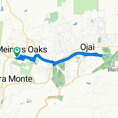
Snail-like route in Ojai
Cycling route in Meiners Oaks, California, United States
- 21.6 km
- Distance
- 568 m
- Ascent
- 587 m
- Descent

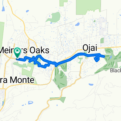
Restful route in Ojai
Cycling route in Meiners Oaks, California, United States
- 28 km
- Distance
- 184 m
- Ascent
- 347 m
- Descent
Discover more routes
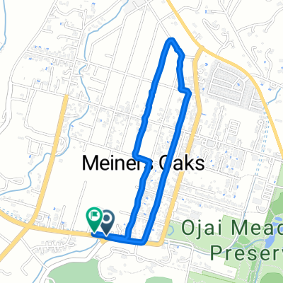
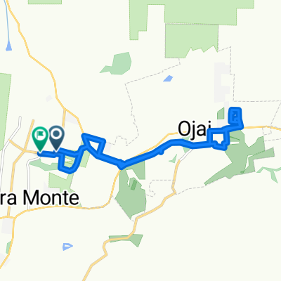
 Ojai Valley Trail to Ojai Retreat &Inn
- Distance
- 5.4 km
- Ascent
- 30 m
- Descent
- 34 m
- Location
- Meiners Oaks, California, United States
 Route to 163–169 W Lomita Ave, Ojai
- Distance
- 0.3 km
- Ascent
- 0 m
- Descent
- 4 m
- Location
- Meiners Oaks, California, United States
 El Sol Avenue to El Sol Avenue
- Distance
- 11 km
- Ascent
- 127 m
- Descent
- 94 m
- Location
- Meiners Oaks, California, United States
 El Sol Avenue to El Sol Avenue
- Distance
- 10.5 km
- Ascent
- 145 m
- Descent
- 104 m
- Location
- Meiners Oaks, California, United States
 El Sol Avenue to El Sol Avenue
- Distance
- 3.2 km
- Ascent
- 50 m
- Descent
- 14 m
- Location
- Meiners Oaks, California, United States
 El Sol Avenue to El Sol Avenue
- Distance
- 12.1 km
- Ascent
- 129 m
- Descent
- 92 m
- Location
- Meiners Oaks, California, United States
 South Pueblo Avenue to West Lomita Avenue
- Distance
- 14.6 km
- Ascent
- 150 m
- Descent
- 113 m
- Location
- Meiners Oaks, California, United States
 15345–15373 Maricopa Hwy, Ojai to Faria Rd, Ventura
- Distance
- 36.1 km
- Ascent
- 152 m
- Descent
- 424 m
- Location
- Meiners Oaks, California, United States