
Cycling in Bay City
Discover a map of 9 cycling routes and bike trails near Bay City, created by our community.
Region portrait
Get to know Bay City
Find the right bike route for you through Bay City, where we've got 9 cycle routes to explore.
170 km
Tracked distance
9
Cycle routes
1,286
Population
Community
Most active users in Bay City


From our community
The best bike routes in and around Bay City
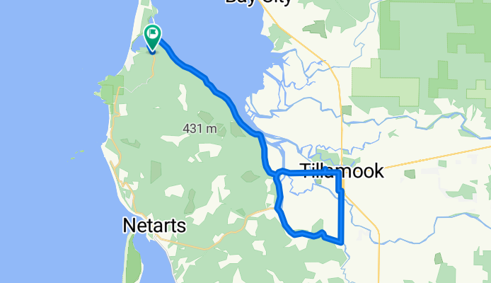
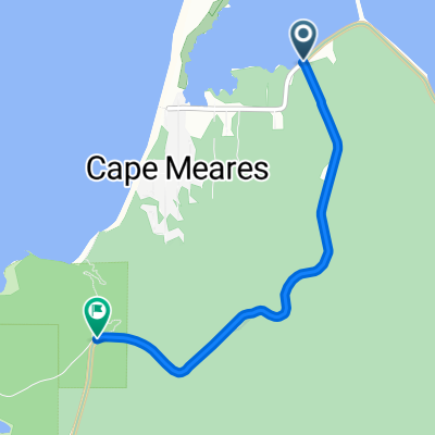
Hospital to cape meares
Cycling route in Bay City, Oregon, United States of America
hospital to cape meares, back to frazier road, the. Back to hospital.
- 28.8 km
- Distance
- 206 m
- Ascent
- 206 m
- Descent
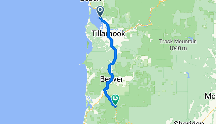
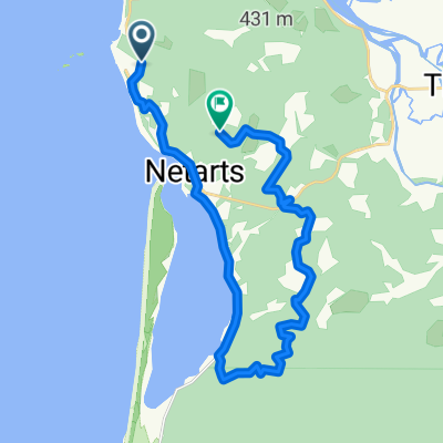
iDay 14
Cycling route in Bay City, Oregon, United States of America
- 48.3 km
- Distance
- 264 m
- Ascent
- 171 m
- Descent
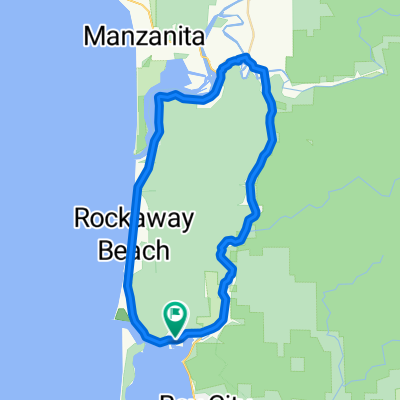
45.489° N -123.965° W to 45.489° N -123.965° W
Cycling route in Bay City, Oregon, United States of America
- 13.1 km
- Distance
- 340 m
- Ascent
- 338 m
- Descent
test
Cycling route in Bay City, Oregon, United States of America
test
- 0.1 km
- Distance
- 0 m
- Ascent
- 0 m
- Descent
Discover more routes
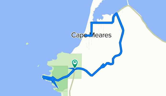
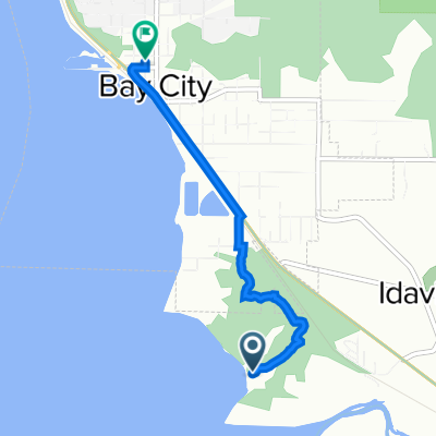
 Cape Meares
- Distance
- 3.2 km
- Ascent
- 242 m
- Descent
- 78 m
- Location
- Bay City, Oregon, United States of America
 Loop 1
- Distance
- 24.3 km
- Ascent
- 377 m
- Descent
- 346 m
- Location
- Bay City, Oregon, United States of America
 Garibaldi // Nehalem
- Distance
- 45.7 km
- Ascent
- 654 m
- Descent
- 654 m
- Location
- Bay City, Oregon, United States of America
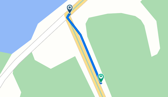
 Tillamook to 9335 Fourth St, Bay City
- Distance
- 3.1 km
- Ascent
- 10 m
- Descent
- 13 m
- Location
- Bay City, Oregon, United States of America
 test 2
- Distance
- 3.2 km
- Ascent
- 220 m
- Descent
- 56 m
- Location
- Bay City, Oregon, United States of America