
Cycling in Chilliwack
Discover a map of 222 cycling routes and bike trails near Chilliwack, created by our community.
Region portrait
Get to know Chilliwack
Find the right bike route for you through Chilliwack, where we've got 222 cycle routes to explore. Most people get on their bikes to ride here in the months of July and August.
52,189 km
Tracked distance
222
Cycle routes
77,000
Population
Community
Most active users in Chilliwack


From our community
The best bike routes in and around Chilliwack


Chilliwack to Hope
Cycling route in Chilliwack, British Columbia, Canada
Despite the light rain that we faced during much of today’s ride, it turned out to be a pretty great route, with one small unavoidable exception.
First, as we started out from the south part of Chilliwack, we probably went seven or eight miles before finally leaving the town. Despite a lot of urban riding, we were almost continually on cycling trails or streets with cycling lanes. The only road without a cycling lane was Chilliwack Central Road, but it had sufficiently light traffic and was wide enough that this was not a problem.
The one unavoidable exception was the bridge crossing the Fraser River on Highway 9. While the highway itself had excellent shoulder for bicycles, the bridge was clearly constructed well prior to today’s wider automobiles and any desire to provide room for pedestrians or bicycles. Despite that, there were (fortunately) signs warning drivers that bicycles and pedestrians have a right to the bridge as well.
Getting onto Highway 7, we found a great relatively low-trafficked road with excellent shoulder and some nice scenery. It was an easy, mostly flat ride to the Highway 1 bridge into Hope.
- 65.3 km
- Distance
- 816 m
- Ascent
- 802 m
- Descent


Chilliwack - Circle toward Chilliwack Lake
Cycling route in Chilliwack, British Columbia, Canada
Circle on Chilliwack Lake Rd east from Chilliwack toward the lake. Turned around at the 14 mile point (well short of the lake) and went back by same route. Nice ride, with some nice scenery. The river in places is very pretty. Good bike path/lane for first half of ride. The rest was a reasonably wide road with relatively light traffic. We rode this on a weekday in late May. The traffic going to the lake would probably be higher in summer and maybe on weekends in the spring and fall when there's good weather.
- 45 km
- Distance
- 457 m
- Ascent
- 457 m
- Descent


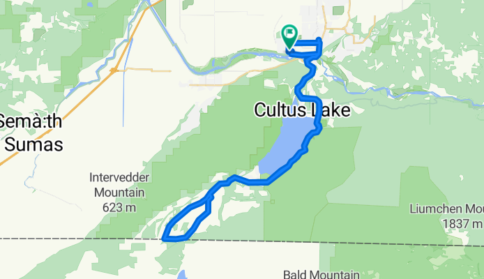
Chilliwack - Circle to Canadian-US border via Lake Cultus, Henderson Rd, and Maple Falls Rd.
Cycling route in Chilliwack, British Columbia, Canada
Overall, this was a pretty nice ride. (This was the second time that we did most of this ride.) There was too much traffic in the first part of the ride, but after passing south of Lake Cultus, the traffic was gone almost completely.
We rode this in late May. Considering all the camping and tourist attractions by the lake, we can imagine that the traffic up to the end of the lake will be terrible during the summer tourist season.
For the portions of the ride with traffic, there was generally good shoulder to ride on. After the lake, we didn't need any road shoulder. That part was close to nirvanna.
- 44 km
- Distance
- 532 m
- Ascent
- 545 m
- Descent


Chilliwack - Circle to Canadian-US border via Lake Cultus and Iverson Rd
Cycling route in Chilliwack, British Columbia, Canada
Overall, this was a pretty nice ride. There was too much traffic in the first part of the ride, but after passing south of Lake Cultus, the traffic was gone almost completely.
We rode this in late May. Considering all the camping and tourist attractions by the lake, we can imagine that the traffic up to the end of the lake will be terrible during the summer tourist season.
For the portions of the ride with traffic, there was generally good shoulder to ride on. After the lake, we didn't need any road shoulder. That part was close to nirvanna.
- 44.8 km
- Distance
- 777 m
- Ascent
- 774 m
- Descent
Discover more routes
 duck route
- Distance
- 72.1 km
- Ascent
- 335 m
- Descent
- 344 m
- Location
- Chilliwack, British Columbia, Canada
 bikey mcfunstein
- Distance
- 72.1 km
- Ascent
- 553 m
- Descent
- 449 m
- Location
- Chilliwack, British Columbia, Canada
 ferry loop
- Distance
- 34 km
- Ascent
- 58 m
- Descent
- 56 m
- Location
- Chilliwack, British Columbia, Canada
 Slow ride in Chilliwack
- Distance
- 10.6 km
- Ascent
- 3 m
- Descent
- 5 m
- Location
- Chilliwack, British Columbia, Canada
 最後一天
最後一天- Distance
- 120.3 km
- Ascent
- 562 m
- Descent
- 567 m
- Location
- Chilliwack, British Columbia, Canada
 kilby
kilby- Distance
- 7.6 km
- Ascent
- 65 m
- Descent
- 69 m
- Location
- Chilliwack, British Columbia, Canada
 Slow ride in Chilliwack
- Distance
- 21.2 km
- Ascent
- 34 m
- Descent
- 70 m
- Location
- Chilliwack, British Columbia, Canada
 Relaxed route in Chilliwack
- Distance
- 6.4 km
- Ascent
- 9 m
- Descent
- 12 m
- Location
- Chilliwack, British Columbia, Canada