
Cycling in Cranbrook
Discover a map of 37 cycling routes and bike trails near Cranbrook, created by our community.
Region portrait
Get to know Cranbrook
Find the right bike route for you through Cranbrook, where we've got 37 cycle routes to explore. Most people get on their bikes to ride here in the months of July and August.
3,248 km
Tracked distance
37
Cycle routes
18,610
Population
Community
Most active users in Cranbrook

From our community
The best bike routes in and around Cranbrook

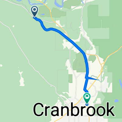
TCT Sectional/ Cranbrook to Wardner
Cycling route in Cranbrook, British Columbia, Canada
This route starts off at the Cranbrook Pavilion, along Cranbrook Rotary Way, on the Isadore Canyon Rail Trail for 13 km. 7km on the shoulder of Hwy 3. Then on the rural paved Ha Ha Creek Road into Wardner.
20 km of this route is paved.
For more detail info refer to Bruce Obee's official guidebook The Trans Canada Trail-BC
refer to pages 302-303
book mileage start- 30.6 km- TCT Pavilion
book mileage end-67.8 km Wardner Park
- 38.1 km
- Distance
- 107 m
- Ascent
- 279 m
- Descent

CranbrookRailTrailMissionWycliffeLoop CLONED FROM ROUTE 531251
Cycling route in Cranbrook, British Columbia, Canada
This scenic paved road route crosses the St. Mary's River twice. This is a very scenic route that goes by the St. Eugene Mission Resort and Golf Course then climbs through open meadows that provide many fine vista views of the Rocky Mountain Trench
- 28 km
- Distance
- 271 m
- Ascent
- 269 m
- Descent

Canada Day 18A: Cranbrook to Kimberley to Kootenay Bay to Nelson
Cycling route in Cranbrook, British Columbia, Canada
20.07.2012 (Friday)
Sample:
(from bad "-5" to good "+5")
----- / +++++
Traffic:
Weather:
Beautiful:
some day again: Y / N
- 152.8 km
- Distance
- 1,322 m
- Ascent
- 1,655 m
- Descent

Medio Fondo
Cycling route in Cranbrook, British Columbia, Canada
This is the ride for the Kootenay Rockies Fondo.
- 102 km
- Distance
- 717 m
- Ascent
- 717 m
- Descent
Discover more routes
 Interm (proposed) regional cycle route Cranbrook to Kimberly, BC
- Distance
- 27.8 km
- Ascent
- 370 m
- Descent
- 147 m
- Location
- Cranbrook, British Columbia, Canada
 Across Canada Trails - Proposed Paved Route - Cranbrook to Fernie, BC
- Distance
- 109.1 km
- Ascent
- 1,278 m
- Descent
- 1,207 m
- Location
- Cranbrook, British Columbia, Canada
 hgjhvv
- Distance
- 8.9 km
- Ascent
- 75 m
- Descent
- 68 m
- Location
- Cranbrook, British Columbia, Canada
 21 Avenue North 252, Cranbrook to V1A, Kimberley
- Distance
- 33.5 km
- Ascent
- 896 m
- Descent
- 558 m
- Location
- Cranbrook, British Columbia, Canada
 Can11 Cranbrook Sparwood
- Distance
- 132.4 km
- Ascent
- 603 m
- Descent
- 382 m
- Location
- Cranbrook, British Columbia, Canada
 18 55+ Road Race Course
- Distance
- 13.6 km
- Ascent
- 152 m
- Descent
- 152 m
- Location
- Cranbrook, British Columbia, Canada
 Option 2 Cranbrook -Creston
- Distance
- 109.5 km
- Ascent
- 437 m
- Descent
- 708 m
- Location
- Cranbrook, British Columbia, Canada
 Recovered Route
- Distance
- 36.6 km
- Ascent
- 424 m
- Descent
- 435 m
- Location
- Cranbrook, British Columbia, Canada