
Cycling in Guelph
Discover a map of 502 cycling routes and bike trails near Guelph, created by our community.
Region portrait
Get to know Guelph
Find the right bike route for you through Guelph, where we've got 502 cycle routes to explore. Most people get on their bikes to ride here in the months of May and June.
18,762 km
Tracked distance
502
Cycle routes
115,760
Population
Community
Most active users in Guelph


Handpicked routes
Discover Guelph through these collections
Tour
Tour
From our community
The best bike routes in and around Guelph

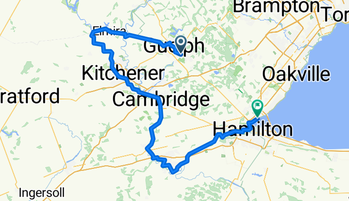
Guelph - Cambridge + Cambridge - Ancaster (1/2) (1/2) + Guelph - Cambridge + Cambridge - Ancaster (1/2) (2/2) + Guelph - Cambridge + Cambridge - Ancaster (2/2)
Cycling route in Guelph, Ontario, Canada
- 55.1 km
- Distance
- 192 m
- Ascent
- 200 m
- Descent

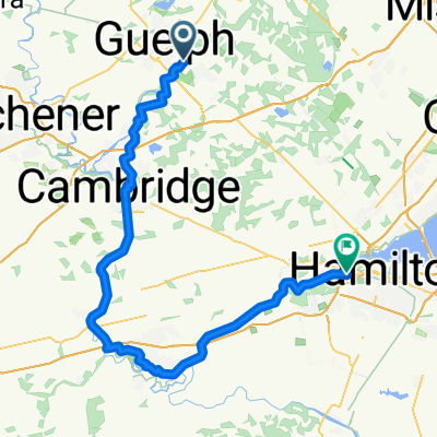
30K Victoria rec centre start
Cycling route in Guelph, Ontario, Canada
- 30.1 km
- Distance
- 145 m
- Ascent
- 155 m
- Descent

Latenda Pl, Guelph to N Shore Blvd W, Burlington
Cycling route in Guelph, Ontario, Canada
- 186.2 km
- Distance
- 903 m
- Ascent
- 1,150 m
- Descent
Discover more routes
 Latenda Pl, Guelph to Ofield Rd, Hamilton
- Distance
- 101.3 km
- Ascent
- 454 m
- Descent
- 690 m
- Location
- Guelph, Ontario, Canada
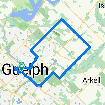
 Like the Country Side
- Distance
- 4.8 km
- Ascent
- 48 m
- Descent
- 46 m
- Location
- Guelph, Ontario, Canada
 Guelph Lake second option
- Distance
- 38.6 km
- Ascent
- 167 m
- Descent
- 167 m
- Location
- Guelph, Ontario, Canada
 16 Oxford St, Guelph to 16 Oxford St, Guelph
- Distance
- 23.9 km
- Ascent
- 357 m
- Descent
- 364 m
- Location
- Guelph, Ontario, Canada
 Bike Route 3 West Guelph
- Distance
- 44.6 km
- Ascent
- 143 m
- Descent
- 145 m
- Location
- Guelph, Ontario, Canada
 Guelph Perimeter
- Distance
- 56.9 km
- Ascent
- 210 m
- Descent
- 210 m
- Location
- Guelph, Ontario, Canada
 Long boy
- Distance
- 62.5 km
- Ascent
- 159 m
- Descent
- 159 m
- Location
- Guelph, Ontario, Canada
 Niska Bridge
- Distance
- 25.3 km
- Ascent
- 105 m
- Descent
- 106 m
- Location
- Guelph, Ontario, Canada