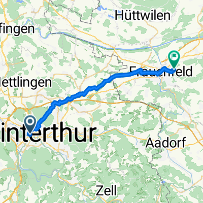
- 20.3 km
- 320 m
- 291 m
- Stadt Winterthur (Kreis 1) / Neuwiesen, Canton of Zurich, Switzerland

Cycling in Stadt Winterthur (Kreis 1) / Neuwiesen
Discover a map of 69 cycling routes and bike trails near Stadt Winterthur (Kreis 1) / Neuwiesen, created by our community.
Region portrait
Get to know Stadt Winterthur (Kreis 1) / Neuwiesen
Find the right bike route for you through Stadt Winterthur (Kreis 1) / Neuwiesen, where we've got 69 cycle routes to explore. Most people get on their bikes to ride here in the months of May and June.
3,870 km
Tracked distance
69
Cycle routes
3,149
Population
Community
Most active users in Stadt Winterthur (Kreis 1) / Neuwiesen
From our community
The best bike routes in and around Stadt Winterthur (Kreis 1) / Neuwiesen
Bahnhofplatz, Winterthur nach Neuweilerstrasse, Basel
Cycling route in Stadt Winterthur (Kreis 1) / Neuwiesen, Canton of Zurich, Switzerland
- 116.6 km
- Distance
- 908 m
- Ascent
- 1,068 m
- Descent
Winterthur Irchel Worrenberg Winterthur
Cycling route in Stadt Winterthur (Kreis 1) / Neuwiesen, Canton of Zurich, Switzerland
- 34.6 km
- Distance
- 551 m
- Ascent
- 542 m
- Descent
Salstrasse nach St.Blasien
Cycling route in Stadt Winterthur (Kreis 1) / Neuwiesen, Canton of Zurich, Switzerland
- 70.5 km
- Distance
- 1,380 m
- Ascent
- 1,021 m
- Descent
Heimtour über Stock und Stein von Agetho
Cycling route in Stadt Winterthur (Kreis 1) / Neuwiesen, Canton of Zurich, Switzerland
- 18.5 km
- Distance
- 273 m
- Ascent
- 187 m
- Descent
Discover more routes
- Geschäft001
- Cracking ride in Frauenfeld
- 19.2 km
- 152 m
- 123 m
- Stadt Winterthur (Kreis 1) / Neuwiesen, Canton of Zurich, Switzerland
- Winterthur - Zürich über VR 5 und Opfikon
- 29.8 km
- 356 m
- 355 m
- Stadt Winterthur (Kreis 1) / Neuwiesen, Canton of Zurich, Switzerland
- Tellstrasse 10, Winterthur nach Dorfstrasse 27, Marbach LU
- 130.7 km
- 1,516 m
- 1,084 m
- Stadt Winterthur (Kreis 1) / Neuwiesen, Canton of Zurich, Switzerland
- Bleichestrasse 10, Winterthur nach Ackeretstrasse 2–8, Winterthur
- 6.4 km
- 0 m
- 0 m
- Stadt Winterthur (Kreis 1) / Neuwiesen, Canton of Zurich, Switzerland
- Winterthur-Glaubtenstrasse
- 23.6 km
- 199 m
- 178 m
- Stadt Winterthur (Kreis 1) / Neuwiesen, Canton of Zurich, Switzerland
- Runde 1
- 39 km
- 477 m
- 511 m
- Stadt Winterthur (Kreis 1) / Neuwiesen, Canton of Zurich, Switzerland
- Winterthur-Marthalen
- 19.1 km
- 100 m
- 149 m
- Stadt Winterthur (Kreis 1) / Neuwiesen, Canton of Zurich, Switzerland


