 / Zinzikon")
Cycling in Oberwinterthur (Kreis 2) / Zinzikon
Discover a map of 61 cycling routes and bike trails near Oberwinterthur (Kreis 2) / Zinzikon, created by our community.
Region portrait
Get to know Oberwinterthur (Kreis 2) / Zinzikon
Find the right bike route for you through Oberwinterthur (Kreis 2) / Zinzikon, where we've got 61 cycle routes to explore. Most people get on their bikes to ride here in the month of July.
2,217 km
Tracked distance
61
Cycle routes
1,842
Population
Community
Most active users in Oberwinterthur (Kreis 2) / Zinzikon


From our community
The best bike routes in and around Oberwinterthur (Kreis 2) / Zinzikon
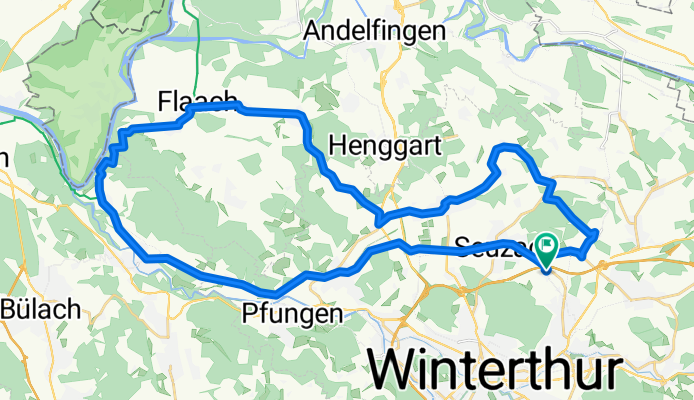
Flaachrunde
Cycling route in Oberwinterthur (Kreis 2) / Zinzikon, Canton of Zurich, Switzerland
- 43.6 km
- Distance
- 579 m
- Ascent
- 585 m
- Descent

winti-rheinfall
Cycling route in Oberwinterthur (Kreis 2) / Zinzikon, Canton of Zurich, Switzerland
- 70.5 km
- Distance
- 418 m
- Ascent
- 418 m
- Descent

halbe ume
Cycling route in Oberwinterthur (Kreis 2) / Zinzikon, Canton of Zurich, Switzerland
- 23.1 km
- Distance
- 101 m
- Ascent
- 101 m
- Descent

Winterthur nord
Cycling route in Oberwinterthur (Kreis 2) / Zinzikon, Canton of Zurich, Switzerland
- 41.8 km
- Distance
- 228 m
- Ascent
- 242 m
- Descent
Discover more routes
 Rikon
Rikon- Distance
- 12.6 km
- Ascent
- 183 m
- Descent
- 134 m
- Location
- Oberwinterthur (Kreis 2) / Zinzikon, Canton of Zurich, Switzerland
 Moderate route in Winterthur
- Distance
- 18.3 km
- Ascent
- 735 m
- Descent
- 736 m
- Location
- Oberwinterthur (Kreis 2) / Zinzikon, Canton of Zurich, Switzerland
 laufrunde mörsburg
- Distance
- 11.8 km
- Ascent
- 113 m
- Descent
- 110 m
- Location
- Oberwinterthur (Kreis 2) / Zinzikon, Canton of Zurich, Switzerland
 Wallrüti–Rheinau
- Distance
- 22.4 km
- Ascent
- 193 m
- Descent
- 282 m
- Location
- Oberwinterthur (Kreis 2) / Zinzikon, Canton of Zurich, Switzerland
 Mein Jahr Dein Jahr
- Distance
- 205.1 km
- Ascent
- 1,799 m
- Descent
- 996 m
- Location
- Oberwinterthur (Kreis 2) / Zinzikon, Canton of Zurich, Switzerland
 Recovered Route
- Distance
- 0.2 km
- Ascent
- 0 m
- Descent
- 0 m
- Location
- Oberwinterthur (Kreis 2) / Zinzikon, Canton of Zurich, Switzerland
 Wiesendangerstrasse 151, Stadel (Winterthur) nach Haldenrainstrasse 44, Stadel (Winterthur)
- Distance
- 8.1 km
- Ascent
- 110 m
- Descent
- 97 m
- Location
- Oberwinterthur (Kreis 2) / Zinzikon, Canton of Zurich, Switzerland
 Ruchwiesenstrasse 28, Winterthur nach Turbenthal
- Distance
- 24 km
- Ascent
- 7 m
- Descent
- 0 m
- Location
- Oberwinterthur (Kreis 2) / Zinzikon, Canton of Zurich, Switzerland