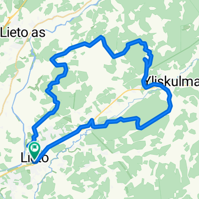
How cycling in Lieto could look like.

Cycling in Lieto

Discover a map of 41 cycling routes and bike trails near Lieto, created by our community.

Region portrait

Get to know Lieto

Find the right bike route for you through Lieto, where we've got 41 cycle routes to explore.

1,074 km

Tracked distance

41

Cycle routes

15,258

Population

Community

Most active users in Lieto

From our community

The best bike routes in and around Lieto

Oksvuoren kartoitusta
MTBGravel
GHOSTBIKE
0

Oksvuoren kartoitusta

Cycling route in Lieto, Southwest Finland, Finland

Polkujen hakemista ja kartoitusta. Sahantietä pohjoiseen, poikkeaminen luoteeseen ennen taloa peltotielle joka jatkuu selvänä väylänä n.950m ja kyseiseltä väylältä on myös yhteys Lehtimäentielle mutta kun ajaakin mutkasta hiuk
15.6 km
Distance
59 m
Ascent
78 m
Descent
Lieto XCO 2014 Trail
MTBGravel
GHOSTBIKE
1

Lieto XCO 2014 Trail

Cycling route in Lieto, Southwest Finland, Finland

1 round in Lieto XCO 2014 trail.  Today, for the first time will be able to ride all the ups and downs without foot contact with the ground :) Lowest point 40m Highest point 70m Percent Slope (dst) 26,8% 
3.6 km
Distance
68 m
Ascent
68 m
Descent
Lieto - Ukura, paths mapping
MTBGravel
GHOSTBIKE
0

Lieto - Ukura, paths mapping

Cycling route in Lieto, Southwest Finland, Finland

<div> The route also goes through the forest logging area, where I tried cleaning up, bigger branches off to the side route. There was still a lot of branches that may degrade the transmission, so be careful. The logging area is approximately 100-200m after which it is already clear path.&nbs
21.9 km
Distance
131 m
Ascent
131 m
Descent
Lieto- Kuninkaanlähde ( Source of the King) - Lieto
MTBGravel
GHOSTBIKE
0

Lieto- Kuninkaanlähde ( Source of the King) - Lieto

Cycling route in Lieto, Southwest Finland, Finland

The source is the Old King's Road of Häme, along the watering place for horses. The route is along the local roads, forest paths, twigs, stumps, rhizomes, horse stables, rock, rocks, asphalt road. Along the route there are two places where you can cool off with a swim though.&lt;
51.6 km
Distance
205 m
Ascent
205 m
Descent

Discover more routes