
Cycling in Ballarat Central
Discover a map of 23 cycling routes and bike trails near Ballarat Central, created by our community.
Region portrait
Get to know Ballarat Central
Find the right bike route for you through Ballarat Central, where we've got 23 cycle routes to explore.
1,697 km
Tracked distance
23
Cycle routes
5,645
Population


From our community
The best bike routes in and around Ballarat Central
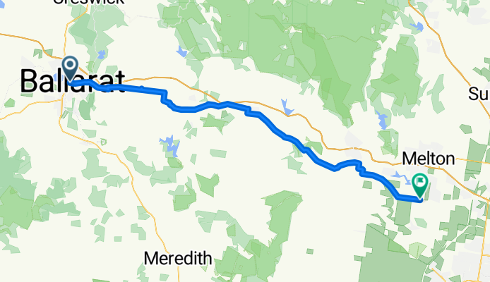
Ballarat Central - Melton South
Cycling route in Ballarat Central, Victoria, Australia
- 75.7 km
- Distance
- 391 m
- Ascent
- 720 m
- Descent

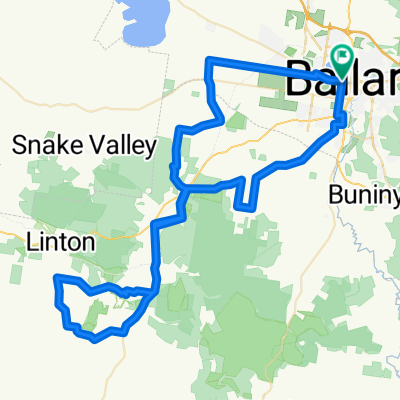
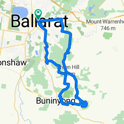
Ballarat City circuit for windy weather
Cycling route in Ballarat Central, Victoria, Australia
- 50.4 km
- Distance
- 232 m
- Ascent
- 222 m
- Descent
![[Herald Sun Tour 2009 - Etapa 00] Ballarat](https://media.bikemap.net/routes/327032/staticmaps/in_02180b6f-925d-4083-b153-b186a50069ea_694x400_bikemap-2021-3D-static.png)
[Herald Sun Tour 2009 - Etapa 00] Ballarat
Cycling route in Ballarat Central, Victoria, Australia
- 2.3 km
- Distance
- 19 m
- Ascent
- 22 m
- Descent

Ballarat To Lara Bikepacking
Cycling route in Ballarat Central, Victoria, Australia
- 103.6 km
- Distance
- 606 m
- Ascent
- 1,026 m
- Descent
Discover more routes
 Tour Down Under Stage 3 mock course
- Distance
- 146.5 km
- Ascent
- 672 m
- Descent
- 516 m
- Location
- Ballarat Central, Victoria, Australia
 Ballarat - Windermere Hotel
- Distance
- 34.9 km
- Ascent
- 699 m
- Descent
- 708 m
- Location
- Ballarat Central, Victoria, Australia
 FHB Ballarat to Southern Cross Station, leg 6
- Distance
- 135.8 km
- Ascent
- 483 m
- Descent
- 898 m
- Location
- Ballarat Central, Victoria, Australia
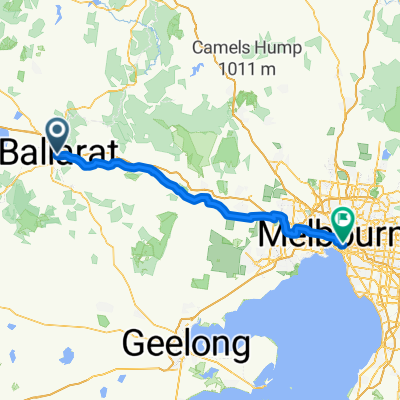 Ballarat to Melbourne
- Distance
- 124.8 km
- Ascent
- 268 m
- Descent
- 683 m
- Location
- Ballarat Central, Victoria, Australia
 Ballarat - Maryborough Trail
- Distance
- 92.4 km
- Ascent
- 375 m
- Descent
- 569 m
- Location
- Ballarat Central, Victoria, Australia
 BAD Ride 2013 100km
- Distance
- 99.9 km
- Ascent
- 495 m
- Descent
- 495 m
- Location
- Ballarat Central, Victoria, Australia
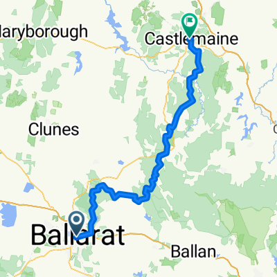 Ballarat - Castlemaine
- Distance
- 117.3 km
- Ascent
- 813 m
- Descent
- 964 m
- Location
- Ballarat Central, Victoria, Australia
 Mt Buninyong Ballarat Gravel
- Distance
- 40.1 km
- Ascent
- 489 m
- Descent
- 489 m
- Location
- Ballarat Central, Victoria, Australia