
Cycling in Municipality of Gorje
Discover a map of 693 cycling routes and bike trails in Municipality of Gorje, created by our community.
Region portrait
Get to know Municipality of Gorje
Find the right bike route for you through Municipality of Gorje, where we've got 693 cycle routes to explore. Most people get on their bikes to ride here in the months of July and August.
38,475 km
Tracked distance
693
Cycle routes
Community
Most active users in Municipality of Gorje


Handpicked routes
Discover Municipality of Gorje through these collections
 Tour
Tour

From our community
The best bike routes in Municipality of Gorje
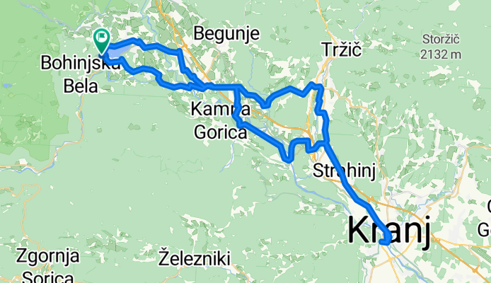
Bled, Bled do Bled, Bled
Cycling route in Zgornje Gorje, Municipality of Gorje, Slovenia
- 73.1 km
- Distance
- 1,266 m
- Ascent
- 1,264 m
- Descent
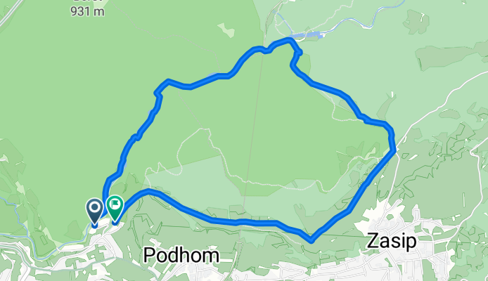
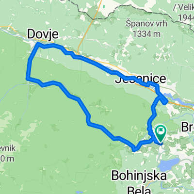
Rundweg durch die Vintgar-Schlucht
Cycling route in Zgornje Gorje, Municipality of Gorje, Slovenia
- 5.6 km
- Distance
- 242 m
- Ascent
- 239 m
- Descent

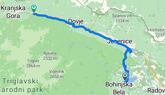
Bled, Bled to Jezerci, Gozd Martuljek
Cycling route in Zgornje Gorje, Municipality of Gorje, Slovenia
- 33.7 km
- Distance
- 814 m
- Ascent
- 591 m
- Descent
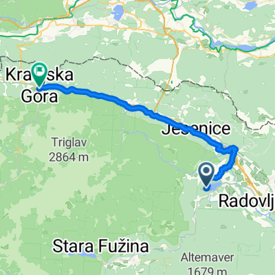
Bled, Bled to Jezerci, Gozd Martuljek
Cycling route in Zgornje Gorje, Municipality of Gorje, Slovenia
- 33.1 km
- Distance
- 818 m
- Ascent
- 596 m
- Descent
Discover more routes
 Bled, Bled to Vitranška ulica, Kranjska Gora
- Distance
- 41 km
- Ascent
- 900 m
- Descent
- 581 m
- Location
- Zgornje Gorje, Municipality of Gorje, Slovenia
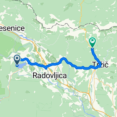 Von Bled bis Tržič
- Distance
- 27.6 km
- Ascent
- 731 m
- Descent
- 565 m
- Location
- Zgornje Gorje, Municipality of Gorje, Slovenia
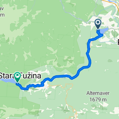 Kolodvorska cesta, Bled - Regionalna Cesta 904, Bohinjsko Jezero
- Distance
- 27.6 km
- Ascent
- 609 m
- Descent
- 606 m
- Location
- Zgornje Gorje, Municipality of Gorje, Slovenia
 pokljuka family
- Distance
- 29.1 km
- Ascent
- 866 m
- Descent
- 862 m
- Location
- Zgornje Gorje, Municipality of Gorje, Slovenia
 Rečiška cesta to Rečiška cesta
- Distance
- 41.9 km
- Ascent
- 1,035 m
- Descent
- 1,034 m
- Location
- Zgornje Gorje, Municipality of Gorje, Slovenia
 Bosques de Bled
- Distance
- 14.8 km
- Ascent
- 549 m
- Descent
- 552 m
- Location
- Zgornje Gorje, Municipality of Gorje, Slovenia
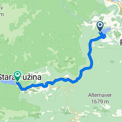 From Bled to Bohinjsko jezero
- Distance
- 28 km
- Ascent
- 861 m
- Descent
- 823 m
- Location
- Zgornje Gorje, Municipality of Gorje, Slovenia
 Kranjska gora s Krmo
- Distance
- 75.3 km
- Ascent
- 683 m
- Descent
- 671 m
- Location
- Zgornje Gorje, Municipality of Gorje, Slovenia
Cycling regions in Municipality of Gorje
Zgornje Gorje
693 cycling routes
See where people are biking in Slovenia
Popular cycling regions in Slovenia

