
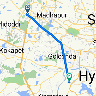
Cycling day trip from Kukatpally to Hyderabad
Customize your own route based on our template or discover how our community prefers to cycle from Kukatpally to Hyderabad.
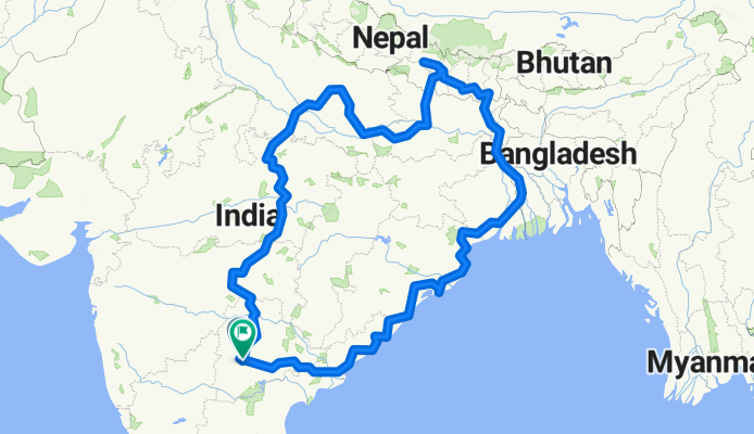
Route template
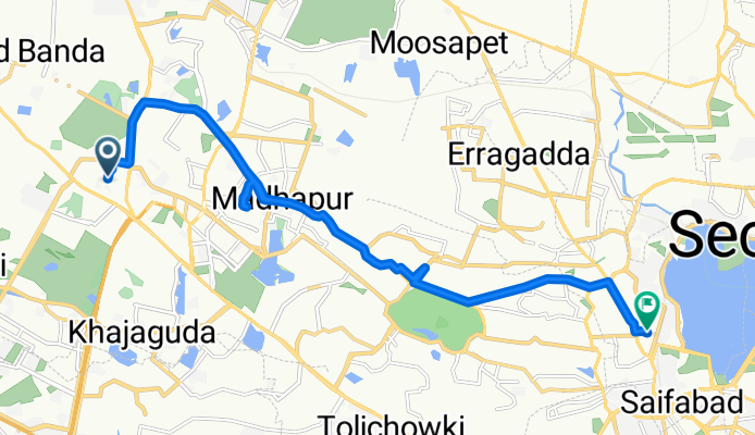
Kukatpally to Hyderabad
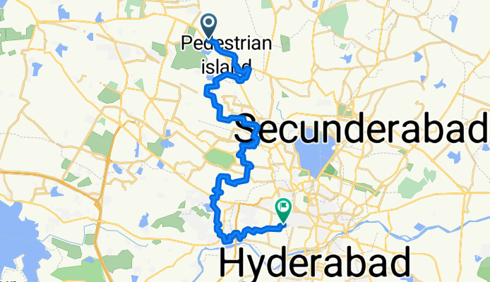
- 1 h 54 min
- Duration
- 33.8 km
- Distance
- 244 m
- Ascent
- 294 m
- Descent
- 17.8 km/h
- Avg. speed
- 602 m
- Max. altitude
Spin out from Kukatpally, the lively northwest suburb known for KPHB Colony and its metro links, and roll toward central Hyderabad. The route is about 34 km and favors quieter neighborhood roads almost all the way, with just a couple of short, busier connectors near major junctions—ride single file and keep lights on.
Terrain is gently rolling: roughly 250 m of climbing and a bit more descending, so you’ll net a slight drop as you approach the city. Surfaces are mostly standard city tarmac, with the odd rough patch.
Aim for an early start to beat heat and traffic, and watch for buses and autos near commercial stretches. You’ll finish in the heart of Hyderabad, where historic lanes meet business districts—perfect excuse to park the bike for an Irani chai or post-ride biryani. If you’ve got extra legs, add a small detour to one of the central landmarks before heading home.
Community
Top users in this region


From our community
The best bike routes from Kukatpally to Hyderabad

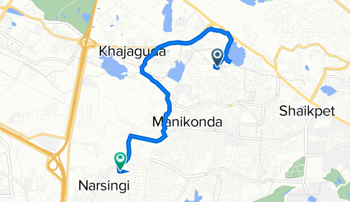
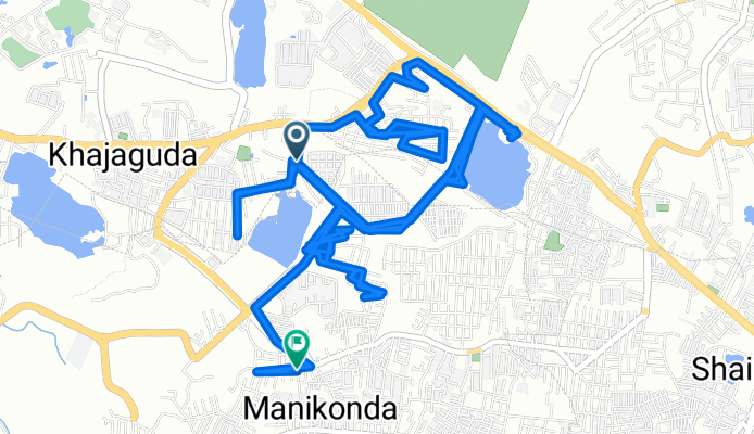
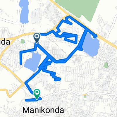
Narsing Nanakramguda Service Road 277, Khajaguda to 989X+RHR, Hyderabad
Cycling route in Kukatpally, Telangana, India
- 4.8 km
- Distance
- 97 m
- Ascent
- 58 m
- Descent
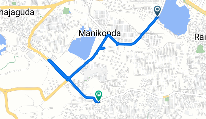
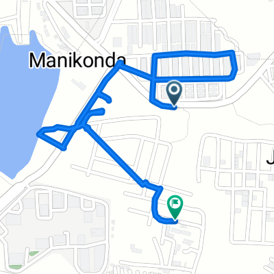
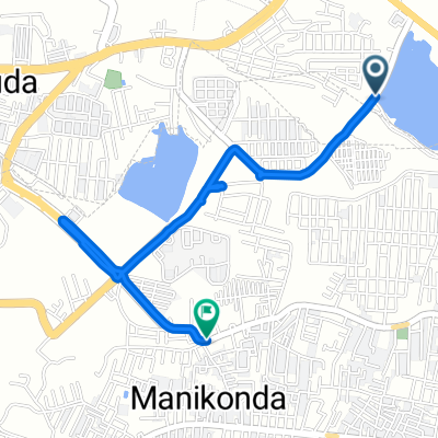
L- 5, Manikonda Jagir to 99V7+R96, Puppalguda
Cycling route in Kukatpally, Telangana, India
- 7.2 km
- Distance
- 53 m
- Ascent
- 62 m
- Descent
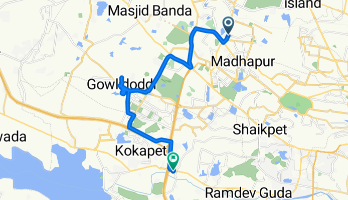
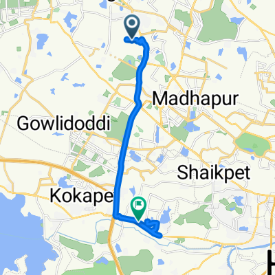
D Block Road to 9-4/S/6-1
Cycling route in Kukatpally, Telangana, India
- 27.6 km
- Distance
- 556 m
- Ascent
- 519 m
- Descent
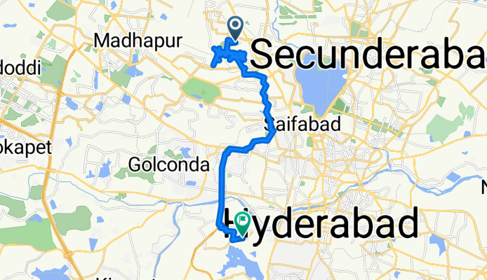
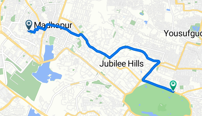
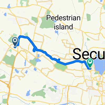
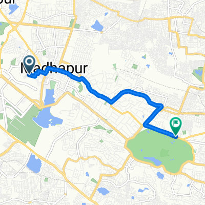
Madhapur to Shankarpalli - Hyderabad Road
Cycling route in Kukatpally, Telangana, India
- 23.9 km
- Distance
- 445 m
- Ascent
- 420 m
- Descent
Route in Hyderabad
Cycling route in Kukatpally, Telangana, India
- 6,565.5 km
- Distance
- 51,602 m
- Ascent
- 51,679 m
- Descent
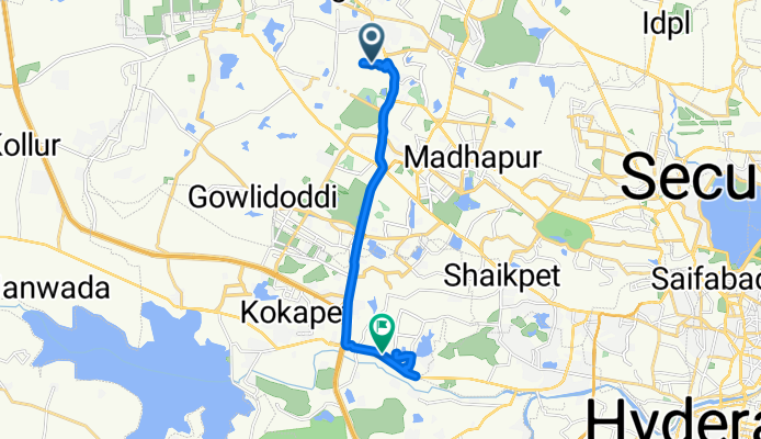
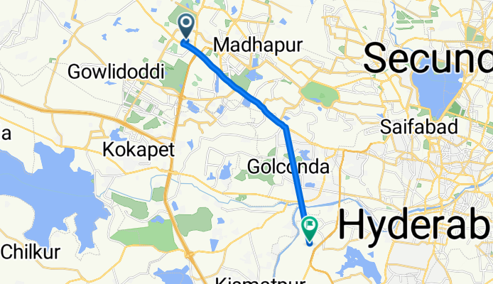
C9W5+3PG to Raj Bhavan Road 6-3-1247/A
Cycling route in Kukatpally, Telangana, India
- 18.7 km
- Distance
- 292 m
- Ascent
- 283 m
- Descent
419c to Osman Sagar Road
Cycling route in Kukatpally, Telangana, India
- 18.9 km
- Distance
- 264 m
- Ascent
- 277 m
- Descent
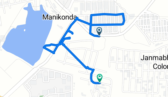
LIG to Muppas Panchavati Colony
Cycling route in Kukatpally, Telangana, India
- 2.7 km
- Distance
- 386 m
- Ascent
- 324 m
- Descent
Arka Rochish to Street Number 1/4B
Cycling route in Kukatpally, Telangana, India
- 18.4 km
- Distance
- 373 m
- Ascent
- 305 m
- Descent
C99M+7Q8 to Lanco Hills Road
Cycling route in Kukatpally, Telangana, India
- 3.7 km
- Distance
- 104 m
- Ascent
- 101 m
- Descent
JV Colony Main Road to 2-4-97/2/B
Cycling route in Kukatpally, Telangana, India
- 13 km
- Distance
- 176 m
- Ascent
- 183 m
- Descent
Vittal Rao Nagar to Road Number
Cycling route in Kukatpally, Telangana, India
- 6.8 km
- Distance
- 133 m
- Ascent
- 106 m
- Descent
Discover more routes
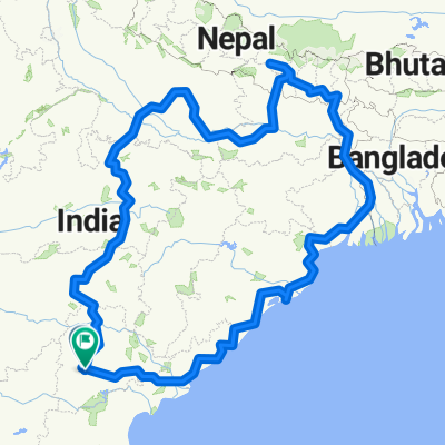 Route in Hyderabad
- Distance
- 6,565.5 km
- Ascent
- 51,602 m
- Descent
- 51,679 m
- Location
- Kukatpally, Telangana, India
 C9W5+3PG to Raj Bhavan Road 6-3-1247/A
- Distance
- 18.7 km
- Ascent
- 292 m
- Descent
- 283 m
- Location
- Kukatpally, Telangana, India
 419c to Osman Sagar Road
- Distance
- 18.9 km
- Ascent
- 264 m
- Descent
- 277 m
- Location
- Kukatpally, Telangana, India
 LIG to Muppas Panchavati Colony
- Distance
- 2.7 km
- Ascent
- 386 m
- Descent
- 324 m
- Location
- Kukatpally, Telangana, India
 Arka Rochish to Street Number 1/4B
- Distance
- 18.4 km
- Ascent
- 373 m
- Descent
- 305 m
- Location
- Kukatpally, Telangana, India
 C99M+7Q8 to Lanco Hills Road
- Distance
- 3.7 km
- Ascent
- 104 m
- Descent
- 101 m
- Location
- Kukatpally, Telangana, India
 JV Colony Main Road to 2-4-97/2/B
- Distance
- 13 km
- Ascent
- 176 m
- Descent
- 183 m
- Location
- Kukatpally, Telangana, India
 Vittal Rao Nagar to Road Number
- Distance
- 6.8 km
- Ascent
- 133 m
- Descent
- 106 m
- Location
- Kukatpally, Telangana, India
Routes from Kukatpally
Cycling day trip from
Kukatpally to Serilingampalle