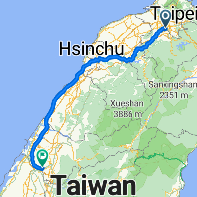
How cycling in Taipei could look like.
How cycling in Chang-hua could look like.

Bikepacking from Taipei to Chang-hua

Customize your own route based on our template or discover how our community prefers to cycle from Taipei to Chang-hua.

Route template

Taipei to Chang-hua

15 h 38 min
Duration
246.9 km
Distance
1,750 m
Ascent
1,696 m
Descent
15.8 km/h
Avg. speed
394 m
Max. altitude

Kick off your cycling adventure in Taipei, the vibrant capital of Taiwan, known for its bustling night markets and the iconic Taipei 101 skyscraper. Picture yourself pedaling away from city life, embarking on a breezy ride towards the quaint town of Chang-hua, a journey spanning approximately 247 kilometers.

Your route is predominantly on quiet roads and cycleways, promising a peaceful ride with a gentle ascent of around 1750 meters and descent of approximately 1696 meters. It's mostly smooth sailing, with the majority of the path's surface details not fully mapped out—adding a sprinkle of adventure. A small percentage of your ride will be on asphalt and paved roads, so your tires will remain happy.

The terrain is friendly on the legs, with the highest elevation point at about 394 meters. As you approach Chang-hua, take time to admire the beautiful countryside before reaching the welcoming, serene vibe of this historic city. Chang-hua is famous for its magnificent Great Buddha Statue and charming traditional streets.

So, pack your sunblock, grab your helmet, and enjoy this captivating journey from one iconic Taiwanese location to another. Safe travels!

Community

Top users in this region

From our community

The best bike routes from Taipei to Chang-hua

西濱北中
Road bikePaved
賽克零派樂特
2

西濱北中

Cycling route in Taipei, Taipei, Taiwan

201.3 km
Distance
188 m
Ascent
168 m
Descent
KHS 騎福路線
Road bikePaved
jimmyhsieh
0

KHS 騎福路線

Cycling route in Taipei, Taipei, Taiwan

1.建議八里到永安可先延61快速道下騎行到永安漁港再轉15線到新屋天后宮. 2.白沙屯開始會接到台1線一直到達大甲後需接回61快速道要注意. 3.過龍井後要由61快速道下轉17線走中彰大橋. 4.過中彰大橋後大約2公里會有一個 路口需右轉.不然會離開17線如圖標示的注意右轉的地點.  
193.8 km
Distance
176 m
Ascent
173 m
Descent
我們家的環島地圖
Road bikeMTBPaved
ryan tseng
0

我們家的環島地圖

Cycling route in Taipei, Taipei, Taiwan

1/14(五) - 16(日) 可能出發
190.6 km
Distance
122 m
Ascent
126 m
Descent
環島Day1台北內湖-彰化鹿港
Road bikeMTBPaved
0

環島Day1台北內湖-彰化鹿港

Cycling route in Taipei, Taipei, Taiwan

補給點: 7-11:安港門市 桃園縣新屋鄉中山西路三段1148號 (台61右轉永安漁港約20公尺) <br /> 2. 全家: 新竹西濱店 新竹市北區東大路四段97號 (台15 竹港大橋下滑後就是)
210.7 km
Distance
231 m
Ascent
253 m
Descent
環島Day1_台北蘆洲至彰化市
Road bikeMTBPaved
Chen
1

環島Day1_台北蘆洲至彰化市

Cycling route in Taipei, Taipei, Taiwan

182.5 km
Distance
224 m
Ascent
197 m
Descent
1

銅人7天環台 DAY1

Cycling route in Taipei, Taipei, Taiwan

185.7 km
Distance
493 m
Ascent
496 m
Descent
VGHTPE TO CHANGHUA
City bikePaved
1

VGHTPE TO CHANGHUA

Cycling route in Taipei, Taipei, Taiwan

191.3 km
Distance
222 m
Ascent
219 m
Descent
0

環島01 台北&gt;鹿港

Cycling route in Taipei, Taipei, Taiwan

211.1 km
Distance
188 m
Ascent
200 m
Descent
0

0011

Cycling route in Taipei, Taipei, Taiwan

222
181.8 km
Distance
542 m
Ascent
523 m
Descent
Day6-淡水-鹿港
Road bikePaved
1

Day6-淡水-鹿港

Cycling route in Taipei, Taipei, Taiwan

Day6-淡水-鹿港
198 km
Distance
361 m
Ascent
354 m
Descent
0

TPE_2_TCH

Cycling route in Taipei, Taipei, Taiwan

177.4 km
Distance
203 m
Ascent
184 m
Descent
1

台北台中海邊

Cycling route in Taipei, Taipei, Taiwan

203 km
Distance
214 m
Ascent
200 m
Descent

Discover more routes