
Cycling day trip from Pingtung City to Hengchun
Customize your own route based on our template or discover how our community prefers to cycle from Pingtung City to Hengchun.
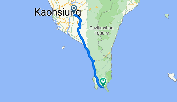
Route template
Pingtung City to Hengchun

- 8 h 6 min
- Duration
- 117.9 km
- Distance
- 1,377 m
- Ascent
- 1,382 m
- Descent
- 14.5 km/h
- Avg. speed
- 425 m
- Max. altitude
This cycling route takes you from vibrant Pingtung City down to the laid-back town of Hengchun at Taiwan’s southern tip—a fantastic ride for anyone looking to see a dramatic change in scenery! Starting out in Pingtung, a hub of local culture and great food, you’ll head south through the lush and rural landscapes of Pingtung County. With just over 117 km to cover, expect a generous amount of climbing—around 1,376 meters—making this ride a good challenge for those who like rolling terrain.
Much of your route follows quiet roads and access lanes, so there’s plenty of space to enjoy the views. Soon enough, the city vibes give way to breezy farmlands and gentle foothills, before you cruise into the Hengchun Peninsula, surrounded by ocean on three sides. Once you reach Hengchun, you’ll be at the gateway to Kenting National Park, famous for its beaches, coral reefs, and chill vibes.
Make sure to stop at a roadside snack stand, enjoy the scenery, and pack some sun protection—the southern sun gets strong!
Community
Top users in this region


From our community
The best bike routes from Pingtung City to Hengchun


2012-01-07 臺南藍魔鬼國際邀請賽-搖滾你的墾丁
Cycling route in Pingtung City, Taiwan, Taiwan
- 98.3 km
- Distance
- 100 m
- Ascent
- 102 m
- Descent

2012 臺南藍魔鬼國際邀請賽-搖滾你的墾丁
Cycling route in Pingtung City, Taiwan, Taiwan
- 99.4 km
- Distance
- 321 m
- Ascent
- 311 m
- Descent
後甲國中單車樂活南墾戶外教學之旅day1
Cycling route in Pingtung City, Taiwan, Taiwan
- 101.4 km
- Distance
- 116 m
- Ascent
- 124 m
- Descent

Dcoward day 7
Cycling route in Pingtung City, Taiwan, Taiwan
- 78.7 km
- Distance
- 189 m
- Ascent
- 193 m
- Descent

20120204墾丁單車遊( day1)
Cycling route in Pingtung City, Taiwan, Taiwan
- 104.5 km
- Distance
- 111 m
- Ascent
- 122 m
- Descent

瘋600K (12/11-12/12)
Cycling route in Pingtung City, Taiwan, Taiwan
- 155.7 km
- Distance
- 337 m
- Ascent
- 354 m
- Descent

環島D4屏東市TO墾丁
Cycling route in Pingtung City, Taiwan, Taiwan
- 100.2 km
- Distance
- 152 m
- Ascent
- 156 m
- Descent

瘋狂計畫: 中雙塔 Day 4
Cycling route in Pingtung City, Taiwan, Taiwan
- 91.6 km
- Distance
- 155 m
- Ascent
- 163 m
- Descent


暑假屏東團
Cycling route in Pingtung City, Taiwan, Taiwan
- 95.1 km
- Distance
- 266 m
- Ascent
- 214 m
- Descent
Discover more routes
 後甲國中單車樂活南墾戶外教學之旅day1
- Distance
- 101.4 km
- Ascent
- 116 m
- Descent
- 124 m
- Location
- Pingtung City, Taiwan, Taiwan
 Dcoward day 7
- Distance
- 78.7 km
- Ascent
- 189 m
- Descent
- 193 m
- Location
- Pingtung City, Taiwan, Taiwan
 20120204墾丁單車遊( day1)
- Distance
- 104.5 km
- Ascent
- 111 m
- Descent
- 122 m
- Location
- Pingtung City, Taiwan, Taiwan
 瘋600K (12/11-12/12)
- Distance
- 155.7 km
- Ascent
- 337 m
- Descent
- 354 m
- Location
- Pingtung City, Taiwan, Taiwan
 環島D4屏東市TO墾丁
- Distance
- 100.2 km
- Ascent
- 152 m
- Descent
- 156 m
- Location
- Pingtung City, Taiwan, Taiwan
 瘋狂計畫: 中雙塔 Day 4
- Distance
- 91.6 km
- Ascent
- 155 m
- Descent
- 163 m
- Location
- Pingtung City, Taiwan, Taiwan
 Day 9
Day 9- Distance
- 98.6 km
- Ascent
- 122 m
- Descent
- 172 m
- Location
- Pingtung City, Taiwan, Taiwan
 暑假屏東團
暑假屏東團- Distance
- 95.1 km
- Ascent
- 266 m
- Descent
- 214 m
- Location
- Pingtung City, Taiwan, Taiwan
Routes to Hengchun
Bikepacking from
Taitung to Hengchun
Bikepacking from
Taitung City to Hengchun
Cycling day trip from
Fongshan District to Hengchun
Cycling day trip from
Kaohsiung City to Hengchun