
By bicycle from Mandaluyong to Pasig
Customize your own route based on our template or discover how our community prefers to cycle from Mandaluyong to Pasig.
Route template
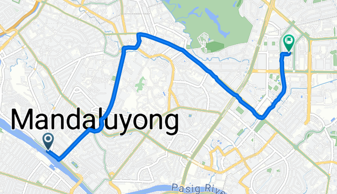
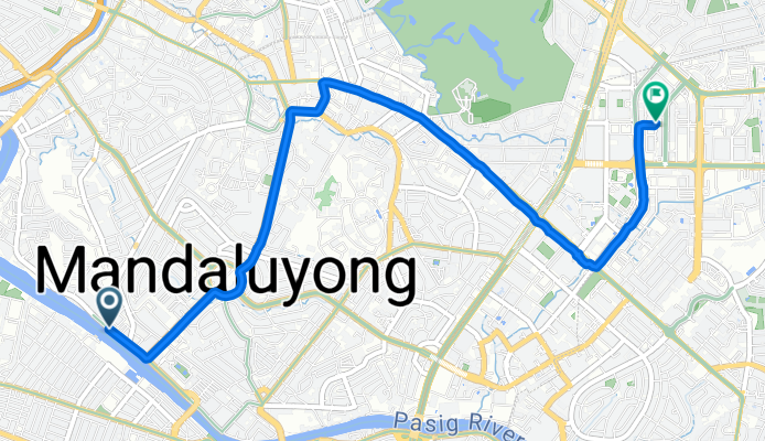
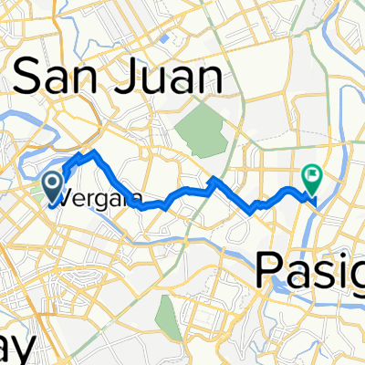
Mandaluyong to Pasig

- 29 min
- Duration
- 6.4 km
- Distance
- 186 m
- Ascent
- 141 m
- Descent
- 13.1 km/h
- Avg. speed
- 94 m
- Max. altitude
Hop on your bike for a relaxed ride from Mandaluyong to Pasig! This roughly 6.4 km route gives you a bit of everything: some climb (about 185 meters up, so get ready for a light workout), and mostly paved surfaces that make for a smooth trip. You’ll roll through mostly quiet roads, weaving between Mandaluyong’s everyday city charm and the bustling corners near Pasig.
Starting in Mandaluyong, known as the “Tiger City” for its rapid growth, you’re never far from local eateries or vibrant neighborhood life. As you pedal toward Pasig, you’ll notice urban vibes giving way to a mix of residential streets and subtle hints of history—Pasig is famous for its old churches and the scenic Pasig River.
Most of your ride sticks to low-traffic roads, but do watch out for a few busy stretches and keep an eye on changing surfaces, especially where there’s construction or missing pavement. The finish line lands you in dynamic Pasig, home to Capitol Commons and Estancia Mall if you feel like grabbing a snack for a job well done!
Community
Top users in this region


From our community
The best bike routes from Mandaluyong to Pasig

Maharlika 643, Mandaluyong to Meralco Avenue 10, Pasig
Cycling route in Mandaluyong, National Capital Region, Philippines
- 4.5 km
- Distance
- 45 m
- Ascent
- 10 m
- Descent

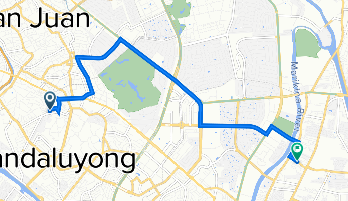
Zobel Roxas Street 1439, Manila to Ortigas Avenue, San Juan
Cycling route in Mandaluyong, National Capital Region, Philippines
- 7.6 km
- Distance
- 38 m
- Ascent
- 59 m
- Descent
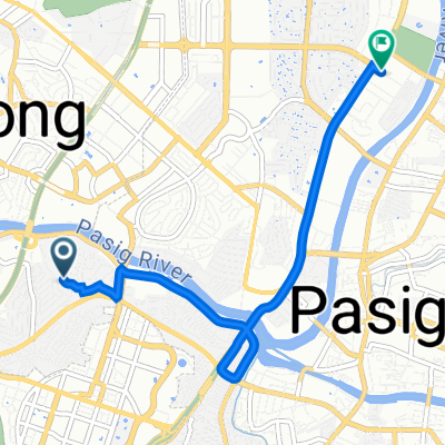
Retired Reverend G Aglipay St, Mandaluyong to Emerald Avenue, Pasig
Cycling route in Mandaluyong, National Capital Region, Philippines
- 6.6 km
- Distance
- 54 m
- Ascent
- 27 m
- Descent
Retired Reverend G Aglipay St, Mandaluyong to Emerald Avenue, Pasig
Cycling route in Mandaluyong, National Capital Region, Philippines
- 6.8 km
- Distance
- 56 m
- Ascent
- 20 m
- Descent

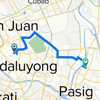
Caimito 151, Makati to P.E. Antonio, Pasig
Cycling route in Mandaluyong, National Capital Region, Philippines
- 6.5 km
- Distance
- 20 m
- Ascent
- 23 m
- Descent

304 M. Vicente Street, Mandaluyong to Buayang Bato, Mandaluyong
Cycling route in Mandaluyong, National Capital Region, Philippines
- 2.3 km
- Distance
- 26 m
- Ascent
- 12 m
- Descent

Route from 1530 A. Mendoza, Makati City
Cycling route in Mandaluyong, National Capital Region, Philippines
- 10.2 km
- Distance
- 107 m
- Ascent
- 103 m
- Descent

To work
Cycling route in Mandaluyong, National Capital Region, Philippines
- 3.7 km
- Distance
- 61 m
- Ascent
- 20 m
- Descent

Boni to Shaw
Cycling route in Mandaluyong, National Capital Region, Philippines
- 1.1 km
- Distance
- 12 m
- Ascent
- 0 m
- Descent

Eloriaga 2421, Manila to Epifanio de los Santos Avenue Corner, Mandaluyong
Cycling route in Mandaluyong, National Capital Region, Philippines
- 10.1 km
- Distance
- 72 m
- Ascent
- 40 m
- Descent
358 R. Aquino Street, Mandaluyong to Stella Maris Main Avenue, Pasig
Cycling route in Mandaluyong, National Capital Region, Philippines
- 8.8 km
- Distance
- 86 m
- Ascent
- 96 m
- Descent

Jasmin 77, Maynila to Shaw Boulevard, Mandaluyong
Cycling route in Mandaluyong, National Capital Region, Philippines
- 4.1 km
- Distance
- 36 m
- Ascent
- 57 m
- Descent
Discover more routes
 Caimito 151, Makati to P.E. Antonio, Pasig
- Distance
- 6.5 km
- Ascent
- 20 m
- Descent
- 23 m
- Location
- Mandaluyong, National Capital Region, Philippines
 304 M. Vicente Street, Mandaluyong to Buayang Bato, Mandaluyong
- Distance
- 2.3 km
- Ascent
- 26 m
- Descent
- 12 m
- Location
- Mandaluyong, National Capital Region, Philippines
 Route from 1530 A. Mendoza, Makati City
- Distance
- 10.2 km
- Ascent
- 107 m
- Descent
- 103 m
- Location
- Mandaluyong, National Capital Region, Philippines
 To work
- Distance
- 3.7 km
- Ascent
- 61 m
- Descent
- 20 m
- Location
- Mandaluyong, National Capital Region, Philippines
 Boni to Shaw
- Distance
- 1.1 km
- Ascent
- 12 m
- Descent
- 0 m
- Location
- Mandaluyong, National Capital Region, Philippines
 Eloriaga 2421, Manila to Epifanio de los Santos Avenue Corner, Mandaluyong
- Distance
- 10.1 km
- Ascent
- 72 m
- Descent
- 40 m
- Location
- Mandaluyong, National Capital Region, Philippines
 358 R. Aquino Street, Mandaluyong to Stella Maris Main Avenue, Pasig
- Distance
- 8.8 km
- Ascent
- 86 m
- Descent
- 96 m
- Location
- Mandaluyong, National Capital Region, Philippines
 Jasmin 77, Maynila to Shaw Boulevard, Mandaluyong
- Distance
- 4.1 km
- Ascent
- 36 m
- Descent
- 57 m
- Location
- Mandaluyong, National Capital Region, Philippines
Routes from Mandaluyong
By bicycle from
Mandaluyong to San Juan City
By bicycle from
Mandaluyong to Makati City
Routes to Pasig
By bicycle from
Makati City to Pasig
By bicycle from
Pateros to Pasig