
Quick ride by bicycle from City of London to Holloway
Customize your own route based on our template or discover how our community prefers to cycle from City of London to Holloway.
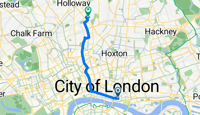
Route template
City of London to Holloway

- 31 min
- Duration
- 8.9 km
- Distance
- 81 m
- Ascent
- 60 m
- Descent
- 17.5 km/h
- Avg. speed
- 54 m
- Max. altitude
Starting your ride in the heart of the City of London, you’ll glide past glass towers, ancient streets, and maybe even sneak a peek at the iconic Gherkin as you pedal north. This 9-kilometer route is a classic urban spin, mostly on quiet roads and cycleways—so you can focus on the city’s sights instead of dodging traffic!
Expect gentle climbs (just over 80 meters of ascent in total) as you leave the financial buzz behind and head towards Holloway, one of North London’s most vibrant and down-to-earth neighborhoods. The surface is almost entirely paved or asphalt, which means a smooth roll the whole way.
Holloway itself is packed with character: Arsenal fans fill the pubs on match days, and eclectic cafes line Holloway Road. It’s a great spot for a bite or a quick refuel at the end of your ride. Whether you’re commuting or exploring, this is a comfy and varied route showcasing a real cross-section of London life.
Community
Top users in this region


From our community
The best bike routes from City of London to Holloway

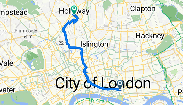
Route to 23 Southcote Road, London
Cycling route in City of London, England, United Kingdom
- 8.9 km
- Distance
- 91 m
- Ascent
- 58 m
- Descent
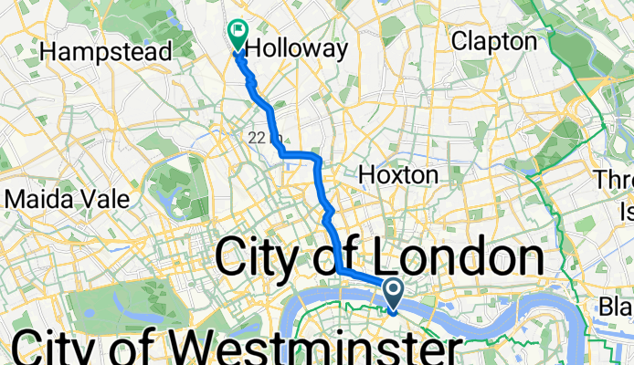
Eastcheap, London à Witherington Road, London
Cycling route in City of London, England, United Kingdom
- 8.8 km
- Distance
- 513 m
- Ascent
- 481 m
- Descent

Work to Home
Cycling route in City of London, England, United Kingdom
- 7.7 km
- Distance
- 76 m
- Ascent
- 68 m
- Descent

4 Shackleton House, Battle Bridge Lane, London to 14 Medina Road, London
Cycling route in City of London, England, United Kingdom
- 10 km
- Distance
- 289 m
- Ascent
- 263 m
- Descent

6 More London Pl, London to 21 Medina Road, London
Cycling route in City of London, England, United Kingdom
- 8.1 km
- Distance
- 82 m
- Ascent
- 57 m
- Descent

28-29 Threadneedle St, London to 59 Penderyn Way, London
Cycling route in City of London, England, United Kingdom
- 7.5 km
- Distance
- 66 m
- Ascent
- 59 m
- Descent
5 Dawson House, Jewry St, London to 577 Caledonian Road, London
Cycling route in City of London, England, United Kingdom
- 8.6 km
- Distance
- 57 m
- Ascent
- 55 m
- Descent

7 Devonshire Sq, London to Elizabeth House, 2 Hurlock St, London
Cycling route in City of London, England, United Kingdom
- 7.5 km
- Distance
- 41 m
- Ascent
- 13 m
- Descent

7 Devonshire Sq, London to Elizabeth House, 2 Hurlock St, London
Cycling route in City of London, England, United Kingdom
- 7.4 km
- Distance
- 46 m
- Ascent
- 32 m
- Descent
1 Colechurch House, Borough High Street, London to 23 Southcote Road, London
Cycling route in City of London, England, United Kingdom
- 8.4 km
- Distance
- 76 m
- Ascent
- 44 m
- Descent
25–73 Harrow Pl, London to Elizabeth House, 2 Hurlock St, London
Cycling route in City of London, England, United Kingdom
- 7.1 km
- Distance
- 22 m
- Ascent
- 10 m
- Descent

7 Devonshire Sq, London to Gillespie Primary School, Gillespie Road, London
Cycling route in City of London, England, United Kingdom
- 7.6 km
- Distance
- 46 m
- Ascent
- 17 m
- Descent
Discover more routes
 6 More London Pl, London to 21 Medina Road, London
- Distance
- 8.1 km
- Ascent
- 82 m
- Descent
- 57 m
- Location
- City of London, England, United Kingdom
 28-29 Threadneedle St, London to 59 Penderyn Way, London
- Distance
- 7.5 km
- Ascent
- 66 m
- Descent
- 59 m
- Location
- City of London, England, United Kingdom
 5 Dawson House, Jewry St, London to 577 Caledonian Road, London
- Distance
- 8.6 km
- Ascent
- 57 m
- Descent
- 55 m
- Location
- City of London, England, United Kingdom
 7 Devonshire Sq, London to Elizabeth House, 2 Hurlock St, London
- Distance
- 7.5 km
- Ascent
- 41 m
- Descent
- 13 m
- Location
- City of London, England, United Kingdom
 7 Devonshire Sq, London to Elizabeth House, 2 Hurlock St, London
- Distance
- 7.4 km
- Ascent
- 46 m
- Descent
- 32 m
- Location
- City of London, England, United Kingdom
 1 Colechurch House, Borough High Street, London to 23 Southcote Road, London
- Distance
- 8.4 km
- Ascent
- 76 m
- Descent
- 44 m
- Location
- City of London, England, United Kingdom
 25–73 Harrow Pl, London to Elizabeth House, 2 Hurlock St, London
- Distance
- 7.1 km
- Ascent
- 22 m
- Descent
- 10 m
- Location
- City of London, England, United Kingdom
 7 Devonshire Sq, London to Gillespie Primary School, Gillespie Road, London
- Distance
- 7.6 km
- Ascent
- 46 m
- Descent
- 17 m
- Location
- City of London, England, United Kingdom
Routes from City of London
Cycling day trip from
City of London to Hinchley Wood
Quick ride by bicycle from
City of London to Bayswater
Quick ride by bicycle from
City of London to City of Westminster
Routes to Holloway
Quick ride by bicycle from
Hackney to Holloway
Quick ride by bicycle from
West End of London to Holloway