
Quick ride by bicycle from Solothurn to Langendorf
Customize your own route based on our template or discover how our community prefers to cycle from Solothurn to Langendorf.
Route template
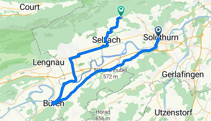
Solothurn to Langendorf

- 13 min
- Duration
- 3.1 km
- Distance
- 47 m
- Ascent
- 11 m
- Descent
- 14.4 km/h
- Avg. speed
- 479 m
- Max. altitude
Kick off your ride in Solothurn, often called the “most beautiful Baroque town in Switzerland.” Pedal northwards and you’ll quickly leave the lively historic old town behind, swapping cobblestone charm for quiet residential streets. The route is just over 3 km—perfect for an easy cruise. Most of the way is on smooth asphalt and quiet roads, so you can relax and soak up views of the Jura foothills as you gently ascend.
The climb isn’t too tough—just enough to get your heart rate up without breaking a sweat—and within 20 minutes you’ll roll into Langendorf. It’s a small, peaceful village just above Solothurn, known for its calm vibe and scenic location. All in all, this short ride is ideal if you want to escape the city buzz for some fresh air, or as a breezy commute. Don’t forget to stop and admire the views back toward Solothurn before you head home!
Community
Top users in this region


From our community
The best bike routes from Solothurn to Langendorf

Solothurn - Bucheggberg - Solothurn
Cycling route in Solothurn, Canton of Solothurn, Switzerland
- 50 km
- Distance
- 249 m
- Ascent
- 244 m
- Descent


Feierabendtour Richtung Balmberg
Cycling route in Solothurn, Canton of Solothurn, Switzerland
- 19.4 km
- Distance
- 1,025 m
- Ascent
- 1,013 m
- Descent

Solothurn-Langendorf-Bellach-Selzach-Im Holz (Berg und Tal)
Cycling route in Solothurn, Canton of Solothurn, Switzerland
- 16.8 km
- Distance
- 423 m
- Ascent
- 236 m
- Descent

Solothurn - Linde - Huttwil - Fritzeflue - Sumiswald - Lueg - Solothurn
Cycling route in Solothurn, Canton of Solothurn, Switzerland
- 84.2 km
- Distance
- 883 m
- Ascent
- 873 m
- Descent

2023 / Samstag / Teil 1
Cycling route in Solothurn, Canton of Solothurn, Switzerland
- 6.5 km
- Distance
- 231 m
- Ascent
- 4 m
- Descent
Solothurn-Arch-Büren-Staad-Grenchen-Selzach-Im Holz
Cycling route in Solothurn, Canton of Solothurn, Switzerland
- 32.6 km
- Distance
- 252 m
- Ascent
- 83 m
- Descent

Tag 1 Samstag _ Solothurn - Bahn
Cycling route in Solothurn, Canton of Solothurn, Switzerland
- 5.9 km
- Distance
- 242 m
- Ascent
- 15 m
- Descent

Nit ganz 100, der Aare entlang, Zusatz H.M. direkt zur Unterkunft
Cycling route in Solothurn, Canton of Solothurn, Switzerland
- 89.9 km
- Distance
- 994 m
- Ascent
- 791 m
- Descent

Solothurn - Wäckerschwend - Wynigen - Utzenstorf - Solothurn
Cycling route in Solothurn, Canton of Solothurn, Switzerland
- 55.5 km
- Distance
- 527 m
- Ascent
- 542 m
- Descent

Solothurn-Rüttenen-Balmberg-Welschenrohr-Gänsbrunnen-Weissenstein-Oberdorf-Im Holz
Cycling route in Solothurn, Canton of Solothurn, Switzerland
- 33.3 km
- Distance
- 1,292 m
- Ascent
- 1,130 m
- Descent

FFH
Cycling route in Solothurn, Canton of Solothurn, Switzerland
- 3.4 km
- Distance
- 92 m
- Ascent
- 5 m
- Descent

Solothurn - St.Niklaus - Rüttenen - Balm(Ruine) - Balmberg - Welschenrohr - Gänsbrunnen - Weissenstein - Weberhüsli - Im Holz
Cycling route in Solothurn, Canton of Solothurn, Switzerland
- 30.8 km
- Distance
- 1,289 m
- Ascent
- 845 m
- Descent
Discover more routes
 2023 / Samstag / Teil 1
- Distance
- 6.5 km
- Ascent
- 231 m
- Descent
- 4 m
- Location
- Solothurn, Canton of Solothurn, Switzerland
 Solothurn-Arch-Büren-Staad-Grenchen-Selzach-Im Holz
- Distance
- 32.6 km
- Ascent
- 252 m
- Descent
- 83 m
- Location
- Solothurn, Canton of Solothurn, Switzerland
 Tag 1 Samstag _ Solothurn - Bahn
- Distance
- 5.9 km
- Ascent
- 242 m
- Descent
- 15 m
- Location
- Solothurn, Canton of Solothurn, Switzerland
 Nit ganz 100, der Aare entlang, Zusatz H.M. direkt zur Unterkunft
- Distance
- 89.9 km
- Ascent
- 994 m
- Descent
- 791 m
- Location
- Solothurn, Canton of Solothurn, Switzerland
 Solothurn - Wäckerschwend - Wynigen - Utzenstorf - Solothurn
- Distance
- 55.5 km
- Ascent
- 527 m
- Descent
- 542 m
- Location
- Solothurn, Canton of Solothurn, Switzerland
 Solothurn-Rüttenen-Balmberg-Welschenrohr-Gänsbrunnen-Weissenstein-Oberdorf-Im Holz
- Distance
- 33.3 km
- Ascent
- 1,292 m
- Descent
- 1,130 m
- Location
- Solothurn, Canton of Solothurn, Switzerland
 FFH
FFH- Distance
- 3.4 km
- Ascent
- 92 m
- Descent
- 5 m
- Location
- Solothurn, Canton of Solothurn, Switzerland
 Solothurn - St.Niklaus - Rüttenen - Balm(Ruine) - Balmberg - Welschenrohr - Gänsbrunnen - Weissenstein - Weberhüsli - Im Holz
- Distance
- 30.8 km
- Ascent
- 1,289 m
- Descent
- 845 m
- Location
- Solothurn, Canton of Solothurn, Switzerland