
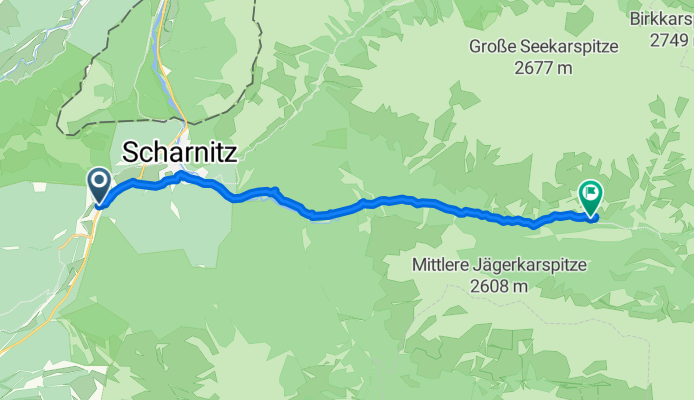
Route template
Scharnitz to Thaur

- 4 h 36 min
- Duration
- 69 km
- Distance
- 793 m
- Ascent
- 1,018 m
- Descent
- 15 km/h
- Avg. speed
- 1,277 m
- Max. altitude
This route takes you from Scharnitz, a charming Alpine village right on the Austrian-German border, down to the lovely town of Thaur near Innsbruck. The ride covers about 69 kilometers and is pretty varied: expect some gentle uphill stretches at first (you’ll climb nearly 800 meters), followed by a sweet descent all the way into Thaur.
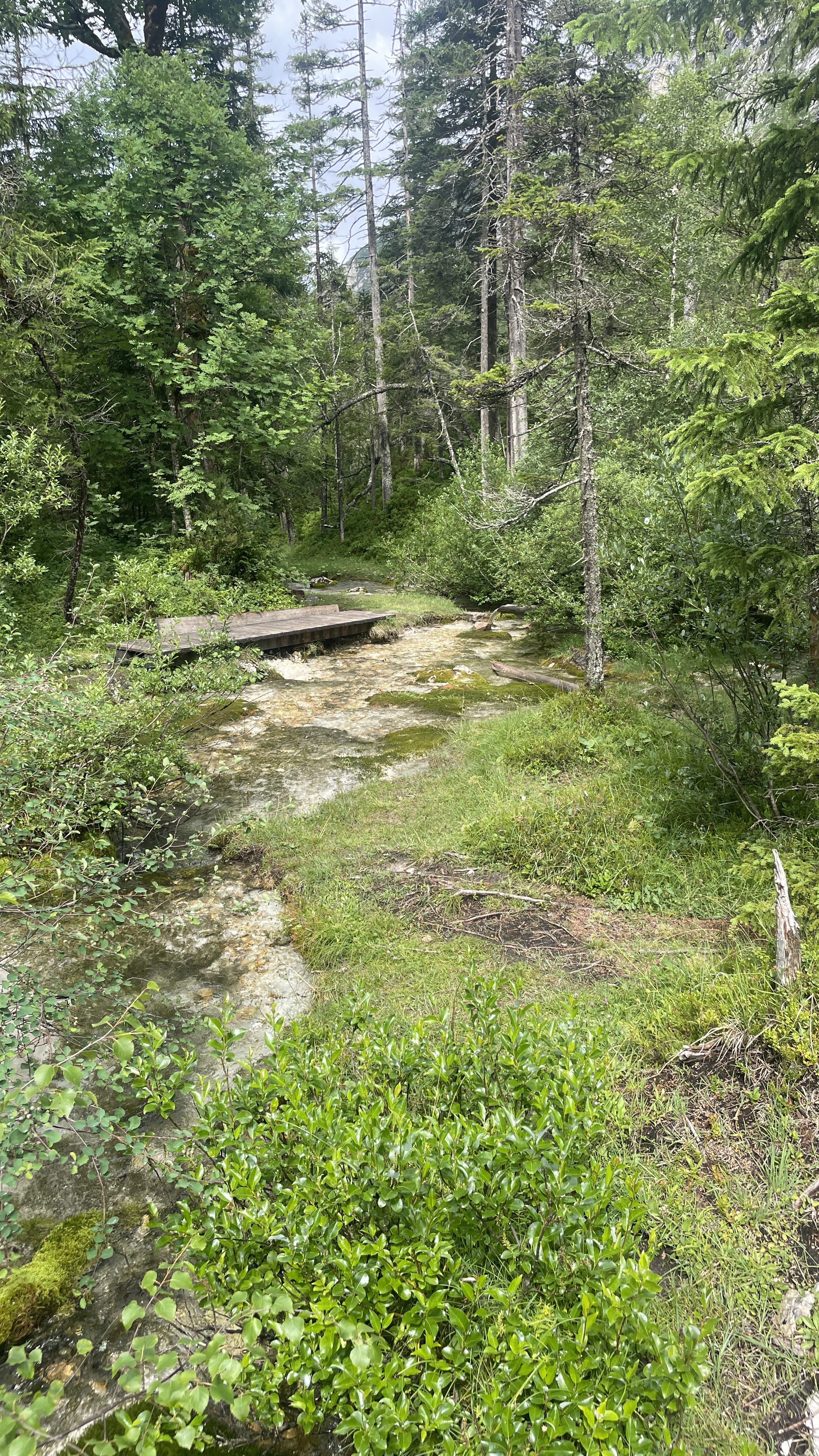
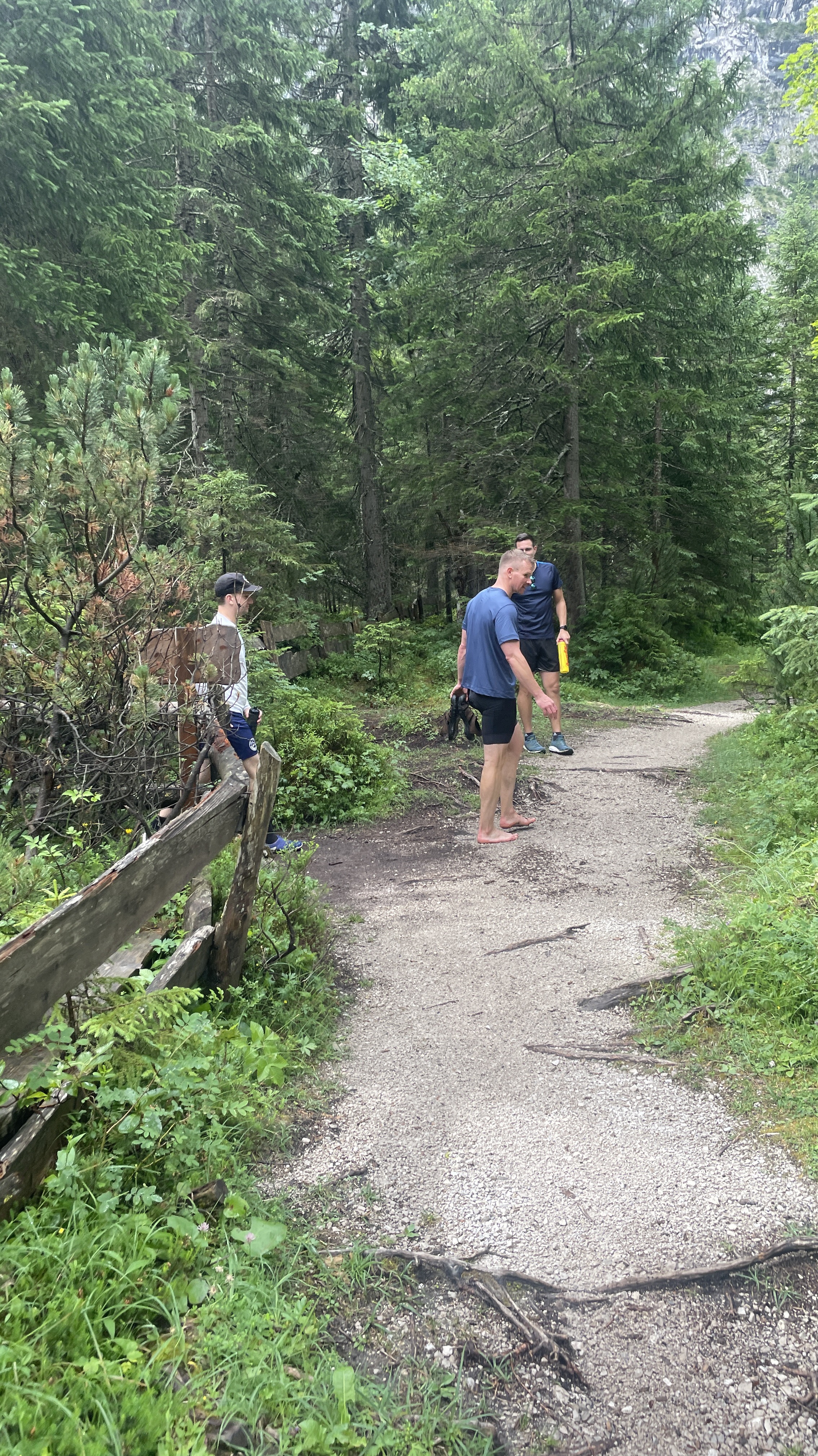
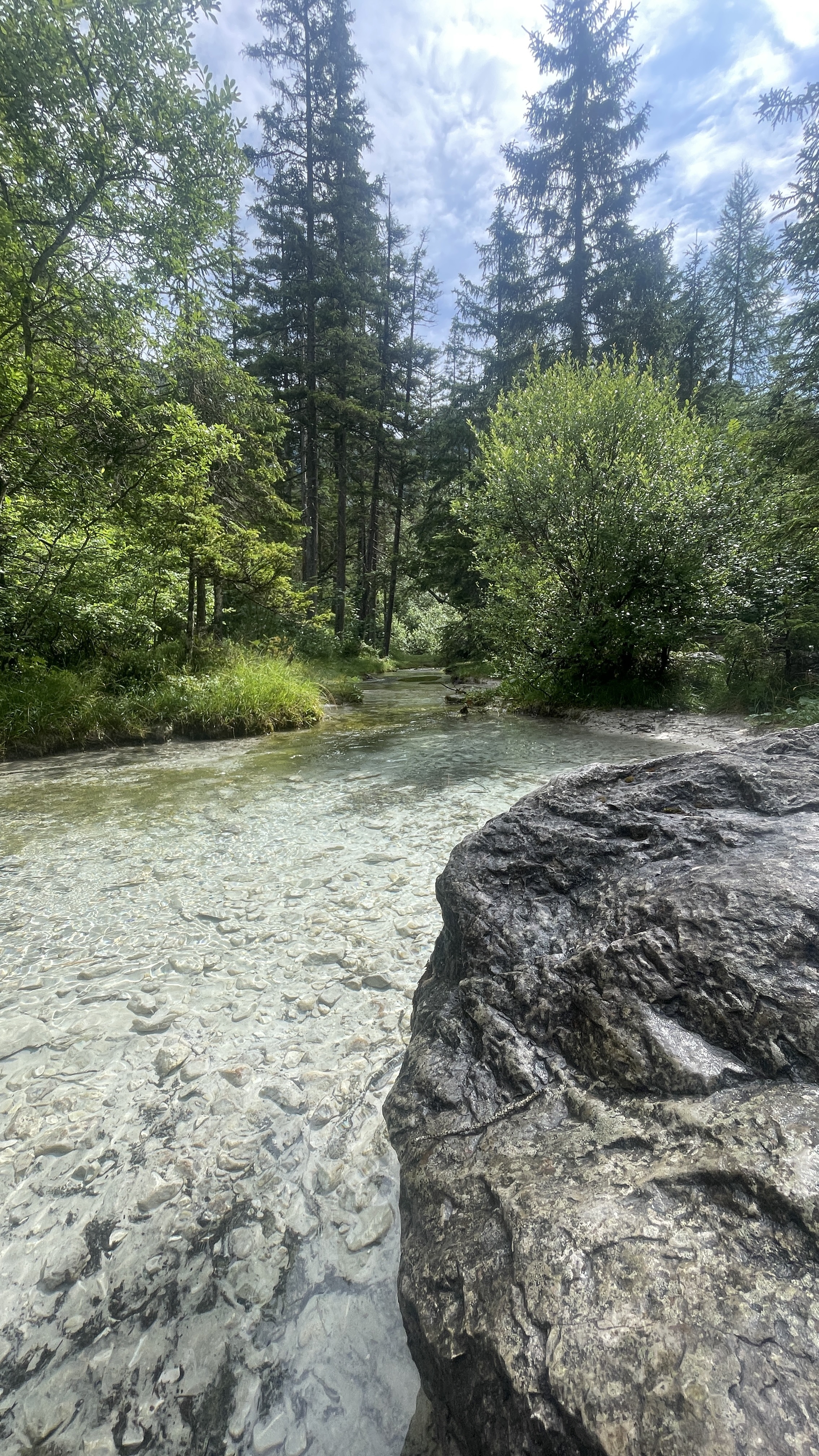
You’ll roll through classic Tyrolean scenery—think forested tracks, smooth cycleways, and quiet country roads, with the Alps as your backdrop. About three-quarters of the way is paved or good asphalt, but there’s a fair bit of gravel and unpaved track, so a gravel or trekking bike is recommended. Along the way, you’ll cross the Karwendel mountains and get panoramic valley views, perfect for photo stops.
Scharnitz is known as a gateway to the Karwendel Nature Park, making it a favorite spot for outdoor lovers. Thaur, meanwhile, is famous for its centuries-old onion farms and its hilltop castle ruins. All in all, a beautiful, mixed-terrain adventure with authentic Tyrolean vibes!
Community
Top users in this region


From our community
The best bike routes from Scharnitz to Thaur

Gießenbach - Pfeishütte
Cycling route in Scharnitz, Tyrol, Austria
- 21.9 km
- Distance
- 1,338 m
- Ascent
- 446 m
- Descent

Pfeishütte
Cycling route in Scharnitz, Tyrol, Austria
- 20.8 km
- Distance
- 1,350 m
- Ascent
- 448 m
- Descent

Gießenbach - Isarursprung
Cycling route in Scharnitz, Tyrol, Austria
- 15.3 km
- Distance
- 272 m
- Ascent
- 113 m
- Descent

Scharnitz - Kastenalm
Cycling route in Scharnitz, Tyrol, Austria
- 14 km
- Distance
- 398 m
- Ascent
- 153 m
- Descent

Isar-Ursprung
Cycling route in Scharnitz, Tyrol, Austria
- 20.3 km
- Distance
- 863 m
- Ascent
- 66 m
- Descent

awv97a1-Scharnitz-Isarquelle
Cycling route in Scharnitz, Tyrol, Austria
- 14.5 km
- Distance
- 320 m
- Ascent
- 61 m
- Descent

Scharnitz Bhf. - Kastenalm
Cycling route in Scharnitz, Tyrol, Austria
- 14.9 km
- Distance
- 391 m
- Ascent
- 129 m
- Descent

Scharnitz - Kastenalm
Cycling route in Scharnitz, Tyrol, Austria
- 14.1 km
- Distance
- 299 m
- Ascent
- 45 m
- Descent


Seefeld: Scharnitz bis Kastenalm
Cycling route in Scharnitz, Tyrol, Austria
- 13.7 km
- Distance
- 291 m
- Ascent
- 45 m
- Descent

Scharnitz Pleishütte
Cycling route in Scharnitz, Tyrol, Austria
- 18.7 km
- Distance
- 1,087 m
- Ascent
- 131 m
- Descent
Discover more routes
 Scharnitz - Kastenalm
- Distance
- 14 km
- Ascent
- 398 m
- Descent
- 153 m
- Location
- Scharnitz, Tyrol, Austria
 Isar-Ursprung
- Distance
- 20.3 km
- Ascent
- 863 m
- Descent
- 66 m
- Location
- Scharnitz, Tyrol, Austria
 awv97a1-Scharnitz-Isarquelle
- Distance
- 14.5 km
- Ascent
- 320 m
- Descent
- 61 m
- Location
- Scharnitz, Tyrol, Austria
 Scharnitz Bhf. - Kastenalm
- Distance
- 14.9 km
- Ascent
- 391 m
- Descent
- 129 m
- Location
- Scharnitz, Tyrol, Austria
 Scharnitz - Kastenalm
- Distance
- 14.1 km
- Ascent
- 299 m
- Descent
- 45 m
- Location
- Scharnitz, Tyrol, Austria
 tttttttttt
- Distance
- 12.8 km
- Ascent
- 260 m
- Descent
- 58 m
- Location
- Scharnitz, Tyrol, Austria
 Seefeld: Scharnitz bis Kastenalm
- Distance
- 13.7 km
- Ascent
- 291 m
- Descent
- 45 m
- Location
- Scharnitz, Tyrol, Austria
 Scharnitz Pleishütte
- Distance
- 18.7 km
- Ascent
- 1,087 m
- Descent
- 131 m
- Location
- Scharnitz, Tyrol, Austria
Routes to Thaur
Cycling day trip from
Mittenwald to Thaur