
By bicycle from Pfarrkirchen im Mühlkreis to Atzesberg
Customize your own route based on our template or discover how our community prefers to cycle from Pfarrkirchen im Mühlkreis to Atzesberg.
Route template
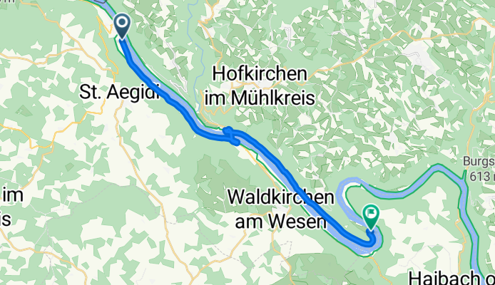
Pfarrkirchen im Mühlkreis to Atzesberg

- 39 min
- Duration
- 10.7 km
- Distance
- 142 m
- Ascent
- 418 m
- Descent
- 16.3 km/h
- Avg. speed
- 818 m
- Max. altitude
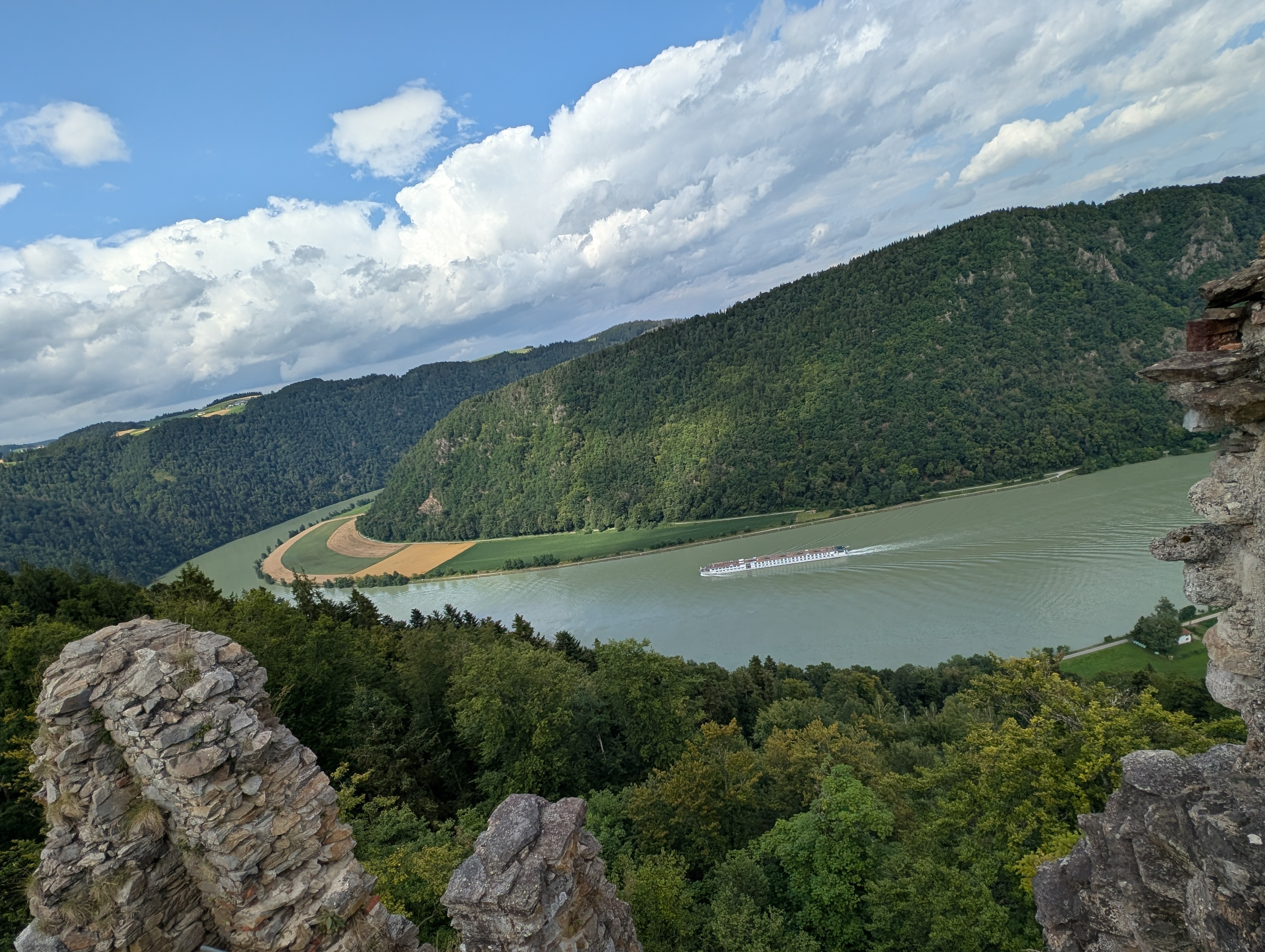
Get ready for a relaxed countryside ride from the hilltop village of Pfarrkirchen im Mühlkreis to the quiet hamlet of Atzesberg! Your journey covers just under 11 km and starts at around 800 meters elevation, so you’re treated to some fantastic views over the rolling Mühlviertel hills right out of the gate.
While you’ll climb a bit at first—about 140 meters of ascent—the ride mostly trends downhill, with over 400 meters of descent, so it’s perfect for riders who want to take it easy and enjoy the scenery. Almost the entire route follows quiet rural roads, giving you a chance to soak in the peaceful vibe of Upper Austria’s green countryside. Just a heads-up: surfaces can vary, so expect some stretches that aren’t fully paved.
By the time you reach Atzesberg, you’ll have swept through picturesque farmland and forests, ending in another cosy rural village. Pfarrkirchen is known for its beautiful Baroque parish church, while Atzesberg offers a tranquil, off-the-beaten-path finish. Bring a camera and maybe a snack—it’s a route to savor.
Community
Top users in this region


From our community
The best bike routes from Pfarrkirchen im Mühlkreis to Atzesberg
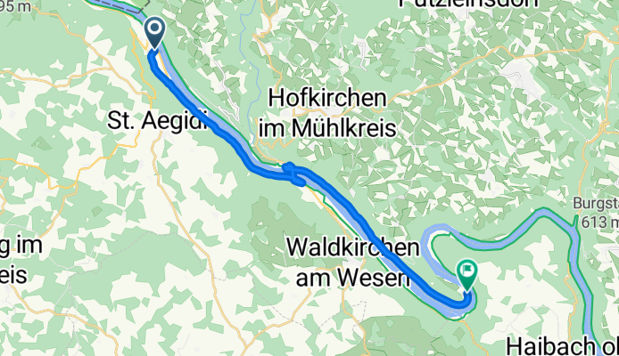
E10.2. 16.7.25 Passau nach Au
Cycling route in Pfarrkirchen im Mühlkreis, Upper Austria, Austria
- 16.2 km
- Distance
- 87 m
- Ascent
- 149 m
- Descent

Donau-Radweg Etappe 2.1
Cycling route in Pfarrkirchen im Mühlkreis, Upper Austria, Austria
- 21.4 km
- Distance
- 250 m
- Ascent
- 283 m
- Descent

Jochenstein Schlögen
Cycling route in Pfarrkirchen im Mühlkreis, Upper Austria, Austria
- 16.7 km
- Distance
- 57 m
- Ascent
- 58 m
- Descent

Tag 2 bis Fähre
Cycling route in Pfarrkirchen im Mühlkreis, Upper Austria, Austria
- 8.6 km
- Distance
- 102 m
- Ascent
- 98 m
- Descent

Hofkirchen im Mühlkreis a Donausteig Passau-Linz-St Nikola, Hofkirchen im Mühlkreis
Cycling route in Pfarrkirchen im Mühlkreis, Upper Austria, Austria
- 0.9 km
- Distance
- 10 m
- Ascent
- 15 m
- Descent

Recovered Route
Cycling route in Pfarrkirchen im Mühlkreis, Upper Austria, Austria
- 15.5 km
- Distance
- 154 m
- Ascent
- 159 m
- Descent

Nibelungen Straße 45, Engelhartszell nach Au 3
Cycling route in Pfarrkirchen im Mühlkreis, Upper Austria, Austria
- 16.8 km
- Distance
- 55 m
- Ascent
- 63 m
- Descent

Mühltalradwegrunde
Cycling route in Pfarrkirchen im Mühlkreis, Upper Austria, Austria
- 41.5 km
- Distance
- 960 m
- Ascent
- 976 m
- Descent

Recovered Route
Cycling route in Pfarrkirchen im Mühlkreis, Upper Austria, Austria
- 9.7 km
- Distance
- 363 m
- Ascent
- 78 m
- Descent
Engelhartszell nach Camping
Cycling route in Pfarrkirchen im Mühlkreis, Upper Austria, Austria
- 16.5 km
- Distance
- 276 m
- Ascent
- 273 m
- Descent

Am Kraftwerk 2, Untergriesbach nach Mitterberg 3, Sankt Agatha
Cycling route in Pfarrkirchen im Mühlkreis, Upper Austria, Austria
- 17.8 km
- Distance
- 120 m
- Ascent
- 126 m
- Descent

De Inzell 6 à Schlögen 2
Cycling route in Pfarrkirchen im Mühlkreis, Upper Austria, Austria
- 6 km
- Distance
- 58 m
- Ascent
- 81 m
- Descent
Discover more routes
 Hofkirchen im Mühlkreis a Donausteig Passau-Linz-St Nikola, Hofkirchen im Mühlkreis
- Distance
- 0.9 km
- Ascent
- 10 m
- Descent
- 15 m
- Location
- Pfarrkirchen im Mühlkreis, Upper Austria, Austria
 Recovered Route
- Distance
- 15.5 km
- Ascent
- 154 m
- Descent
- 159 m
- Location
- Pfarrkirchen im Mühlkreis, Upper Austria, Austria
 Nibelungen Straße 45, Engelhartszell nach Au 3
- Distance
- 16.8 km
- Ascent
- 55 m
- Descent
- 63 m
- Location
- Pfarrkirchen im Mühlkreis, Upper Austria, Austria
 Mühltalradwegrunde
- Distance
- 41.5 km
- Ascent
- 960 m
- Descent
- 976 m
- Location
- Pfarrkirchen im Mühlkreis, Upper Austria, Austria
 Recovered Route
- Distance
- 9.7 km
- Ascent
- 363 m
- Descent
- 78 m
- Location
- Pfarrkirchen im Mühlkreis, Upper Austria, Austria
 Engelhartszell nach Camping
- Distance
- 16.5 km
- Ascent
- 276 m
- Descent
- 273 m
- Location
- Pfarrkirchen im Mühlkreis, Upper Austria, Austria
 Am Kraftwerk 2, Untergriesbach nach Mitterberg 3, Sankt Agatha
- Distance
- 17.8 km
- Ascent
- 120 m
- Descent
- 126 m
- Location
- Pfarrkirchen im Mühlkreis, Upper Austria, Austria
 De Inzell 6 à Schlögen 2
- Distance
- 6 km
- Ascent
- 58 m
- Descent
- 81 m
- Location
- Pfarrkirchen im Mühlkreis, Upper Austria, Austria
Routes from Pfarrkirchen im Mühlkreis
Cycling day trip from
Pfarrkirchen im Mühlkreis to Ottensheim
Cycling day trip from
Pfarrkirchen im Mühlkreis to Schärding
Routes to Atzesberg
Cycling day trip from
Passau to Atzesberg
Cycling day trip from
Schärding to Atzesberg