
Route template
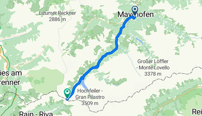
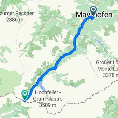
Mayrhofen to Schmirn

- 7 h 44 min
- Duration
- 114 km
- Distance
- 2,366 m
- Ascent
- 1,579 m
- Descent
- 14.7 km/h
- Avg. speed
- 1,430 m
- Max. altitude
Starting your cycling adventure in Mayrhofen, a lively Tyrolean village known for its stunning mountain backdrop and as a gateway to the Zillertal Alps, you’ll be heading to the peaceful alpine valley of Schmirn. Your journey covers around 114 kilometers with some serious climbing—expect about 2,400 meters of ascent!
You’ll roll out on mostly paved and quiet mountain roads, soaking in classic Austrian alpine scenery. The route features a mix of back roads and gravel tracks, occasionally crossing onto local cycleways. As you climb higher, take a moment to enjoy panoramic views and stop in a mountain hut for a refreshing break.
Once you reach Schmirn, nestled in a tranquil side valley off the Wipptal, you’ll discover an authentic, sleepy Tyrolean village surrounded by dramatic peaks—perfect for a well-earned rest. It’s a challenging route that rewards with a real taste of Alpine adventure!
Bikepacking tours
Already sliced up into perfect stages by our community
Community
Top users in this region


From our community
The best bike routes from Mayrhofen to Schmirn

PŘ 12z - AT2012 - Mayrhofen - přehrada Schlegeisspeicher
Cycling route in Mayrhofen, Tyrol, Austria
- 27.2 km
- Distance
- 2,320 m
- Ascent
- 1,093 m
- Descent

Mayerhofen Schlegeis
Cycling route in Mayrhofen, Tyrol, Austria
- 25 km
- Distance
- 2,246 m
- Ascent
- 1,076 m
- Descent

Zillertal
Cycling route in Mayrhofen, Tyrol, Austria
- 12.6 km
- Distance
- 842 m
- Ascent
- 50 m
- Descent


02 Venedig: Mayrhofen - Breitlahner
Cycling route in Mayrhofen, Tyrol, Austria
- 18.4 km
- Distance
- 674 m
- Ascent
- 36 m
- Descent

Transe-Alp 2007
Cycling route in Mayrhofen, Tyrol, Austria
- 29.1 km
- Distance
- 3,355 m
- Ascent
- 1,740 m
- Descent

2024_MTB_TZ_Tuxer_Joch
Cycling route in Mayrhofen, Tyrol, Austria
- 30.3 km
- Distance
- 2,167 m
- Ascent
- 483 m
- Descent

Breitlahner
Cycling route in Mayrhofen, Tyrol, Austria
- 24.1 km
- Distance
- 1,184 m
- Ascent
- 147 m
- Descent


Lanersbach zum Tuxerjochhaus
Cycling route in Mayrhofen, Tyrol, Austria
- 15 km
- Distance
- 1,126 m
- Ascent
- 104 m
- Descent
Transalp 2017 THG Nördlingen
Cycling route in Mayrhofen, Tyrol, Austria
- 30.4 km
- Distance
- 1,665 m
- Ascent
- 70 m
- Descent

Mayrhofen - Schlegeis Speicher
Cycling route in Mayrhofen, Tyrol, Austria
- 22.7 km
- Distance
- 2,392 m
- Ascent
- 1,248 m
- Descent
Discover more routes
 02 Venedig: Mayrhofen - Breitlahner
- Distance
- 18.4 km
- Ascent
- 674 m
- Descent
- 36 m
- Location
- Mayrhofen, Tyrol, Austria
 Transe-Alp 2007
- Distance
- 29.1 km
- Ascent
- 3,355 m
- Descent
- 1,740 m
- Location
- Mayrhofen, Tyrol, Austria
 2024_MTB_TZ_Tuxer_Joch
- Distance
- 30.3 km
- Ascent
- 2,167 m
- Descent
- 483 m
- Location
- Mayrhofen, Tyrol, Austria
 Breitlahner
- Distance
- 24.1 km
- Ascent
- 1,184 m
- Descent
- 147 m
- Location
- Mayrhofen, Tyrol, Austria
 2024_MTB_TZ_PJoch
- Distance
- 30.8 km
- Ascent
- 2,082 m
- Descent
- 479 m
- Location
- Mayrhofen, Tyrol, Austria
 Lanersbach zum Tuxerjochhaus
- Distance
- 15 km
- Ascent
- 1,126 m
- Descent
- 104 m
- Location
- Mayrhofen, Tyrol, Austria
 Transalp 2017 THG Nördlingen
- Distance
- 30.4 km
- Ascent
- 1,665 m
- Descent
- 70 m
- Location
- Mayrhofen, Tyrol, Austria
 Mayrhofen - Schlegeis Speicher
- Distance
- 22.7 km
- Ascent
- 2,392 m
- Descent
- 1,248 m
- Location
- Mayrhofen, Tyrol, Austria
Routes from Mayrhofen
Cycling day trip from
Mayrhofen to Ried