


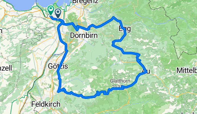


Oberstaufenrunde (kurze Variante)
- 128.2 km
- 2,052 m
- 2,049 m
- Höchst, Vorarlberg, Austria

Route template

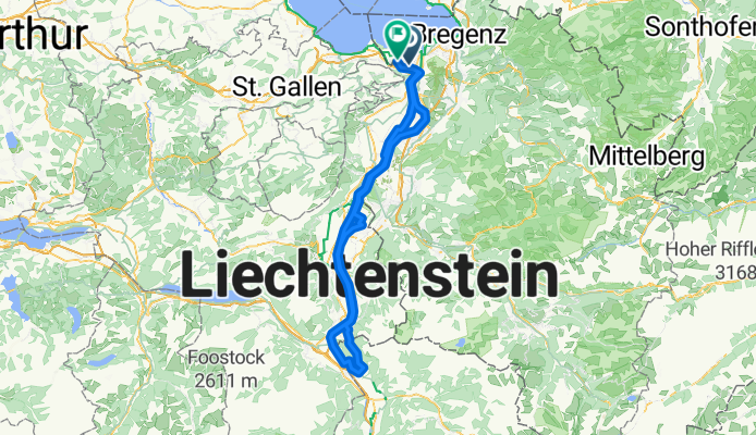
Get ready for a pleasant ride from Höchst to Rheineck! This 10.4 km cycling route is mostly flat and gentle, with just about 46 meters of climbing, making it perfect for a relaxing outing or a leisurely commute. Starting in Höchst, a charming Austrian town nestled near the natural beauty of the Rhine delta, you’ll pedal along quiet cycleways and some scenic paths.
Around 80% of the surfaces are paved, so you’ll have a smooth ride for most of the trip—with just a few stretches of gravel to keep things interesting. There’s no need to worry about busy roads; this route steers you clear of traffic, sticking mostly to peaceful residential streets and dedicated cycle paths.
Your destination, Rheineck, welcomes you on the Swiss side of the border. It’s a small, historic town right by the Rhine River, known for its old town atmosphere and riverside charm. All in all, this is a lovely, cross-border ride with riverside views, postcard towns, and just enough variety to keep it fun!
Community
From our community
Cycling route in Höchst, Vorarlberg, Austria
Cycling route in Höchst, Vorarlberg, Austria
Cycling route in Höchst, Vorarlberg, Austria
Cycling route in Höchst, Vorarlberg, Austria
Cycling route in Höchst, Vorarlberg, Austria
Cycling route in Höchst, Vorarlberg, Austria
Cycling route in Höchst, Vorarlberg, Austria
Cycling route in Höchst, Vorarlberg, Austria
Cycling route in Höchst, Vorarlberg, Austria
Cycling route in Höchst, Vorarlberg, Austria
Cycling route in Höchst, Vorarlberg, Austria
Cycling route in Höchst, Vorarlberg, Austria


