
Cycling day trip from Bruck an der Großglocknerstraße to Heiligenblut am Großglockner
Customize your own route based on our template or discover how our community prefers to cycle from Bruck an der Großglocknerstraße to Heiligenblut am Großglockner.
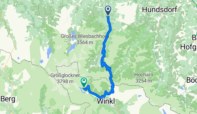
Route template
Bruck an der Großglocknerstraße to Heiligenblut am Großglockner

- 9 h 44 min
- Duration
- 128.4 km
- Distance
- 3,810 m
- Ascent
- 3,285 m
- Descent
- 13.2 km/h
- Avg. speed
- 1,543 m
- Max. altitude
Get ready for an Alpine epic! This cycling route takes you from Bruck an der Großglocknerstraße—your classic gateway to Austria’s legendary mountains—over to the postcard-perfect village of Heiligenblut am Großglockner.
The ride packs in about 128 km with a whopping 3,800 meters of climbing, so bring your mountain legs. Most of your ride is on paved or asphalt surfaces, cruising along quiet roads and the occasional cycle path, but there’s just enough variety to keep things interesting. You’ll wind your way up through forests and meadows, catching jaw-dropping views of Austria’s highest peak, the Großglockner (3,798 m), before a thrilling descent to Heiligenblut—famous for its striking church and dramatic mountain backdrop.
Take plenty of stops for photos and snacks, especially as you reach the high point: this is one of Europe’s dream cycling routes! Heiligenblut awaits at the end, offering cozy cafés and classic mountain charm—a perfect finish after an unforgettable ride.
Community
Top users in this region


From our community
The best bike routes from Bruck an der Großglocknerstraße to Heiligenblut am Großglockner

Glocknerkönig
Cycling route in Bruck an der Großglocknerstraße, Salzburg, Austria
- 27.3 km
- Distance
- 1,699 m
- Ascent
- 222 m
- Descent

Fusch Grossglockner
Cycling route in Bruck an der Großglocknerstraße, Salzburg, Austria
- 19.1 km
- Distance
- 1,605 m
- Ascent
- 26 m
- Descent

Grossglockner route
Cycling route in Bruck an der Großglocknerstraße, Salzburg, Austria
- 51.6 km
- Distance
- 2,423 m
- Ascent
- 828 m
- Descent
Zeller Fusch, Fusch an der Großglocknerstraße nach Winkl, Heiligenblut am Großglockner
Cycling route in Bruck an der Großglocknerstraße, Salzburg, Austria
- 42.6 km
- Distance
- 3,046 m
- Ascent
- 1,548 m
- Descent

EDL
Cycling route in Bruck an der Großglocknerstraße, Salzburg, Austria
- 29.5 km
- Distance
- 1,804 m
- Ascent
- 7 m
- Descent

BPM - die Glocknererklimmung von Bruck
Cycling route in Bruck an der Großglocknerstraße, Salzburg, Austria
- 29 km
- Distance
- 1,876 m
- Ascent
- 235 m
- Descent

Grossglockner climb from Fusch (fr north)
Cycling route in Bruck an der Großglocknerstraße, Salzburg, Austria
- 27.2 km
- Distance
- 2,019 m
- Ascent
- 264 m
- Descent

Großklocknertour 2017 1. Etappe
Cycling route in Bruck an der Großglocknerstraße, Salzburg, Austria
- 64.6 km
- Distance
- 2,388 m
- Ascent
- 1,844 m
- Descent

...
Cycling route in Bruck an der Großglocknerstraße, Salzburg, Austria
- 59 km
- Distance
- 2,620 m
- Ascent
- 1,022 m
- Descent

Grossglockner
Cycling route in Bruck an der Großglocknerstraße, Salzburg, Austria
- 61.2 km
- Distance
- 2,832 m
- Ascent
- 2,362 m
- Descent

Day 70
Cycling route in Bruck an der Großglocknerstraße, Salzburg, Austria
- 42.7 km
- Distance
- 2,018 m
- Ascent
- 1,567 m
- Descent
Großglockner / Edelweißspitze
Cycling route in Bruck an der Großglocknerstraße, Salzburg, Austria
- 30.4 km
- Distance
- 1,818 m
- Ascent
- 17 m
- Descent
Discover more routes
 EDL
EDL- Distance
- 29.5 km
- Ascent
- 1,804 m
- Descent
- 7 m
- Location
- Bruck an der Großglocknerstraße, Salzburg, Austria
 BPM - die Glocknererklimmung von Bruck
- Distance
- 29 km
- Ascent
- 1,876 m
- Descent
- 235 m
- Location
- Bruck an der Großglocknerstraße, Salzburg, Austria
 Grossglockner climb from Fusch (fr north)
- Distance
- 27.2 km
- Ascent
- 2,019 m
- Descent
- 264 m
- Location
- Bruck an der Großglocknerstraße, Salzburg, Austria
 Großklocknertour 2017 1. Etappe
- Distance
- 64.6 km
- Ascent
- 2,388 m
- Descent
- 1,844 m
- Location
- Bruck an der Großglocknerstraße, Salzburg, Austria
 ...
...- Distance
- 59 km
- Ascent
- 2,620 m
- Descent
- 1,022 m
- Location
- Bruck an der Großglocknerstraße, Salzburg, Austria
 Grossglockner
- Distance
- 61.2 km
- Ascent
- 2,832 m
- Descent
- 2,362 m
- Location
- Bruck an der Großglocknerstraße, Salzburg, Austria
 Day 70
- Distance
- 42.7 km
- Ascent
- 2,018 m
- Descent
- 1,567 m
- Location
- Bruck an der Großglocknerstraße, Salzburg, Austria
 Großglockner / Edelweißspitze
- Distance
- 30.4 km
- Ascent
- 1,818 m
- Descent
- 17 m
- Location
- Bruck an der Großglocknerstraße, Salzburg, Austria
Routes from Bruck an der Großglocknerstraße
Cycling day trip from
Bruck an der Großglocknerstraße to Lienz
By bicycle from
Bruck an der Großglocknerstraße to Zell am See
Routes to Heiligenblut am Großglockner
Cycling day trip from
Lienz to Heiligenblut am Großglockner
Cycling day trip from
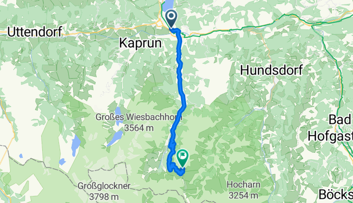
Kaprun to Heiligenblut am Großglockner
By bicycle from
Großkirchheim to Heiligenblut am Großglockner