
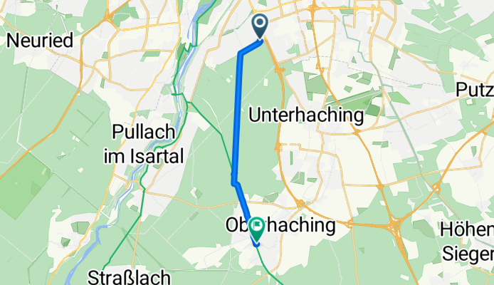
By bicycle from Unterhaching to Oberhaching
Customize your own route based on our template or discover how our community prefers to cycle from Unterhaching to Oberhaching.
Route template
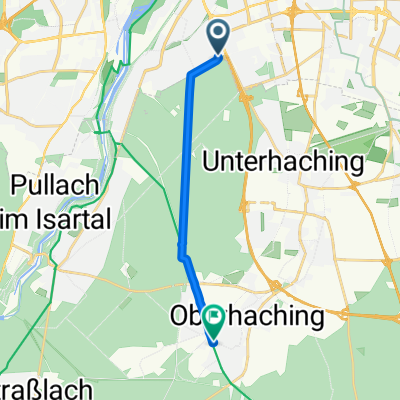
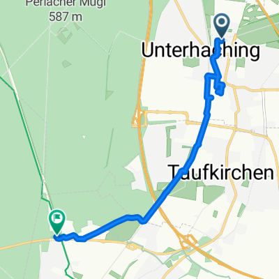
Unterhaching to Oberhaching
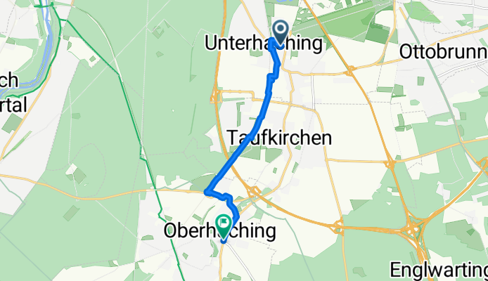
- 25 min
- Duration
- 6.7 km
- Distance
- 30 m
- Ascent
- 11 m
- Descent
- 16 km/h
- Avg. speed
- 583 m
- Max. altitude
Ready for a leisurely ride through the southern edge of Munich? This route takes you from Unterhaching to Oberhaching—two charming Bavarian towns just outside the city.
Starting in Unterhaching, known for its vibrant community and proximity to great green spaces, you’ll head south for about 6.7 km. Most of the ride is on smooth paved surfaces, so you can cruise comfortably whether you’re on a road bike or a city cruiser. Paths and quiet roads make up the majority of the route, which means you’ll enjoy a relaxed atmosphere with minimal traffic.
The elevation gain is gentle (just under 30 meters), so expect only mild hills—perfect for an easy-paced outing. Along the way, keep an eye out for lush parks and glimpses of the Isar valley. You’ll finish in Oberhaching, a scenic village with a historic center and traditional Bavarian charm—perfect for a coffee stop or a stroll before heading back.
Happy cycling!
Community
Top users in this region


From our community
The best bike routes from Unterhaching to Oberhaching

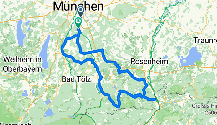
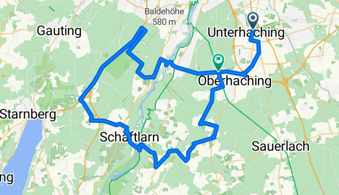
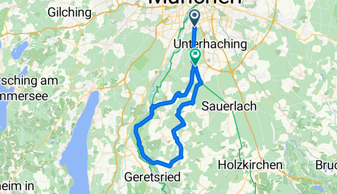
200km + Klettertour
Cycling route in Unterhaching, Bavaria, Germany
- 203.6 km
- Distance
- 1,284 m
- Ascent
- 1,235 m
- Descent

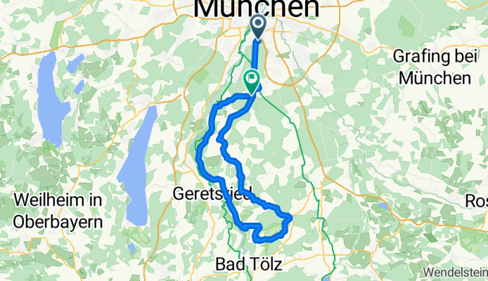
Humbacher Berg und über Schäftlarn zurück
Cycling route in Unterhaching, Bavaria, Germany
- 73.4 km
- Distance
- 444 m
- Ascent
- 386 m
- Descent

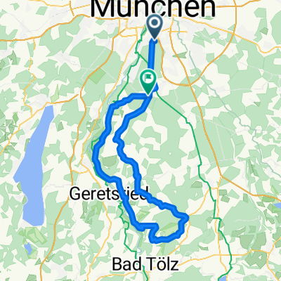
Schönste Runde im Münchner Süden
Cycling route in Unterhaching, Bavaria, Germany
- 61 km
- Distance
- 343 m
- Ascent
- 302 m
- Descent
220mit valepp und Sudelfeld
Cycling route in Unterhaching, Bavaria, Germany
- 224.3 km
- Distance
- 1,678 m
- Ascent
- 1,638 m
- Descent
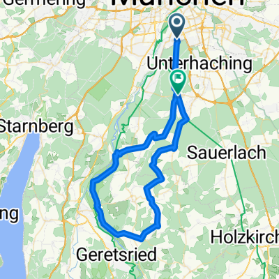
Training_Bairaweis
Cycling route in Unterhaching, Bavaria, Germany
- 89.3 km
- Distance
- 456 m
- Ascent
- 396 m
- Descent
Schäftlarn/Aumühle
Cycling route in Unterhaching, Bavaria, Germany
- 63.6 km
- Distance
- 561 m
- Ascent
- 486 m
- Descent
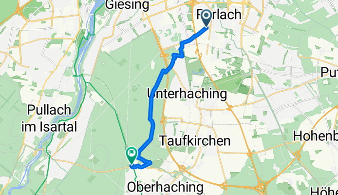
München-Harlaching nach Deisenhofen
Cycling route in Unterhaching, Bavaria, Germany
- 9 km
- Distance
- 45 m
- Ascent
- 0 m
- Descent
Haus-Rabe-bike
Cycling route in Unterhaching, Bavaria, Germany
- 10.9 km
- Distance
- 45 m
- Ascent
- 11 m
- Descent
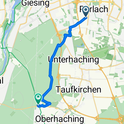
Fasangartenstraße, München nach Linienstraße, Oberhaching
Cycling route in Unterhaching, Bavaria, Germany
- 10.2 km
- Distance
- 65 m
- Ascent
- 13 m
- Descent
Fasangartenstraße, München nach Linienstraße, Oberhaching
Cycling route in Unterhaching, Bavaria, Germany
- 10 km
- Distance
- 48 m
- Ascent
- 4 m
- Descent

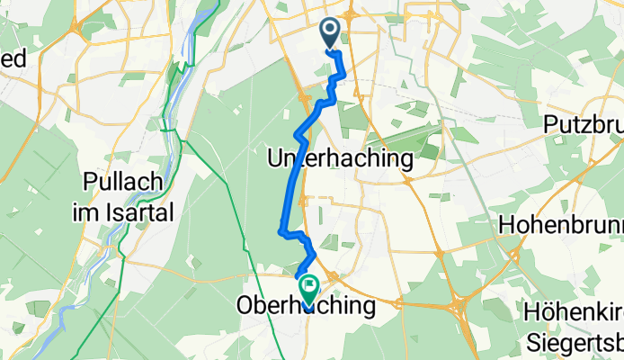
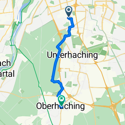
Walter-Paetzmann-Straße, Unterhaching nach Linienstraße, Oberhaching
Cycling route in Unterhaching, Bavaria, Germany
- 7.2 km
- Distance
- 52 m
- Ascent
- 20 m
- Descent
Discover more routes
 Training_Bairaweis
- Distance
- 89.3 km
- Ascent
- 456 m
- Descent
- 396 m
- Location
- Unterhaching, Bavaria, Germany
 Schäftlarn/Aumühle
- Distance
- 63.6 km
- Ascent
- 561 m
- Descent
- 486 m
- Location
- Unterhaching, Bavaria, Germany
 München-Harlaching nach Deisenhofen
- Distance
- 9 km
- Ascent
- 45 m
- Descent
- 0 m
- Location
- Unterhaching, Bavaria, Germany
 Haus-Rabe-bike
- Distance
- 10.9 km
- Ascent
- 45 m
- Descent
- 11 m
- Location
- Unterhaching, Bavaria, Germany
 Fasangartenstraße, München nach Linienstraße, Oberhaching
- Distance
- 10.2 km
- Ascent
- 65 m
- Descent
- 13 m
- Location
- Unterhaching, Bavaria, Germany
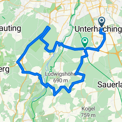
 Sevi´s Erste
- Distance
- 59.1 km
- Ascent
- 265 m
- Descent
- 230 m
- Location
- Unterhaching, Bavaria, Germany
 Fasangartenstraße, München nach Linienstraße, Oberhaching
- Distance
- 10 km
- Ascent
- 48 m
- Descent
- 4 m
- Location
- Unterhaching, Bavaria, Germany
 Walter-Paetzmann-Straße, Unterhaching nach Linienstraße, Oberhaching
- Distance
- 7.2 km
- Ascent
- 52 m
- Descent
- 20 m
- Location
- Unterhaching, Bavaria, Germany
Routes from Unterhaching
By bicycle from
Unterhaching to Munich
By bicycle from
Unterhaching to Bogenhausen
Routes to Oberhaching
By bicycle from
Munich to Oberhaching