
By bicycle from Übach-Palenberg to Geilenkirchen
Customize your own route based on our template or discover how our community prefers to cycle from Übach-Palenberg to Geilenkirchen.
Route template
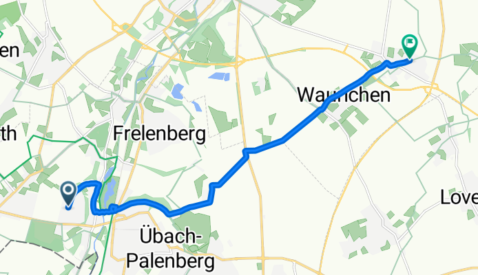
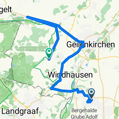
Übach-Palenberg to Geilenkirchen

- 38 min
- Duration
- 10.7 km
- Distance
- 47 m
- Ascent
- 60 m
- Descent
- 17 km/h
- Avg. speed
- 117 m
- Max. altitude
Start your ride in Übach-Palenberg, a cozy town nestled close to the Dutch border, known for its mining history and pretty parklands along the Wurm river. From here, your 10.7 km journey to Geilenkirchen is mostly gentle, with around 47 meters of ascent and a bit more descent, so you can let gravity help you along the way!
You'll pedal along a pleasant mix of quiet roads, paved paths, and a few stretches of cycleway. Most of the surface is somewhat mixed, so while you’ll get a lot of paved and asphalt sections, there may be missing bits—perfect for those who like a little adventure off the well-trodden path.
Geilenkirchen awaits at the end, a charming town best known for its role as home to a NATO airbase and as a gateway to the scenic Selfkant region. It’s a relaxed ride with countryside scenery and plenty of fresh air—ideal for an easy afternoon spin!
Community
Top users in this region


From our community
The best bike routes from Übach-Palenberg to Geilenkirchen


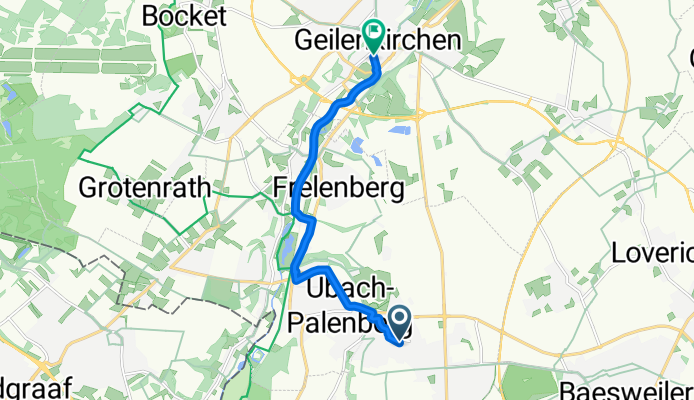
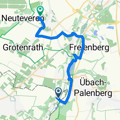
Route nach Apweilerstraße, Geilenkirchen
Cycling route in Übach-Palenberg, North Rhine-Westphalia, Germany
- 9 km
- Distance
- 51 m
- Ascent
- 60 m
- Descent
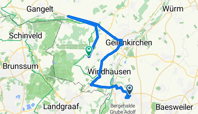
Thornstraße, Übach-Palenberg nach Herzog-Wilhelm-Straße, Geilenkirchen
Cycling route in Übach-Palenberg, North Rhine-Westphalia, Germany
- 7.9 km
- Distance
- 11 m
- Ascent
- 62 m
- Descent

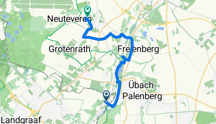
worm roer
Cycling route in Übach-Palenberg, North Rhine-Westphalia, Germany
- 8.6 km
- Distance
- 12 m
- Ascent
- 33 m
- Descent

Wauricher Weg, Geilenkirchen a Konrad-Adenauer-Straße 101, Geilenkirchen
Cycling route in Übach-Palenberg, North Rhine-Westphalia, Germany
- 4.6 km
- Distance
- 345 m
- Ascent
- 384 m
- Descent
Uebach palenberg - Nato Air Base
Cycling route in Übach-Palenberg, North Rhine-Westphalia, Germany
- 23.2 km
- Distance
- 50 m
- Ascent
- 89 m
- Descent

Zur Arbeit 26
Cycling route in Übach-Palenberg, North Rhine-Westphalia, Germany
- 26.1 km
- Distance
- 96 m
- Ascent
- 83 m
- Descent

MdRzA 19 km
Cycling route in Übach-Palenberg, North Rhine-Westphalia, Germany
- 19.2 km
- Distance
- 76 m
- Ascent
- 63 m
- Descent

Cafe Immendorf
Cycling route in Übach-Palenberg, North Rhine-Westphalia, Germany
- 10.1 km
- Distance
- 42 m
- Ascent
- 45 m
- Descent
Brugstraat 16, Landgraaf to Sisbenden 24, Geilenkirchen
Cycling route in Übach-Palenberg, North Rhine-Westphalia, Germany
- 9.3 km
- Distance
- 66 m
- Ascent
- 65 m
- Descent

Prummern-Rimburg
Cycling route in Übach-Palenberg, North Rhine-Westphalia, Germany
- 27.8 km
- Distance
- 84 m
- Ascent
- 100 m
- Descent

MdRzA 19
Cycling route in Übach-Palenberg, North Rhine-Westphalia, Germany
- 18.5 km
- Distance
- 96 m
- Ascent
- 84 m
- Descent

an die Limburgischen Grenzgebiet DE-NL
Cycling route in Übach-Palenberg, North Rhine-Westphalia, Germany
- 61.4 km
- Distance
- 143 m
- Ascent
- 158 m
- Descent
Discover more routes
 Uebach palenberg - Nato Air Base
- Distance
- 23.2 km
- Ascent
- 50 m
- Descent
- 89 m
- Location
- Übach-Palenberg, North Rhine-Westphalia, Germany
 Zur Arbeit 26
- Distance
- 26.1 km
- Ascent
- 96 m
- Descent
- 83 m
- Location
- Übach-Palenberg, North Rhine-Westphalia, Germany
 MdRzA 19 km
- Distance
- 19.2 km
- Ascent
- 76 m
- Descent
- 63 m
- Location
- Übach-Palenberg, North Rhine-Westphalia, Germany
 Cafe Immendorf
- Distance
- 10.1 km
- Ascent
- 42 m
- Descent
- 45 m
- Location
- Übach-Palenberg, North Rhine-Westphalia, Germany
 Brugstraat 16, Landgraaf to Sisbenden 24, Geilenkirchen
- Distance
- 9.3 km
- Ascent
- 66 m
- Descent
- 65 m
- Location
- Übach-Palenberg, North Rhine-Westphalia, Germany
 Prummern-Rimburg
- Distance
- 27.8 km
- Ascent
- 84 m
- Descent
- 100 m
- Location
- Übach-Palenberg, North Rhine-Westphalia, Germany
 MdRzA 19
- Distance
- 18.5 km
- Ascent
- 96 m
- Descent
- 84 m
- Location
- Übach-Palenberg, North Rhine-Westphalia, Germany
 an die Limburgischen Grenzgebiet DE-NL
- Distance
- 61.4 km
- Ascent
- 143 m
- Descent
- 158 m
- Location
- Übach-Palenberg, North Rhine-Westphalia, Germany