
Quick ride by bicycle from Tempelhof to Mariendorf
Customize your own route based on our template or discover how our community prefers to cycle from Tempelhof to Mariendorf.
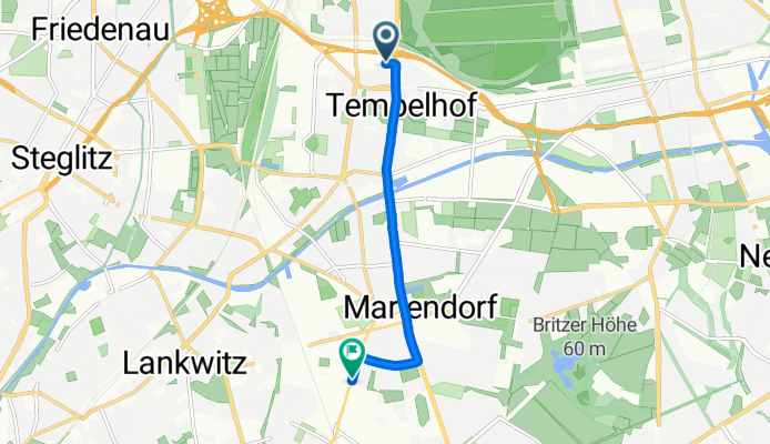
Route template
Tempelhof to Mariendorf

- 42 min
- Duration
- 10.5 km
- Distance
- 27 m
- Ascent
- 22 m
- Descent
- 15.2 km/h
- Avg. speed
- 53 m
- Max. altitude
This relaxed ride starts in Tempelhof, a lively South Berlin district famous for its vast Tempelhofer Feld—a former airport turned massive urban park. As you pedal south, you’ll cruise mostly on quiet roads and smooth asphalt, so it’s easy-going and safe for most abilities. There’s a gentle climb here and there, but nothing leg-burning; overall, it’s a smooth urban glide.
The route winds roughly 10.5 km towards Mariendorf, a charming neighborhood known for its historical horse racing track and peaceful residential streets. Along the way, you’ll catch a blend of city energy and leafy corners, with plenty of opportunities to grab a coffee or relax in a park. Keep an eye out for pockets of Berlin’s classic architecture and community gardens as you go.
With most of the way paved and traffic pretty light, this is a great route if you want a mellow Berlin cycling experience from one classic Kiez to another—perfect for a casual ride or a laid-back commute.
Community
Top users in this region


From our community
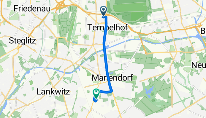
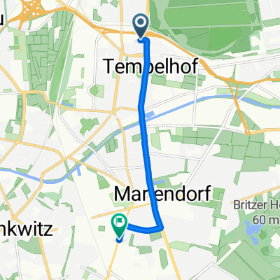
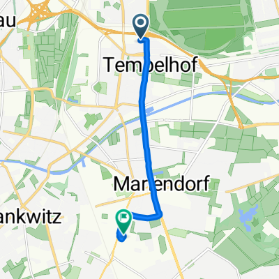
The best bike routes from Tempelhof to Mariendorf


Mariendorfer Weg 21, Berlin nach Im Marienpark 3–11, Berlin
Cycling route in Tempelhof, State of Berlin, Germany
- 5.6 km
- Distance
- 130 m
- Ascent
- 139 m
- Descent

Tempelhof-Schöneberg, Berlin nach Rathausstraße 27, Berlin
Cycling route in Tempelhof, State of Berlin, Germany
- 16.6 km
- Distance
- 72 m
- Ascent
- 73 m
- Descent

Kleineweg 75, Berlin nach Wolframstraße 49, Berlin
Cycling route in Tempelhof, State of Berlin, Germany
- 4.5 km
- Distance
- 62 m
- Ascent
- 61 m
- Descent

Colditzstraße 34-36, Berlin nach Rathausstraße 100, Berlin
Cycling route in Tempelhof, State of Berlin, Germany
- 9.2 km
- Distance
- 6 m
- Ascent
- 6 m
- Descent

Neukölln, Berlin nach Königstraße 16, Berlin
Cycling route in Tempelhof, State of Berlin, Germany
- 11.5 km
- Distance
- 91 m
- Ascent
- 98 m
- Descent

Neukölln, Berlin nach Königstraße 17, Berlin
Cycling route in Tempelhof, State of Berlin, Germany
- 15.2 km
- Distance
- 54 m
- Ascent
- 62 m
- Descent
Ringbahnstraße, Berlin nach Großbeerenstraße, Berlin
Cycling route in Tempelhof, State of Berlin, Germany
- 5.4 km
- Distance
- 6 m
- Ascent
- 10 m
- Descent
Ringbahnstraße, Berlin nach Großbeerenstraße, Berlin
Cycling route in Tempelhof, State of Berlin, Germany
- 6.5 km
- Distance
- 17 m
- Ascent
- 20 m
- Descent

Tempelhof-Schöneberg, Berlin nach Rathausstraße 80, Berlin
Cycling route in Tempelhof, State of Berlin, Germany
- 13.8 km
- Distance
- 26 m
- Ascent
- 29 m
- Descent

Manteuffelstraße 28, Berlin nach Königstraße 16, Berlin
Cycling route in Tempelhof, State of Berlin, Germany
- 18 km
- Distance
- 96 m
- Ascent
- 101 m
- Descent

Volkmarstraße 21, Berlin nach Alarichstraße 22, Berlin
Cycling route in Tempelhof, State of Berlin, Germany
- 6.5 km
- Distance
- 16 m
- Ascent
- 13 m
- Descent

Alt-Tempelhof 53, Berlin nach Wolframstraße 92, Berlin
Cycling route in Tempelhof, State of Berlin, Germany
- 1.9 km
- Distance
- 7 m
- Ascent
- 8 m
- Descent
Discover more routes
 Neukölln, Berlin nach Königstraße 16, Berlin
- Distance
- 11.5 km
- Ascent
- 91 m
- Descent
- 98 m
- Location
- Tempelhof, State of Berlin, Germany
 Neukölln, Berlin nach Königstraße 17, Berlin
- Distance
- 15.2 km
- Ascent
- 54 m
- Descent
- 62 m
- Location
- Tempelhof, State of Berlin, Germany
 Ringbahnstraße, Berlin nach Großbeerenstraße, Berlin
- Distance
- 5.4 km
- Ascent
- 6 m
- Descent
- 10 m
- Location
- Tempelhof, State of Berlin, Germany
 Ringbahnstraße, Berlin nach Großbeerenstraße, Berlin
- Distance
- 6.5 km
- Ascent
- 17 m
- Descent
- 20 m
- Location
- Tempelhof, State of Berlin, Germany
 Tempelhof-Schöneberg, Berlin nach Rathausstraße 80, Berlin
- Distance
- 13.8 km
- Ascent
- 26 m
- Descent
- 29 m
- Location
- Tempelhof, State of Berlin, Germany
 Manteuffelstraße 28, Berlin nach Königstraße 16, Berlin
- Distance
- 18 km
- Ascent
- 96 m
- Descent
- 101 m
- Location
- Tempelhof, State of Berlin, Germany
 Volkmarstraße 21, Berlin nach Alarichstraße 22, Berlin
- Distance
- 6.5 km
- Ascent
- 16 m
- Descent
- 13 m
- Location
- Tempelhof, State of Berlin, Germany
 Alt-Tempelhof 53, Berlin nach Wolframstraße 92, Berlin
- Distance
- 1.9 km
- Ascent
- 7 m
- Descent
- 8 m
- Location
- Tempelhof, State of Berlin, Germany
Routes from Tempelhof
Quick ride by bicycle from
Tempelhof to Treptow
Quick ride by bicycle from
Tempelhof to Berlin Schöneberg
Routes to Mariendorf
Quick ride by bicycle from
Friedenau to Mariendorf