
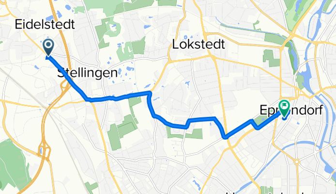
Quick ride by bicycle from Stellingen to Hamburg-Nord
Customize your own route based on our template or discover how our community prefers to cycle from Stellingen to Hamburg-Nord.
Route template
Stellingen to Hamburg-Nord

- 21 min
- Duration
- 6.3 km
- Distance
- 0 m
- Ascent
- 11 m
- Descent
- 17.7 km/h
- Avg. speed
- 24 m
- Max. altitude
This relaxed route takes you from the Stellingen district to Hamburg-Nord, covering a little over 6 kilometers—perfect for a casual ride. You’ll travel mainly on quiet roads with smooth asphalt, so it’s easy on your wheels and suitable for any type of bike. Stellingen is known for its proximity to Hagenbeck Zoo, one of Hamburg’s most famous attractions, so you might catch the sound of exotic animals as you roll out.
The ride itself weaves through peaceful residential streets, with a short stretch through pedestrian areas—watch for pedestrians and enjoy the local vibe. With hardly any elevation change, it’s a gentle cruise all the way. You’ll finish up in Hamburg-Nord, a lively part of the city popular for its green parks and cozy cafes. Overall, it’s a safe, pleasant journey—ideal for everyday cycling or a relaxed weekend outing.
Community
Top users in this region


From our community
The best bike routes from Stellingen to Hamburg-Nord

Grelckstraße 21A, Hamburg nach Siemersplatz 1, Hamburg
Cycling route in Stellingen, City state of Hamburg, Germany
- 52.1 km
- Distance
- 159 m
- Ascent
- 158 m
- Descent

Schnackenburgallee 24, Hamburg nach Nedderfeld 70, Hamburg
Cycling route in Stellingen, City state of Hamburg, Germany
- 8 km
- Distance
- 13 m
- Ascent
- 37 m
- Descent

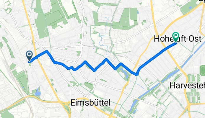
Döhrnstraße 4, Hamburg nach Hoheluftchaussee 2–16, Hamburg
Cycling route in Stellingen, City state of Hamburg, Germany
- 4.2 km
- Distance
- 10 m
- Ascent
- 13 m
- Descent
Eimsbüttel, Hamburg nach Straßenbahnring, Hamburg
Cycling route in Stellingen, City state of Hamburg, Germany
- 4.1 km
- Distance
- 6 m
- Ascent
- 19 m
- Descent

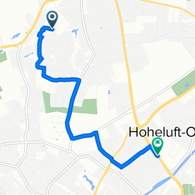
Max-Tau-Straße 35B, Hamburg nach Hoheluftchaussee 91, Hamburg
Cycling route in Stellingen, City state of Hamburg, Germany
- 2.6 km
- Distance
- 15 m
- Ascent
- 16 m
- Descent

Döhrnstraße 4, Hamburg nach Hoheluftchaussee 27–57, Hamburg
Cycling route in Stellingen, City state of Hamburg, Germany
- 2.7 km
- Distance
- 10 m
- Ascent
- 13 m
- Descent

Döhrnstraße 4, Hamburg nach Hoheluftchaussee 18, Hamburg
Cycling route in Stellingen, City state of Hamburg, Germany
- 2.9 km
- Distance
- 13 m
- Ascent
- 12 m
- Descent

Max-Tau-Straße 35B, Hamburg nach Martinistraße, Hamburg
Cycling route in Stellingen, City state of Hamburg, Germany
- 4.7 km
- Distance
- 58 m
- Ascent
- 53 m
- Descent
Kieler Straße 565, Hamburg nach Robert-Koch-Straße 26, Hamburg
Cycling route in Stellingen, City state of Hamburg, Germany
- 6.2 km
- Distance
- 20 m
- Ascent
- 27 m
- Descent

Emil-Andresen-Straße 34C, Hamburg nach Hoheluftchaussee 59–85, Hamburg
Cycling route in Stellingen, City state of Hamburg, Germany
- 3.7 km
- Distance
- 10 m
- Ascent
- 16 m
- Descent

Max-Tau-Straße 35B, Hamburg nach Stresemannallee 19B, Hamburg
Cycling route in Stellingen, City state of Hamburg, Germany
- 1.8 km
- Distance
- 7 m
- Ascent
- 7 m
- Descent

Kollenhof 44, Hamburg nach B447 83, Hamburg
Cycling route in Stellingen, City state of Hamburg, Germany
- 2 km
- Distance
- 38 m
- Ascent
- 44 m
- Descent
Discover more routes
 Max-Tau-Straße 35B, Hamburg nach Hoheluftchaussee 91, Hamburg
- Distance
- 2.6 km
- Ascent
- 15 m
- Descent
- 16 m
- Location
- Stellingen, City state of Hamburg, Germany
 Döhrnstraße 4, Hamburg nach Hoheluftchaussee 27–57, Hamburg
- Distance
- 2.7 km
- Ascent
- 10 m
- Descent
- 13 m
- Location
- Stellingen, City state of Hamburg, Germany
 Döhrnstraße 4, Hamburg nach Hoheluftchaussee 18, Hamburg
- Distance
- 2.9 km
- Ascent
- 13 m
- Descent
- 12 m
- Location
- Stellingen, City state of Hamburg, Germany
 Max-Tau-Straße 35B, Hamburg nach Martinistraße, Hamburg
- Distance
- 4.7 km
- Ascent
- 58 m
- Descent
- 53 m
- Location
- Stellingen, City state of Hamburg, Germany
 Kieler Straße 565, Hamburg nach Robert-Koch-Straße 26, Hamburg
- Distance
- 6.2 km
- Ascent
- 20 m
- Descent
- 27 m
- Location
- Stellingen, City state of Hamburg, Germany
 Emil-Andresen-Straße 34C, Hamburg nach Hoheluftchaussee 59–85, Hamburg
- Distance
- 3.7 km
- Ascent
- 10 m
- Descent
- 16 m
- Location
- Stellingen, City state of Hamburg, Germany
 Max-Tau-Straße 35B, Hamburg nach Stresemannallee 19B, Hamburg
- Distance
- 1.8 km
- Ascent
- 7 m
- Descent
- 7 m
- Location
- Stellingen, City state of Hamburg, Germany
 Kollenhof 44, Hamburg nach B447 83, Hamburg
- Distance
- 2 km
- Ascent
- 38 m
- Descent
- 44 m
- Location
- Stellingen, City state of Hamburg, Germany
Routes from Stellingen
Quick ride by bicycle from
Stellingen to Hamburg
Quick ride by bicycle from
Stellingen to Eidelstedt
Routes to Hamburg-Nord
Quick ride by bicycle from
Winterhude to Hamburg-Nord
Quick ride by bicycle from
Altona to Hamburg-Nord