

Quick ride by bicycle from Saint Egidien to Glauchau
Customize your own route based on our template or discover how our community prefers to cycle from Saint Egidien to Glauchau.
Route template
Saint Egidien to Glauchau
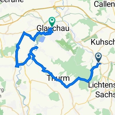
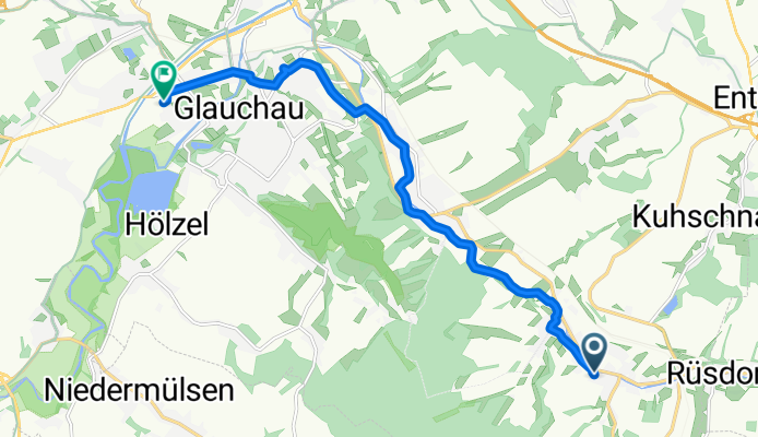
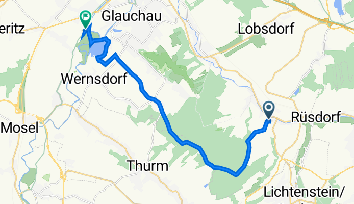
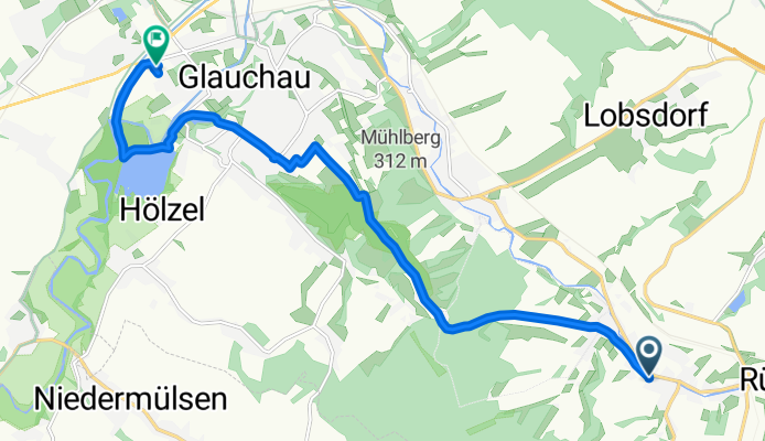
This scenic ride takes you from the charming village of Saint Egidien to the historic town of Glauchau, covering just a little over 10 km—perfect for a relaxed outing. You’ll start in Saint Egidien, a spot known for its peaceful rural vibe and proximity to lovely rolling fields. The route winds north, leading you along mostly quiet roads with a good mix of smooth asphalt (about 59%), and for those who like a bit of adventure, there’s a pleasant dose of gravel and unpaved tracks (together making up about 30%).
Expect gentle climbs and descents, with around 140 meters up and down—just enough to keep it interesting without being too tough. With almost no busy roads, it’s a peaceful ride, ideal for soaking in Saxony's countryside. As you reach Glauchau, you’ll be greeted by its charming old town and the impressive Glauchau Castle, a historical gem and a great spot for a café break. Enjoy the ride and don’t forget to snap a photo of the beautiful landscape along the way!
Community
Top users in this region
From our community
The best bike routes from Saint Egidien to Glauchau
Höhenweg 7A, Sankt Egidien nach Grenayer Straße 1, Glauchau
Cycling route in Saint Egidien, Saxony, Germany
- 9.7 km
- Distance
- 351 m
- Ascent
- 403 m
- Descent
Höhenweg 7A, Sankt Egidien nach Auestraße 125, Glauchau
Cycling route in Saint Egidien, Saxony, Germany
- 13.8 km
- Distance
- 206 m
- Ascent
- 303 m
- Descent
Höhenweg 7A nach Laubenweg
Cycling route in Saint Egidien, Saxony, Germany
- 11 km
- Distance
- 173 m
- Ascent
- 267 m
- Descent
Höhenweg 7A nach Auestraße
Cycling route in Saint Egidien, Saxony, Germany
- 11.6 km
- Distance
- 114 m
- Ascent
- 210 m
- Descent
Höhenweg 7A nach Laubenweg
Cycling route in Saint Egidien, Saxony, Germany
- 9.5 km
- Distance
- 96 m
- Ascent
- 191 m
- Descent
Höhenweg nach Auestraße
Cycling route in Saint Egidien, Saxony, Germany
- 10.9 km
- Distance
- 155 m
- Ascent
- 236 m
- Descent
Höhenweg 7A nach Auestraße
Cycling route in Saint Egidien, Saxony, Germany
- 10.5 km
- Distance
- 66 m
- Ascent
- 171 m
- Descent
Höhenweg 7A nach Auestraße
Cycling route in Saint Egidien, Saxony, Germany
- 13.5 km
- Distance
- 361 m
- Ascent
- 448 m
- Descent
Höhenweg nach Auestraße
Cycling route in Saint Egidien, Saxony, Germany
- 14.7 km
- Distance
- 274 m
- Ascent
- 333 m
- Descent
Höhenweg 7A nach Laubenweg
Cycling route in Saint Egidien, Saxony, Germany
- 13.9 km
- Distance
- 208 m
- Ascent
- 283 m
- Descent
Höhenweg 7A nach Laubenweg
Cycling route in Saint Egidien, Saxony, Germany
- 14 km
- Distance
- 155 m
- Ascent
- 227 m
- Descent
Höhenweg 7, Sankt Egidien nach Obere Muldenstraße 117, Glauchau
Cycling route in Saint Egidien, Saxony, Germany
- 13.2 km
- Distance
- 224 m
- Ascent
- 276 m
- Descent
Discover more routes
- Höhenweg 7A nach Laubenweg
- Distance
- 9.5 km
- Ascent
- 96 m
- Descent
- 191 m
- Location
- Saint Egidien, Saxony, Germany
- Höhenweg nach Auestraße
- Distance
- 10.9 km
- Ascent
- 155 m
- Descent
- 236 m
- Location
- Saint Egidien, Saxony, Germany
- Höhenweg 7A nach Auestraße
- Distance
- 10.5 km
- Ascent
- 66 m
- Descent
- 171 m
- Location
- Saint Egidien, Saxony, Germany
- Höhenweg 7A nach Auestraße
- Distance
- 13.5 km
- Ascent
- 361 m
- Descent
- 448 m
- Location
- Saint Egidien, Saxony, Germany
- Höhenweg nach Auestraße
- Distance
- 14.7 km
- Ascent
- 274 m
- Descent
- 333 m
- Location
- Saint Egidien, Saxony, Germany
- Höhenweg 7A nach Laubenweg
- Distance
- 13.9 km
- Ascent
- 208 m
- Descent
- 283 m
- Location
- Saint Egidien, Saxony, Germany
- Höhenweg 7A nach Laubenweg
- Distance
- 14 km
- Ascent
- 155 m
- Descent
- 227 m
- Location
- Saint Egidien, Saxony, Germany
- Höhenweg 7, Sankt Egidien nach Obere Muldenstraße 117, Glauchau
- Distance
- 13.2 km
- Ascent
- 224 m
- Descent
- 276 m
- Location
- Saint Egidien, Saxony, Germany