
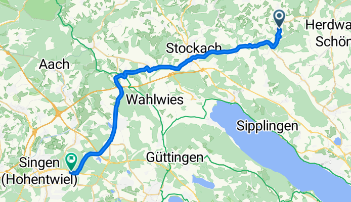
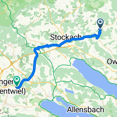
Route template
Rot to Singen

- 2 h 34 min
- Duration
- 44.3 km
- Distance
- 508 m
- Ascent
- 729 m
- Descent
- 17.3 km/h
- Avg. speed
- 659 m
- Max. altitude
Set off from Rot, a tranquil hamlet near the edge of the Black Forest, and ride south toward Singen, the gateway to the Hegau volcano country. This 44 km journey is a treat for anyone who craves quiet roads and scenic countryside. Most of the ride is on smooth asphalt, with brief patches of gravel and unpaved paths that add a touch of adventure. Expect some climbing early on—over 500 meters of ascent will get your legs working—but you'll be rewarded with nearly 730 meters of descent as you approach Singen.
Cycling through lush meadows and farmland, you’ll pass through peaceful villages and forests, far from busy roads. Singen awaits you at the end, nestled under the volcanic peak of Hohentwiel, famous for its hilltop fortress and panoramic views. It’s a perfect spot to rest and soak in the unique landscape shaped by ancient eruptions. Don’t forget to stop for a photo or two!
Community
Top users in this region


From our community
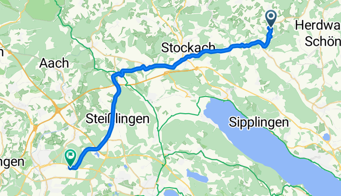
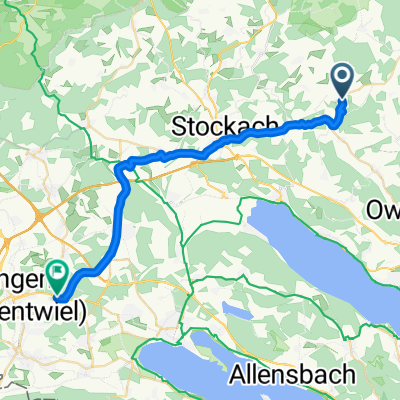
The best bike routes from Rot to Singen

Kahlweg 2, Hohenfels nach Alusingen-Weg, Singen (Hohentwiel)
Cycling route in Rot, Baden-Wurttemberg, Germany
- 29.3 km
- Distance
- 94 m
- Ascent
- 292 m
- Descent

Am Josenberg 16, Hohenfels nach Radolfzeller Straße 51, Singen (Hohentwiel)
Cycling route in Rot, Baden-Wurttemberg, Germany
- 29 km
- Distance
- 90 m
- Ascent
- 323 m
- Descent

Am Josenberg 16, Hohenfels nach Alusingen-Weg, Singen (Hohentwiel)
Cycling route in Rot, Baden-Wurttemberg, Germany
- 29.5 km
- Distance
- 95 m
- Ascent
- 306 m
- Descent

Am Josenberg, Hohenfels nach Alusingen-Weg, Singen (Hohentwiel)
Cycling route in Rot, Baden-Wurttemberg, Germany
- 29.4 km
- Distance
- 105 m
- Ascent
- 325 m
- Descent

Am Josenberg, Hohenfels nach Alusingen-Weg, Singen (Hohentwiel)
Cycling route in Rot, Baden-Wurttemberg, Germany
- 29.3 km
- Distance
- 106 m
- Ascent
- 320 m
- Descent
Kahlweg, Hohenfels nach Alusingen-Weg, Singen (Hohentwiel)
Cycling route in Rot, Baden-Wurttemberg, Germany
- 28.9 km
- Distance
- 106 m
- Ascent
- 299 m
- Descent
Am Josenberg, Hohenfels nach Singen (Hohentwiel)
Cycling route in Rot, Baden-Wurttemberg, Germany
- 29.4 km
- Distance
- 114 m
- Ascent
- 325 m
- Descent

Am Josenberg 16, Hohenfels nach Alusingen-Weg, Singen (Hohentwiel)
Cycling route in Rot, Baden-Wurttemberg, Germany
- 29.7 km
- Distance
- 102 m
- Ascent
- 316 m
- Descent

Am Josenberg, Hohenfels nach Alusingen-Weg, Singen (Hohentwiel)
Cycling route in Rot, Baden-Wurttemberg, Germany
- 30 km
- Distance
- 101 m
- Ascent
- 315 m
- Descent

Am Josenberg, Hohenfels nach Alusingen-Weg, Singen (Hohentwiel)
Cycling route in Rot, Baden-Wurttemberg, Germany
- 29.8 km
- Distance
- 94 m
- Ascent
- 310 m
- Descent

Am Josenberg, Hohenfels nach Alusingen-Weg, Singen (Hohentwiel)
Cycling route in Rot, Baden-Wurttemberg, Germany
- 29.3 km
- Distance
- 104 m
- Ascent
- 321 m
- Descent

Am Josenberg, Hohenfels nach Alusingen-Weg, Singen (Hohentwiel)
Cycling route in Rot, Baden-Wurttemberg, Germany
- 29.3 km
- Distance
- 101 m
- Ascent
- 319 m
- Descent
Discover more routes
 Am Josenberg, Hohenfels nach Alusingen-Weg, Singen (Hohentwiel)
- Distance
- 29.3 km
- Ascent
- 106 m
- Descent
- 320 m
- Location
- Rot, Baden-Wurttemberg, Germany
 Kahlweg, Hohenfels nach Alusingen-Weg, Singen (Hohentwiel)
- Distance
- 28.9 km
- Ascent
- 106 m
- Descent
- 299 m
- Location
- Rot, Baden-Wurttemberg, Germany
 Am Josenberg, Hohenfels nach Singen (Hohentwiel)
- Distance
- 29.4 km
- Ascent
- 114 m
- Descent
- 325 m
- Location
- Rot, Baden-Wurttemberg, Germany
 Am Josenberg 16, Hohenfels nach Alusingen-Weg, Singen (Hohentwiel)
- Distance
- 29.7 km
- Ascent
- 102 m
- Descent
- 316 m
- Location
- Rot, Baden-Wurttemberg, Germany
 Am Josenberg, Hohenfels nach Alusingen-Weg, Singen (Hohentwiel)
- Distance
- 30 km
- Ascent
- 101 m
- Descent
- 315 m
- Location
- Rot, Baden-Wurttemberg, Germany
 Am Josenberg, Hohenfels nach Alusingen-Weg, Singen (Hohentwiel)
- Distance
- 29.8 km
- Ascent
- 94 m
- Descent
- 310 m
- Location
- Rot, Baden-Wurttemberg, Germany
 Am Josenberg, Hohenfels nach Alusingen-Weg, Singen (Hohentwiel)
- Distance
- 29.3 km
- Ascent
- 104 m
- Descent
- 321 m
- Location
- Rot, Baden-Wurttemberg, Germany
 Am Josenberg, Hohenfels nach Alusingen-Weg, Singen (Hohentwiel)
- Distance
- 29.3 km
- Ascent
- 101 m
- Descent
- 319 m
- Location
- Rot, Baden-Wurttemberg, Germany