
By bicycle from Prenzlauer Berg to Gesundbrunnen
Customize your own route based on our template or discover how our community prefers to cycle from Prenzlauer Berg to Gesundbrunnen.
Route template
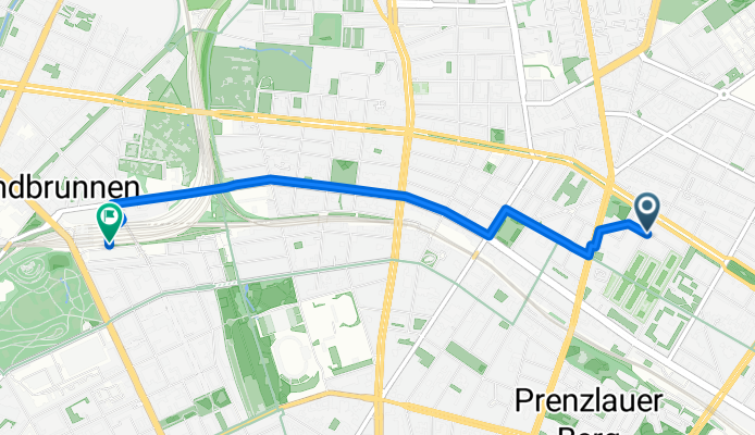
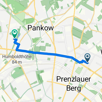
Prenzlauer Berg to Gesundbrunnen

- 17 min
- Duration
- 4.5 km
- Distance
- 9 m
- Ascent
- 15 m
- Descent
- 15.6 km/h
- Avg. speed
- 58 m
- Max. altitude
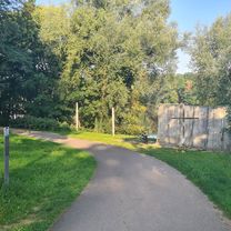
Hop on your bike in the lively neighborhood of Prenzlauer Berg, known for its tree-lined streets, stylish cafés, and historical charm. This easy ride takes you north to Gesundbrunnen, a district famous for its vibrant multicultural vibe and the fascinating subterranean world of the Berliner Unterwelten tours.
The route covers about 4.5 km, making it a perfect quick spin for a morning or afternoon. It’s mostly flat—so don’t worry about any hill climbs—just a gentle 9 meters of ascent and a little more descent as you cruise into Gesundbrunnen. The path is well-paved throughout, with over half on smooth asphalt and the rest on paving stones and a touch of cobblestone for that Berlin flavor.
You'll enjoy almost half the route on dedicated cycleways, with the remainder on quiet roads and shared paths, keeping the ride relaxed and stress-free. As you arrive in Gesundbrunnen, take a moment to explore its bustling markets and perhaps plan a visit to the nearby Humboldthain Park or catch a glimpse of the impressive Flak Tower ruins. Perfect for a leisurely city cruise!
Community
Top users in this region


From our community
The best bike routes from Prenzlauer Berg to Gesundbrunnen

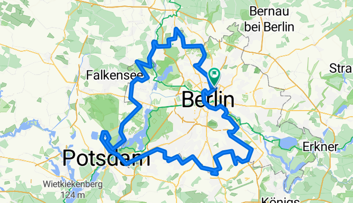
BLN_RR_90_Ost_BB_WL
Cycling route in Prenzlauer Berg, State of Berlin, Germany
- 90.3 km
- Distance
- 175 m
- Ascent
- 180 m
- Descent

Nordschleife zum Gorinsee
Cycling route in Prenzlauer Berg, State of Berlin, Germany
- 57.2 km
- Distance
- 75 m
- Ascent
- 80 m
- Descent

Nordberlin-Runde
Cycling route in Prenzlauer Berg, State of Berlin, Germany
- 67.5 km
- Distance
- 89 m
- Ascent
- 103 m
- Descent
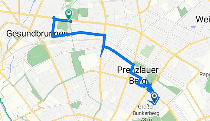
zum Bahnhof Gesundbrunnen
Cycling route in Prenzlauer Berg, State of Berlin, Germany
- 3.5 km
- Distance
- 32 m
- Ascent
- 35 m
- Descent

prenzlauer berg to kreuzberg
Cycling route in Prenzlauer Berg, State of Berlin, Germany
- 55.6 km
- Distance
- 98 m
- Ascent
- 101 m
- Descent

100Milen Mauerweg Berlin
Cycling route in Prenzlauer Berg, State of Berlin, Germany
- 178.6 km
- Distance
- 688 m
- Ascent
- 683 m
- Descent
Bötzowstraße 41, Berlin nach Berlin
Cycling route in Prenzlauer Berg, State of Berlin, Germany
- 6.6 km
- Distance
- 28 m
- Ascent
- 60 m
- Descent

Schönower Heide
Cycling route in Prenzlauer Berg, State of Berlin, Germany
- 50.8 km
- Distance
- 59 m
- Ascent
- 56 m
- Descent

Daily routine
Cycling route in Prenzlauer Berg, State of Berlin, Germany
- 3.4 km
- Distance
- 28 m
- Ascent
- 31 m
- Descent

Nightride 19. Januar 2022 Mercedes Platz —> Volksbühne am Rosa-Luxemburg-Platz
Cycling route in Prenzlauer Berg, State of Berlin, Germany
- 33.3 km
- Distance
- 524 m
- Ascent
- 524 m
- Descent

Greifswalder Straße 190, Berlin nach Isländische Straße 3B, Berlin
Cycling route in Prenzlauer Berg, State of Berlin, Germany
- 15.1 km
- Distance
- 83 m
- Ascent
- 78 m
- Descent
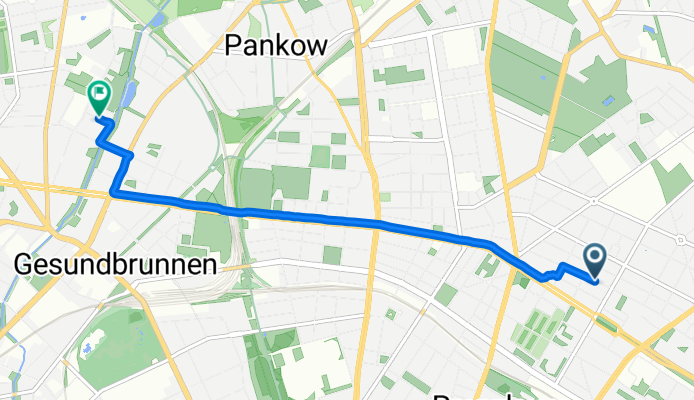
Lehderstraße nach Zechliner Straße
Cycling route in Prenzlauer Berg, State of Berlin, Germany
- 5.2 km
- Distance
- 72 m
- Ascent
- 124 m
- Descent
Discover more routes
 prenzlauer berg to kreuzberg
- Distance
- 55.6 km
- Ascent
- 98 m
- Descent
- 101 m
- Location
- Prenzlauer Berg, State of Berlin, Germany
 100Milen Mauerweg Berlin
- Distance
- 178.6 km
- Ascent
- 688 m
- Descent
- 683 m
- Location
- Prenzlauer Berg, State of Berlin, Germany
 Bötzowstraße 41, Berlin nach Berlin
- Distance
- 6.6 km
- Ascent
- 28 m
- Descent
- 60 m
- Location
- Prenzlauer Berg, State of Berlin, Germany
 Schönower Heide
- Distance
- 50.8 km
- Ascent
- 59 m
- Descent
- 56 m
- Location
- Prenzlauer Berg, State of Berlin, Germany
 Daily routine
- Distance
- 3.4 km
- Ascent
- 28 m
- Descent
- 31 m
- Location
- Prenzlauer Berg, State of Berlin, Germany
 Nightride 19. Januar 2022 Mercedes Platz —> Volksbühne am Rosa-Luxemburg-Platz
- Distance
- 33.3 km
- Ascent
- 524 m
- Descent
- 524 m
- Location
- Prenzlauer Berg, State of Berlin, Germany
 Greifswalder Straße 190, Berlin nach Isländische Straße 3B, Berlin
- Distance
- 15.1 km
- Ascent
- 83 m
- Descent
- 78 m
- Location
- Prenzlauer Berg, State of Berlin, Germany
 Lehderstraße nach Zechliner Straße
- Distance
- 5.2 km
- Ascent
- 72 m
- Descent
- 124 m
- Location
- Prenzlauer Berg, State of Berlin, Germany
Routes from Prenzlauer Berg
Cycling day trip from
Prenzlauer Berg to Falkenhagener Feld
By bicycle from
Prenzlauer Berg to Treptow
By bicycle from
Prenzlauer Berg to Tiergarten
Routes to Gesundbrunnen
By bicycle from
Tiergarten to Gesundbrunnen
By bicycle from
Berlin Schöneberg to Gesundbrunnen