
By bicycle from Mittenwald to Scharnitz
Customize your own route based on our template or discover how our community prefers to cycle from Mittenwald to Scharnitz.
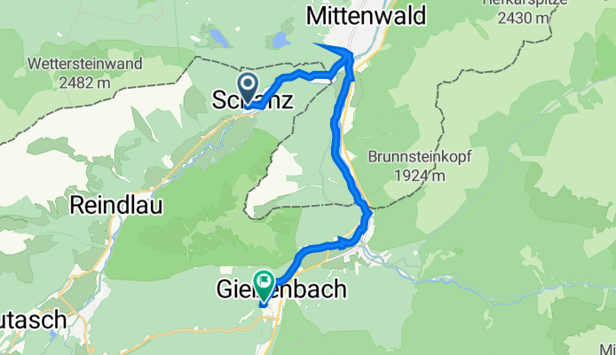
Route template
Mittenwald to Scharnitz

- 36 min
- Duration
- 8.8 km
- Distance
- 148 m
- Ascent
- 99 m
- Descent
- 14.6 km/h
- Avg. speed
- 994 m
- Max. altitude
Cycling from Mittenwald to Scharnitz
This scenic 8.7 km ride takes you from the charming Bavarian town of Mittenwald, nestled at the foot of the Karwendel mountains and famous for its violin-making tradition, south towards Scharnitz, just across the Austrian border.
You’ll roll out of Mittenwald on a mix of gravel tracks and quiet roads, soaking in views of alpine meadows and forested foothills. Most of the route is unpaved (about half), giving it a real nature-trail vibe—perfect for gravel bikes or fat tires. There’s some climbing with a total ascent of about 147 meters, but the alpine views make it worth the effort.
As you descend towards Scharnitz, you’ll cross into Austria. Scharnitz is the gateway to the Karwendel Nature Park, so you’re literally riding from one outdoor adventure spot to another! Pack a snack and enjoy a relaxing pedal; this route is all about the mountain air and peaceful landscapes.
Community
Top users in this region


From our community
The best bike routes from Mittenwald to Scharnitz

Mittenwald-Karwendelhaus CLONED FROM ROUTE 5766
Cycling route in Mittenwald, Bavaria, Germany
- 25.1 km
- Distance
- 915 m
- Ascent
- 83 m
- Descent

Tag 7 - Mitterand - Isar Ursprung
Cycling route in Mittenwald, Bavaria, Germany
- 13.3 km
- Distance
- 219 m
- Ascent
- 81 m
- Descent

Mittenwald (D) - Riedboden (D/A) - Scharnitz(A) - Wiesenhof(A)
Cycling route in Mittenwald, Bavaria, Germany
- 10.1 km
- Distance
- 172 m
- Ascent
- 90 m
- Descent
Schanz 266b, Leutasch nach Boden-Niederlög 1, Leutasch
Cycling route in Mittenwald, Bavaria, Germany
- 13.1 km
- Distance
- 119 m
- Ascent
- 184 m
- Descent

Mittenwald-Karwendelhaus
Cycling route in Mittenwald, Bavaria, Germany
- 25 km
- Distance
- 776 m
- Ascent
- 157 m
- Descent

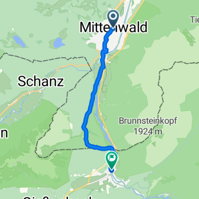
Mittenwald Scharnitz
Cycling route in Mittenwald, Bavaria, Germany
- 7.7 km
- Distance
- 58 m
- Ascent
- 11 m
- Descent

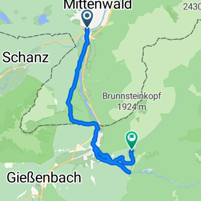
Mittenwald-Scharnitz
Cycling route in Mittenwald, Bavaria, Germany
- 10.8 km
- Distance
- 119 m
- Ascent
- 61 m
- Descent

MTB mit Holger und Arnd
Cycling route in Mittenwald, Bavaria, Germany
- 203.2 km
- Distance
- 3,251 m
- Ascent
- 3,065 m
- Descent

Gasthof Mühle-Scharnitz
Cycling route in Mittenwald, Bavaria, Germany
- 17 km
- Distance
- 478 m
- Ascent
- 534 m
- Descent


mittenwald_brandelalm
Cycling route in Mittenwald, Bavaria, Germany
- 13.9 km
- Distance
- 534 m
- Ascent
- 331 m
- Descent

Mittenwald
Cycling route in Mittenwald, Bavaria, Germany
- 13 km
- Distance
- 211 m
- Ascent
- 38 m
- Descent
Discover more routes
 Mittenwald-Karwendelhaus
- Distance
- 25 km
- Ascent
- 776 m
- Descent
- 157 m
- Location
- Mittenwald, Bavaria, Germany
 Mittenwald Scharnitz
- Distance
- 7.7 km
- Ascent
- 58 m
- Descent
- 11 m
- Location
- Mittenwald, Bavaria, Germany
 Mittenwald-Scharnitz
- Distance
- 10.8 km
- Ascent
- 119 m
- Descent
- 61 m
- Location
- Mittenwald, Bavaria, Germany
 MTB mit Holger und Arnd
- Distance
- 203.2 km
- Ascent
- 3,251 m
- Descent
- 3,065 m
- Location
- Mittenwald, Bavaria, Germany
 Gasthof Mühle-Scharnitz
- Distance
- 17 km
- Ascent
- 478 m
- Descent
- 534 m
- Location
- Mittenwald, Bavaria, Germany
 Tag 1
Tag 1- Distance
- 13.5 km
- Ascent
- 1,448 m
- Descent
- 615 m
- Location
- Mittenwald, Bavaria, Germany
 mittenwald_brandelalm
- Distance
- 13.9 km
- Ascent
- 534 m
- Descent
- 331 m
- Location
- Mittenwald, Bavaria, Germany
 Mittenwald
- Distance
- 13 km
- Ascent
- 211 m
- Descent
- 38 m
- Location
- Mittenwald, Bavaria, Germany
Routes from Mittenwald
Cycling day trip from
Mittenwald to Thaur
Cycling day trip from
Mittenwald to Bad Tölz