
Quick ride by bicycle from Leverkusen to Langenfeld
Customize your own route based on our template or discover how our community prefers to cycle from Leverkusen to Langenfeld.
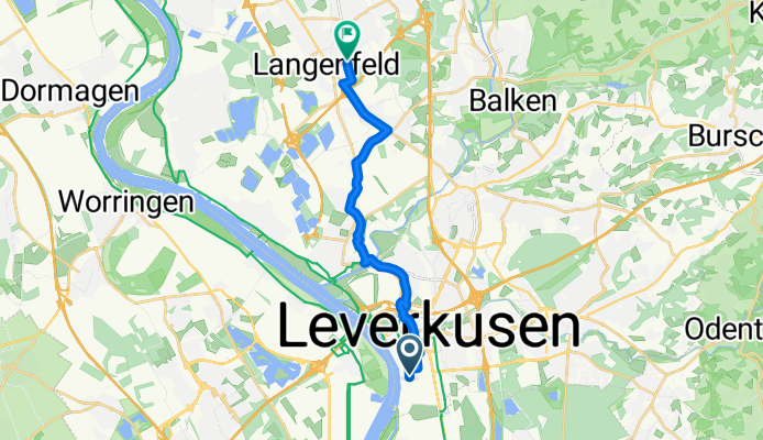
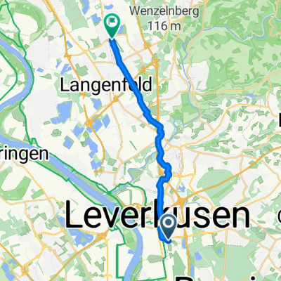
Route template
Leverkusen to Langenfeld

- 52 min
- Duration
- 14.4 km
- Distance
- 49 m
- Ascent
- 50 m
- Descent
- 16.7 km/h
- Avg. speed
- 75 m
- Max. altitude
This gentle ride takes you from Leverkusen to Langenfeld, covering just over 14 kilometers—perfect for a relaxed outing! You'll start in Leverkusen, a vibrant city on the Rhine that’s famously home to the Bayer chemical company and a strong football tradition. As you pedal north, much of the route rolls along quiet roads and dedicated cycle paths, keeping things safe and stress-free.
There’s just a little bit of climbing—under 50 meters up, and about the same down—so it’s smooth sailing for most cyclists. With nearly 80% of the surface being paved or asphalt, it’s suitable for pretty much any type of bike. Along the way, expect to pass through some green spaces and residential areas before arriving in Langenfeld, a lively town known for its parks and friendly small-town feel.
This route is a great option for anyone looking to connect two interesting towns on a mellow ride. Enjoy the scenery and the relaxed pace!
Community
Top users in this region


From our community
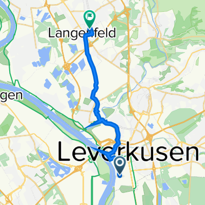
The best bike routes from Leverkusen to Langenfeld

Markt Langenfeld
Cycling route in Leverkusen, North Rhine-Westphalia, Germany
- 13.4 km
- Distance
- 68 m
- Ascent
- 74 m
- Descent

Chempark 14O, Leverkusen nach Gostyniner Straße 8, Langenfeld (Rheinland)
Cycling route in Leverkusen, North Rhine-Westphalia, Germany
- 12.9 km
- Distance
- 44 m
- Ascent
- 41 m
- Descent

Chempark 33T, Leverkusen nach Gostyniner Straße 10, Langenfeld (Rheinland)
Cycling route in Leverkusen, North Rhine-Westphalia, Germany
- 13 km
- Distance
- 42 m
- Ascent
- 39 m
- Descent
Chempark, Leverkusen nach Gostyniner Straße, Langenfeld (Rheinland)
Cycling route in Leverkusen, North Rhine-Westphalia, Germany
- 13.1 km
- Distance
- 51 m
- Ascent
- 46 m
- Descent
Kurtekottenweg, Leverkusen nach Oderstraße, Langenfeld (Rheinland)
Cycling route in Leverkusen, North Rhine-Westphalia, Germany
- 14.7 km
- Distance
- 59 m
- Ascent
- 49 m
- Descent

51.020° N 6.980° W nach Gostyniner Straße 6, Langenfeld (Rheinland)
Cycling route in Leverkusen, North Rhine-Westphalia, Germany
- 12.6 km
- Distance
- 25 m
- Ascent
- 23 m
- Descent
Europaring, Leverkusen do Grenzstraße 54, Langenfeld
Cycling route in Leverkusen, North Rhine-Westphalia, Germany
- 10.9 km
- Distance
- 54 m
- Ascent
- 53 m
- Descent

Rheinallee 1, Leverkusen nach Gostyniner Straße 8, Langenfeld (Rheinland)
Cycling route in Leverkusen, North Rhine-Westphalia, Germany
- 11.7 km
- Distance
- 23 m
- Ascent
- 22 m
- Descent

Rheindorfer Straße 112, Leverkusen nach Immigrath, Langenfeld (Rheinland)
Cycling route in Leverkusen, North Rhine-Westphalia, Germany
- 10.3 km
- Distance
- 71 m
- Ascent
- 66 m
- Descent

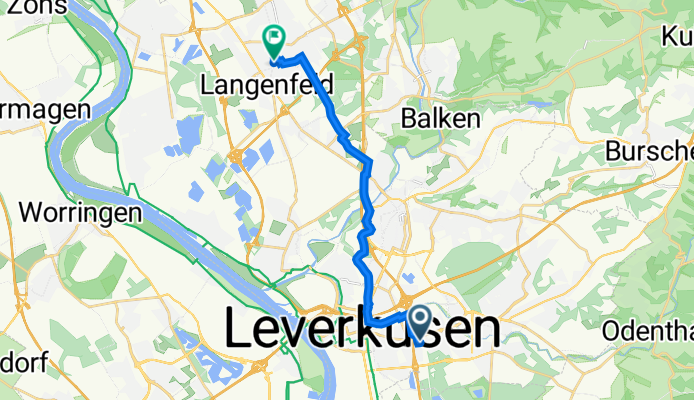
Chempark 11T, Leverkusen nach Gostyniner Straße 8, Langenfeld (Rheinland)
Cycling route in Leverkusen, North Rhine-Westphalia, Germany
- 13.5 km
- Distance
- 27 m
- Ascent
- 23 m
- Descent

Chempark 14O, Leverkusen nach Gostyniner Straße 8, Langenfeld (Rheinland)
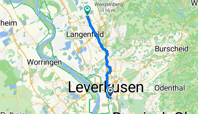
Cycling route in Leverkusen, North Rhine-Westphalia, Germany
- 12.7 km
- Distance
- 98 m
- Ascent
- 91 m
- Descent
Halligstraße 4, Leverkusen nach Hauptstraße 116, Langenfeld (Rheinland)
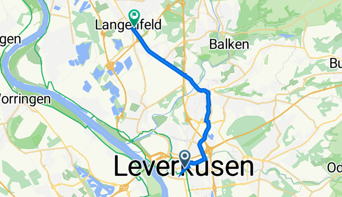
Cycling route in Leverkusen, North Rhine-Westphalia, Germany
- 13.3 km
- Distance
- 73 m
- Ascent
- 77 m
- Descent
Discover more routes
 Kurtekottenweg, Leverkusen nach Oderstraße, Langenfeld (Rheinland)
- Distance
- 14.7 km
- Ascent
- 59 m
- Descent
- 49 m
- Location
- Leverkusen, North Rhine-Westphalia, Germany
 51.020° N 6.980° W nach Gostyniner Straße 6, Langenfeld (Rheinland)
- Distance
- 12.6 km
- Ascent
- 25 m
- Descent
- 23 m
- Location
- Leverkusen, North Rhine-Westphalia, Germany
 Europaring, Leverkusen do Grenzstraße 54, Langenfeld
- Distance
- 10.9 km
- Ascent
- 54 m
- Descent
- 53 m
- Location
- Leverkusen, North Rhine-Westphalia, Germany
 Rheinallee 1, Leverkusen nach Gostyniner Straße 8, Langenfeld (Rheinland)
- Distance
- 11.7 km
- Ascent
- 23 m
- Descent
- 22 m
- Location
- Leverkusen, North Rhine-Westphalia, Germany
 Rheindorfer Straße 112, Leverkusen nach Immigrath, Langenfeld (Rheinland)
- Distance
- 10.3 km
- Ascent
- 71 m
- Descent
- 66 m
- Location
- Leverkusen, North Rhine-Westphalia, Germany
 Chempark 11T, Leverkusen nach Gostyniner Straße 8, Langenfeld (Rheinland)
- Distance
- 13.5 km
- Ascent
- 27 m
- Descent
- 23 m
- Location
- Leverkusen, North Rhine-Westphalia, Germany
 Chempark 14O, Leverkusen nach Gostyniner Straße 8, Langenfeld (Rheinland)
- Distance
- 12.7 km
- Ascent
- 98 m
- Descent
- 91 m
- Location
- Leverkusen, North Rhine-Westphalia, Germany
 Halligstraße 4, Leverkusen nach Hauptstraße 116, Langenfeld (Rheinland)
- Distance
- 13.3 km
- Ascent
- 73 m
- Descent
- 77 m
- Location
- Leverkusen, North Rhine-Westphalia, Germany
Routes from Leverkusen
Quick ride by bicycle from
Leverkusen to Cologne
Quick ride by bicycle from
Leverkusen to Opladen
Routes to Langenfeld
Cycling day trip from
Düsseldorf to Langenfeld
Quick ride by bicycle from
Leichlingen to Langenfeld
Quick ride by bicycle from
Opladen to Langenfeld