
Cycling day trip from Hügelsheim to Ottersweier
Customize your own route based on our template or discover how our community prefers to cycle from Hügelsheim to Ottersweier.
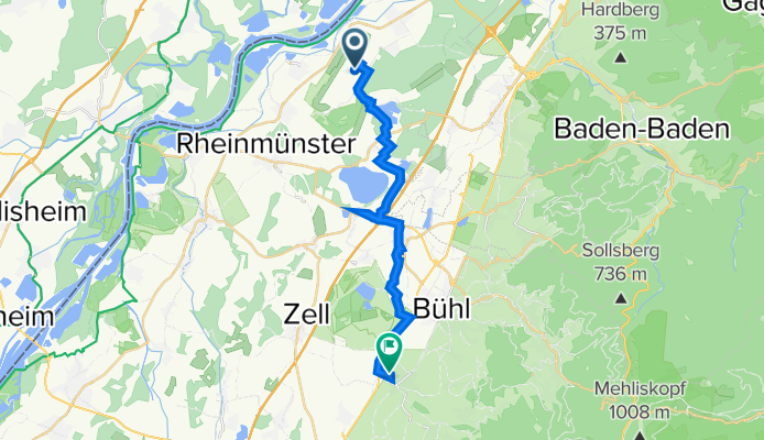
Route template
Hügelsheim to Ottersweier

- 1 h 15 min
- Duration
- 22.4 km
- Distance
- 41 m
- Ascent
- 27 m
- Descent
- 17.9 km/h
- Avg. speed
- 140 m
- Max. altitude
This relaxed cycling route takes you from Hügelsheim, a charming village near the Rhine famous for its proximity to Baden Airpark, down to Ottersweier, nestled at the edge of the Black Forest. Covering about 22 km, you’ll cruise mostly on paved and asphalt surfaces, with just a few short stretches of paving stones and perhaps some unpaved patches to keep things interesting.
The route is mainly flat—less than 50 meters of gentle ascent—perfect if you want a smooth ride without any tough climbs. You'll pedal through quiet roads and tracks, skirting fields and small hamlets, with occasional sections on dedicated cycle paths for an added sense of ease and safety.
Ottersweier greets riders with its traditional Baden architecture and easygoing vibe. If you have time, explore a bit; the area is known for its pretty church and proximity to plenty of scenic hiking and cycling routes leading deeper into the Black Forest. All in all, it’s an enjoyable and accessible ride for a chill day out!
Community
Top users in this region


From our community
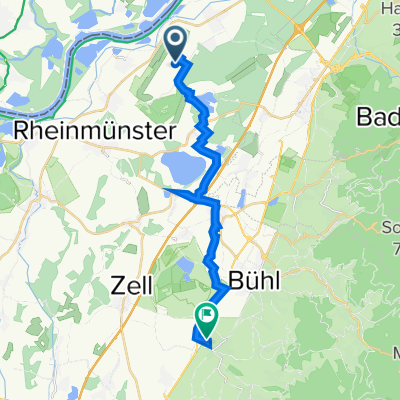
The best bike routes from Hügelsheim to Ottersweier

Flugplatz B 511, Rheinmünster nach Holunderweg 7, Ottersweier
Cycling route in Hügelsheim, Baden-Wurttemberg, Germany
- 18.4 km
- Distance
- 48 m
- Ascent
- 38 m
- Descent

Flugplatz B 511, Rheinmünster nach Haselweg 2, Ottersweier
Cycling route in Hügelsheim, Baden-Wurttemberg, Germany
- 19.1 km
- Distance
- 48 m
- Ascent
- 33 m
- Descent

Flugplatz B 511, Rheinmünster nach Haselweg 2, Ottersweier
Cycling route in Hügelsheim, Baden-Wurttemberg, Germany
- 19.1 km
- Distance
- 44 m
- Ascent
- 28 m
- Descent

Flugplatz B 511, Rheinmünster nach Holunderweg 7, Ottersweier
Cycling route in Hügelsheim, Baden-Wurttemberg, Germany
- 18.4 km
- Distance
- 38 m
- Ascent
- 23 m
- Descent

Flugplatz B 511, Rheinmünster nach Haselweg 2, Ottersweier
Cycling route in Hügelsheim, Baden-Wurttemberg, Germany
- 19.2 km
- Distance
- 38 m
- Ascent
- 26 m
- Descent

Flugplatz B 511, Rheinmünster nach Haselweg 2, Ottersweier
Cycling route in Hügelsheim, Baden-Wurttemberg, Germany
- 18.3 km
- Distance
- 49 m
- Ascent
- 33 m
- Descent

Flugplatz B 339–387, Rheinmünster nach Haselweg 2, Ottersweier
Cycling route in Hügelsheim, Baden-Wurttemberg, Germany
- 18.5 km
- Distance
- 58 m
- Ascent
- 25 m
- Descent

Flugplatz B 511, Rheinmünster nach Haselweg 2, Ottersweier
Cycling route in Hügelsheim, Baden-Wurttemberg, Germany
- 19.1 km
- Distance
- 42 m
- Ascent
- 29 m
- Descent

Flugplatz B 511, Rheinmünster nach Haselweg 2, Ottersweier
Cycling route in Hügelsheim, Baden-Wurttemberg, Germany
- 18.5 km
- Distance
- 49 m
- Ascent
- 35 m
- Descent

Flugplatz B 511, Rheinmünster nach Haselweg 2, Ottersweier
Cycling route in Hügelsheim, Baden-Wurttemberg, Germany
- 18.6 km
- Distance
- 46 m
- Ascent
- 32 m
- Descent
Flugplatz B 511, Rheinmünster nach Haselweg 2, Ottersweier
Cycling route in Hügelsheim, Baden-Wurttemberg, Germany
- 18.4 km
- Distance
- 47 m
- Ascent
- 32 m
- Descent

Flugplatz B 511, Rheinmünster nach Holunderweg 7, Ottersweier
Cycling route in Hügelsheim, Baden-Wurttemberg, Germany
- 18.5 km
- Distance
- 47 m
- Ascent
- 40 m
- Descent
Discover more routes
 Flugplatz B 511, Rheinmünster nach Haselweg 2, Ottersweier
- Distance
- 19.2 km
- Ascent
- 38 m
- Descent
- 26 m
- Location
- Hügelsheim, Baden-Wurttemberg, Germany
 Flugplatz B 511, Rheinmünster nach Haselweg 2, Ottersweier
- Distance
- 18.3 km
- Ascent
- 49 m
- Descent
- 33 m
- Location
- Hügelsheim, Baden-Wurttemberg, Germany
 Flugplatz B 339–387, Rheinmünster nach Haselweg 2, Ottersweier
- Distance
- 18.5 km
- Ascent
- 58 m
- Descent
- 25 m
- Location
- Hügelsheim, Baden-Wurttemberg, Germany
 Flugplatz B 511, Rheinmünster nach Haselweg 2, Ottersweier
- Distance
- 19.1 km
- Ascent
- 42 m
- Descent
- 29 m
- Location
- Hügelsheim, Baden-Wurttemberg, Germany
 Flugplatz B 511, Rheinmünster nach Haselweg 2, Ottersweier
- Distance
- 18.5 km
- Ascent
- 49 m
- Descent
- 35 m
- Location
- Hügelsheim, Baden-Wurttemberg, Germany
 Flugplatz B 511, Rheinmünster nach Haselweg 2, Ottersweier
- Distance
- 18.6 km
- Ascent
- 46 m
- Descent
- 32 m
- Location
- Hügelsheim, Baden-Wurttemberg, Germany
 Flugplatz B 511, Rheinmünster nach Haselweg 2, Ottersweier
- Distance
- 18.4 km
- Ascent
- 47 m
- Descent
- 32 m
- Location
- Hügelsheim, Baden-Wurttemberg, Germany
 Flugplatz B 511, Rheinmünster nach Holunderweg 7, Ottersweier
- Distance
- 18.5 km
- Ascent
- 47 m
- Descent
- 40 m
- Location
- Hügelsheim, Baden-Wurttemberg, Germany