
Cycling day trip from Hinterweidenthal to Schweigen-Rechtenbach
Customize your own route based on our template or discover how our community prefers to cycle from Hinterweidenthal to Schweigen-Rechtenbach.
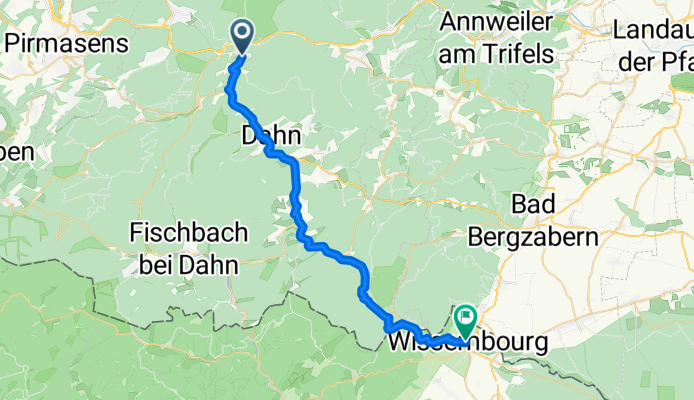
Route template
Hinterweidenthal to Schweigen-Rechtenbach

- 2 h 18 min
- Duration
- 34.5 km
- Distance
- 966 m
- Ascent
- 969 m
- Descent
- 15 km/h
- Avg. speed
- 274 m
- Max. altitude
This ride takes you from the charming village of Hinterweidenthal, nestled in the heart of the Palatinate Forest, all the way down to Schweigen-Rechtenbach, the famous gateway to the German Wine Route. You'll cover about 34.5 km, with plenty of ups and downs—nearly 970 meters of climbing and descending along the way. Most of the route rolls over smooth asphalt and quiet tracks, giving you a pleasant mix of forested paths and peaceful rural roads.
Hinterweidenthal is known for its dramatic red sandstone rock formations—if you’ve got a moment before you start, Tolksmühle and Teufelstisch are worth a peek. The ride itself leads you through lush forests and rolling hills, so expect some good leg workouts on those ascents.
Your adventure ends in Schweigen-Rechtenbach, right at the impressive Deutsches Weintor, where the German Wine Route officially begins. Treat yourself to a glass of local Riesling or a well-earned slice of Pfälzer sausage when you arrive—after all, you’ve earned it!
Community
Top users in this region


From our community
The best bike routes from Hinterweidenthal to Schweigen-Rechtenbach

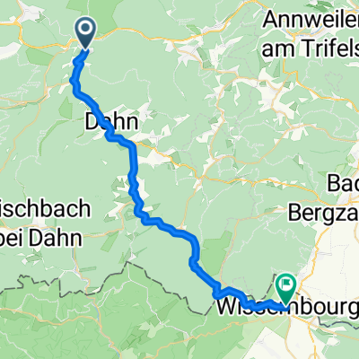
Radweg Hinterweidenthal - Wissembourg
Cycling route in Hinterweidenthal, Rhineland-Palatinate, Germany
- 32.1 km
- Distance
- 913 m
- Ascent
- 973 m
- Descent

Hinterweidenthal Bf. - Wissembourg Frank. - Hinterweidenthal Bf. - Wissembourg Frank.
Cycling route in Hinterweidenthal, Rhineland-Palatinate, Germany
- 31.2 km
- Distance
- 922 m
- Ascent
- 983 m
- Descent

Wieslautertal-Radweg - Wieslautertal-Radweg
Cycling route in Hinterweidenthal, Rhineland-Palatinate, Germany
- 32.9 km
- Distance
- 921 m
- Ascent
- 991 m
- Descent

Zwischen Deutschland und Frankreich
Cycling route in Hinterweidenthal, Rhineland-Palatinate, Germany
- 30.9 km
- Distance
- 779 m
- Ascent
- 804 m
- Descent

Lange Radrunde vom 23. August, 10:25
Cycling route in Hinterweidenthal, Rhineland-Palatinate, Germany
- 32 km
- Distance
- 394 m
- Ascent
- 489 m
- Descent

Hinterweidenthal_Dahn_Wissembourg
Cycling route in Hinterweidenthal, Rhineland-Palatinate, Germany
- 31.5 km
- Distance
- 305 m
- Ascent
- 369 m
- Descent

1.Hinterweidenthal-Wissembourg
Cycling route in Hinterweidenthal, Rhineland-Palatinate, Germany
- 38.9 km
- Distance
- 311 m
- Ascent
- 379 m
- Descent

Im Tal 4-6, Hinterweidenthal nach Rue du Général Leclerc 29, Wissembourg
Cycling route in Hinterweidenthal, Rhineland-Palatinate, Germany
- 31.2 km
- Distance
- 890 m
- Ascent
- 948 m
- Descent

Tour de Netzwerkökonomie 2022
Cycling route in Hinterweidenthal, Rhineland-Palatinate, Germany
- 53 km
- Distance
- 711 m
- Ascent
- 757 m
- Descent

Hinterweidenthal-Weissenburg
Cycling route in Hinterweidenthal, Rhineland-Palatinate, Germany
- 29.7 km
- Distance
- 357 m
- Ascent
- 421 m
- Descent

Radweg Hinterweidenthal - Wissembourg
Cycling route in Hinterweidenthal, Rhineland-Palatinate, Germany
- 31.7 km
- Distance
- 322 m
- Ascent
- 391 m
- Descent
Hauptstraße, Hinterweidenthal nach Rue du Marché aux Poissons, Wissembourg
Cycling route in Hinterweidenthal, Rhineland-Palatinate, Germany
- 31.1 km
- Distance
- 901 m
- Ascent
- 959 m
- Descent
Discover more routes
 Lange Radrunde vom 23. August, 10:25
- Distance
- 32 km
- Ascent
- 394 m
- Descent
- 489 m
- Location
- Hinterweidenthal, Rhineland-Palatinate, Germany
 Hinterweidenthal_Dahn_Wissembourg
- Distance
- 31.5 km
- Ascent
- 305 m
- Descent
- 369 m
- Location
- Hinterweidenthal, Rhineland-Palatinate, Germany
 1.Hinterweidenthal-Wissembourg
- Distance
- 38.9 km
- Ascent
- 311 m
- Descent
- 379 m
- Location
- Hinterweidenthal, Rhineland-Palatinate, Germany
 Im Tal 4-6, Hinterweidenthal nach Rue du Général Leclerc 29, Wissembourg
- Distance
- 31.2 km
- Ascent
- 890 m
- Descent
- 948 m
- Location
- Hinterweidenthal, Rhineland-Palatinate, Germany
 Tour de Netzwerkökonomie 2022
- Distance
- 53 km
- Ascent
- 711 m
- Descent
- 757 m
- Location
- Hinterweidenthal, Rhineland-Palatinate, Germany
 Hinterweidenthal-Weissenburg
- Distance
- 29.7 km
- Ascent
- 357 m
- Descent
- 421 m
- Location
- Hinterweidenthal, Rhineland-Palatinate, Germany
 Radweg Hinterweidenthal - Wissembourg
- Distance
- 31.7 km
- Ascent
- 322 m
- Descent
- 391 m
- Location
- Hinterweidenthal, Rhineland-Palatinate, Germany
 Hauptstraße, Hinterweidenthal nach Rue du Marché aux Poissons, Wissembourg
- Distance
- 31.1 km
- Ascent
- 901 m
- Descent
- 959 m
- Location
- Hinterweidenthal, Rhineland-Palatinate, Germany