
Cycling day trip from Hattingen to Gelsenkirchen
Customize your own route based on our template or discover how our community prefers to cycle from Hattingen to Gelsenkirchen.
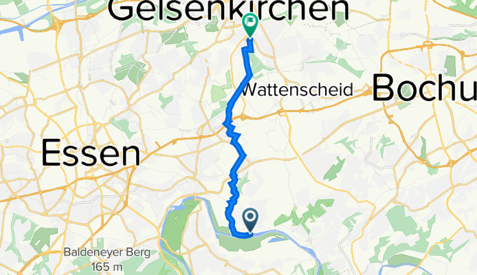
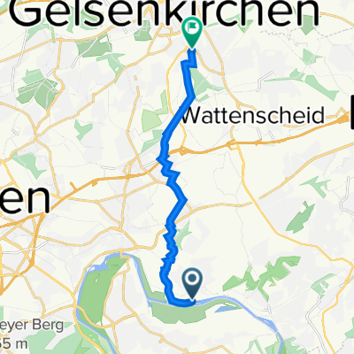
Route template
Hattingen to Gelsenkirchen

- 1 h 21 min
- Duration
- 22.5 km
- Distance
- 182 m
- Ascent
- 228 m
- Descent
- 16.8 km/h
- Avg. speed
- 119 m
- Max. altitude
This scenic cycling route starts in the charming town of Hattingen, known for its beautifully preserved medieval old town with timber-framed houses and inviting cafés. From there, you’ll pedal northwards toward Gelsenkirchen, a lively city famous for its football culture and the renowned Veltins-Arena.
The ride covers about 22.5 kilometers and is mostly on paved surfaces, with smooth asphalt making up the majority—perfect for a relaxed pedal. Expect a gentle mix of ascent and descent as you leave Hattingen’s hilly surrounds and gradually make your way into the lower-lying Ruhr landscape.
Most of your journey stays pleasantly quiet, sticking to peaceful roads and scenic paths rather than busy traffic routes. You’ll also pass patches of paving stones and the occasional gravel or concrete section, but nothing too challenging.
As you roll into Gelsenkirchen, you’ll find plenty of options to grab a snack or even catch a glimpse of Schalke 04 fans in blue. All in all, it’s an enjoyable ride linking history-rich Hattingen with the energy of urban Gelsenkirchen!
Community
Top users in this region


From our community
The best bike routes from Hattingen to Gelsenkirchen

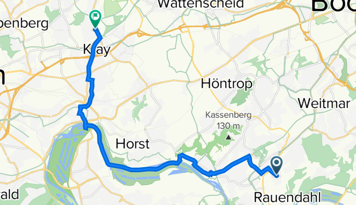
Route in Bochum
Cycling route in Hattingen, North Rhine-Westphalia, Germany
- 8 km
- Distance
- 75 m
- Ascent
- 129 m
- Descent

Verbindungsweg R25
Cycling route in Hattingen, North Rhine-Westphalia, Germany
- 10 km
- Distance
- 108 m
- Ascent
- 114 m
- Descent

K 24, Hattingen nach Gedingeweg 27, Essen
Cycling route in Hattingen, North Rhine-Westphalia, Germany
- 11 km
- Distance
- 100 m
- Ascent
- 105 m
- Descent

Auf und Ab durch die Elfringhauser Schweiz
Cycling route in Hattingen, North Rhine-Westphalia, Germany
- 55.6 km
- Distance
- 488 m
- Ascent
- 472 m
- Descent

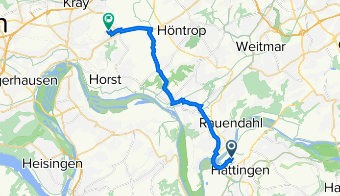
Rauendahlstraße 63–151, Bochum nach Erzbahnstraße, Gelsenkirchen
Cycling route in Hattingen, North Rhine-Westphalia, Germany
- 18.7 km
- Distance
- 23 m
- Ascent
- 46 m
- Descent
Welperstraße 44, Bochum nach Rotthauser Straße 35, Essen
Cycling route in Hattingen, North Rhine-Westphalia, Germany
- 13.5 km
- Distance
- 76 m
- Ascent
- 131 m
- Descent
Essen nach Bochumer Straße, Gelsenkirchen
Cycling route in Hattingen, North Rhine-Westphalia, Germany
- 10.4 km
- Distance
- 58 m
- Ascent
- 75 m
- Descent

Pitschner
Cycling route in Hattingen, North Rhine-Westphalia, Germany
- 9.4 km
- Distance
- 60 m
- Ascent
- 146 m
- Descent

Schultenhof -> WF
Cycling route in Hattingen, North Rhine-Westphalia, Germany
- 11.3 km
- Distance
- 145 m
- Ascent
- 134 m
- Descent
Ruhrallee 6, Hattingen nach Märkische Straße 80, Essen
Cycling route in Hattingen, North Rhine-Westphalia, Germany
- 11.2 km
- Distance
- 147 m
- Ascent
- 119 m
- Descent

Haus Horst 1, Essen nach Steeler Straße 84, Bochum
Cycling route in Hattingen, North Rhine-Westphalia, Germany
- 9.5 km
- Distance
- 62 m
- Ascent
- 72 m
- Descent
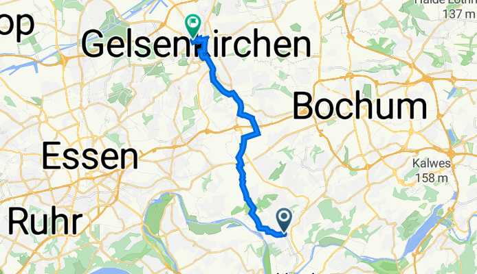
Hattinger Straße 863A, Bochum nach Kurt-Schumacher-Straße 8–14, Gelsenkirchen
Cycling route in Hattingen, North Rhine-Westphalia, Germany
- 15.3 km
- Distance
- 109 m
- Ascent
- 170 m
- Descent
Discover more routes
 Rauendahlstraße 63–151, Bochum nach Erzbahnstraße, Gelsenkirchen
- Distance
- 18.7 km
- Ascent
- 23 m
- Descent
- 46 m
- Location
- Hattingen, North Rhine-Westphalia, Germany
 Welperstraße 44, Bochum nach Rotthauser Straße 35, Essen
- Distance
- 13.5 km
- Ascent
- 76 m
- Descent
- 131 m
- Location
- Hattingen, North Rhine-Westphalia, Germany
 Essen nach Bochumer Straße, Gelsenkirchen
- Distance
- 10.4 km
- Ascent
- 58 m
- Descent
- 75 m
- Location
- Hattingen, North Rhine-Westphalia, Germany
 Pitschner
- Distance
- 9.4 km
- Ascent
- 60 m
- Descent
- 146 m
- Location
- Hattingen, North Rhine-Westphalia, Germany
 Schultenhof -> WF
- Distance
- 11.3 km
- Ascent
- 145 m
- Descent
- 134 m
- Location
- Hattingen, North Rhine-Westphalia, Germany
 Ruhrallee 6, Hattingen nach Märkische Straße 80, Essen
- Distance
- 11.2 km
- Ascent
- 147 m
- Descent
- 119 m
- Location
- Hattingen, North Rhine-Westphalia, Germany
 Haus Horst 1, Essen nach Steeler Straße 84, Bochum
- Distance
- 9.5 km
- Ascent
- 62 m
- Descent
- 72 m
- Location
- Hattingen, North Rhine-Westphalia, Germany
 Hattinger Straße 863A, Bochum nach Kurt-Schumacher-Straße 8–14, Gelsenkirchen
- Distance
- 15.3 km
- Ascent
- 109 m
- Descent
- 170 m
- Location
- Hattingen, North Rhine-Westphalia, Germany
Routes from Hattingen
Cycling day trip from
Hattingen to Witten
Cycling day trip from
Hattingen to Mülheim
By bicycle from
Hattingen to Sprockhövel
By bicycle from
Hattingen to Bochum
Routes to Gelsenkirchen
Cycling day trip from
Oberhausen to Gelsenkirchen
Cycling day trip from
Bottrop to Gelsenkirchen
By bicycle from
Bochum to Gelsenkirchen
By bicycle from
Bochum-Hordel to Gelsenkirchen