
By bicycle from Grainau to Garmisch-Partenkirchen
Customize your own route based on our template or discover how our community prefers to cycle from Grainau to Garmisch-Partenkirchen.
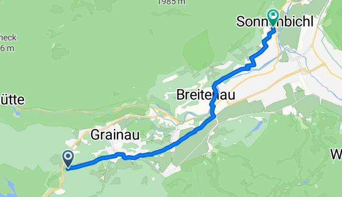
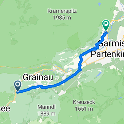
Route template
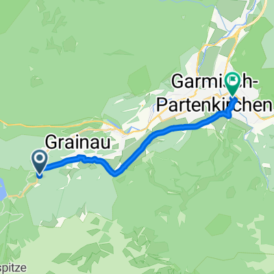
Grainau to Garmisch-Partenkirchen

- 29 min
- Duration
- 7.5 km
- Distance
- 84 m
- Ascent
- 131 m
- Descent
- 15.5 km/h
- Avg. speed
- 763 m
- Max. altitude
This route takes you from the peaceful village of Grainau to the lively town of Garmisch-Partenkirchen, covering just over 7.5 km—perfect for a relaxed ride with stunning mountain views. You’ll start in Grainau, nestled at the foot of Germany’s highest peak, the Zugspitze, and pedal mostly along quiet roads and scenic tracks. With just a gentle climb and a bit more downhill, it’s suitable for all fitness levels.
The ride is nearly all on smooth asphalt, making it ideal for any bike. As you approach Garmisch-Partenkirchen, you might catch glimpses of the Alps rising dramatically around you. Once in town, take time to explore—Garmisch-Partenkirchen is known for its charming Bavarian architecture and as a hotspot for winter sports, thanks to its Olympic history. Whether you’re finishing your ride with a coffee in a cozy café or planning to explore further, this route nicely blends natural peace with a festive destination!
Community
Top users in this region


From our community
The best bike routes from Grainau to Garmisch-Partenkirchen

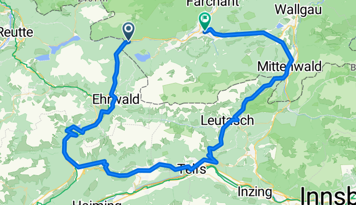
Leutasch Garmisch bis Grenze Aufnahme vom 21. April 11:57
Cycling route in Grainau, Bavaria, Germany
- 13.8 km
- Distance
- 38 m
- Ascent
- 150 m
- Descent

Garmisch zur Reintalangerhütte
Cycling route in Grainau, Bavaria, Germany
- 20.3 km
- Distance
- 215 m
- Ascent
- 890 m
- Descent

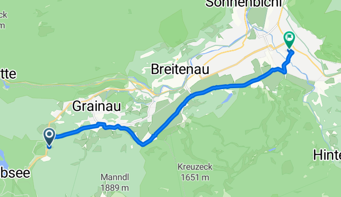
Grainau-Eibseeumrundung-Grainau
Cycling route in Grainau, Bavaria, Germany
- 24.1 km
- Distance
- 587 m
- Ascent
- 381 m
- Descent

Zugspitzenroute 1 - Reintal
Cycling route in Grainau, Bavaria, Germany
- 19.7 km
- Distance
- 56 m
- Ascent
- 1,396 m
- Descent

zur johanneskirche Partenkirchen
Cycling route in Grainau, Bavaria, Germany
- 6 km
- Distance
- 8 m
- Ascent
- 50 m
- Descent

Bike and swimm: Eibsee - Kaizenbad
Cycling route in Grainau, Bavaria, Germany
- 20.7 km
- Distance
- 160 m
- Ascent
- 432 m
- Descent

Garmisch Höllentorkopf
Cycling route in Grainau, Bavaria, Germany
- 13 km
- Distance
- 28 m
- Ascent
- 1,332 m
- Descent
Eibseestraße, Grainau nach Pflegerseestraße, Garmisch-Partenkirchen
Cycling route in Grainau, Bavaria, Germany
- 9.1 km
- Distance
- 41 m
- Ascent
- 209 m
- Descent
Eibseestraße, Grainau nach Reintalstraße, Garmisch-Partenkirchen
Cycling route in Grainau, Bavaria, Germany
- 10.3 km
- Distance
- 38 m
- Ascent
- 213 m
- Descent

Kreuzeck - Ferchenbach - Ellmau 12km 60hm
Cycling route in Grainau, Bavaria, Germany
- 11.6 km
- Distance
- 75 m
- Ascent
- 850 m
- Descent

Discover more routes
 zur johanneskirche Partenkirchen
- Distance
- 6 km
- Ascent
- 8 m
- Descent
- 50 m
- Location
- Grainau, Bavaria, Germany
 Bike and swimm: Eibsee - Kaizenbad
- Distance
- 20.7 km
- Ascent
- 160 m
- Descent
- 432 m
- Location
- Grainau, Bavaria, Germany
 Garmisch Höllentorkopf
- Distance
- 13 km
- Ascent
- 28 m
- Descent
- 1,332 m
- Location
- Grainau, Bavaria, Germany
 Eibseestraße, Grainau nach Pflegerseestraße, Garmisch-Partenkirchen
- Distance
- 9.1 km
- Ascent
- 41 m
- Descent
- 209 m
- Location
- Grainau, Bavaria, Germany
 Eibseestraße, Grainau nach Reintalstraße, Garmisch-Partenkirchen
- Distance
- 10.3 km
- Ascent
- 38 m
- Descent
- 213 m
- Location
- Grainau, Bavaria, Germany
 Kreuzeck - Ferchenbach - Ellmau 12km 60hm
- Distance
- 11.6 km
- Ascent
- 75 m
- Descent
- 850 m
- Location
- Grainau, Bavaria, Germany
 wamberg
- Distance
- 24 km
- Ascent
- 730 m
- Descent
- 493 m
- Location
- Grainau, Bavaria, Germany
 GAP_98km_1610hm
- Distance
- 98.1 km
- Ascent
- 1,403 m
- Descent
- 1,512 m
- Location
- Grainau, Bavaria, Germany
Routes from Grainau
Cycling day trip from
Grainau to Imst
Routes to Garmisch-Partenkirchen
Cycling day trip from
Füssen to Garmisch-Partenkirchen
Cycling day trip from
Mittenwald to Garmisch-Partenkirchen