
Quick ride by bicycle from Gesundbrunnen to Wedding
Customize your own route based on our template or discover how our community prefers to cycle from Gesundbrunnen to Wedding.
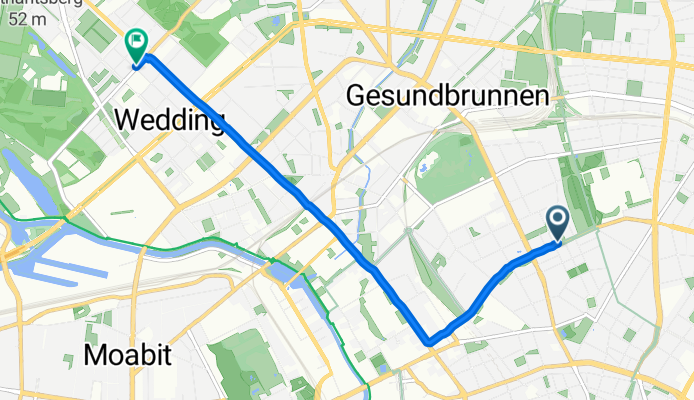
Route template
Gesundbrunnen to Wedding

- 25 min
- Duration
- 6.4 km
- Distance
- 14 m
- Ascent
- 25 m
- Descent
- 15.4 km/h
- Avg. speed
- 52 m
- Max. altitude
Hop on your bike for a smooth city loop from Gesundbrunnen to Wedding—two neighboring, vibrant Berlin districts packed with character. Starting at Gesundbrunnen, a busy travel hub famous for its train station and easy access to Mauerpark, you’ll roll mostly along paved surfaces (expect lots of asphalt and some charming stretches of paving stones—classic Berlin flair).
The route is a chill 6.4 km, and there’s hardly any climbing, so it’s easy on the legs. You’ll spend most of your time on proper cycleways and quiet streets, winding past local shops, leafy squares, and cafés. Expect just a bit of cobblestone to keep things interesting, but it’s nearly all smooth riding.
As you arrive in Wedding—a true Berlin mix of old-school charm and multicultural buzz—take a moment to check out some of the indie galleries or grab a coffee at a sidewalk café. This ride is perfect if you want a taste of everyday Berlin life, away from the tourist crowds.
Community
Top users in this region


From our community
The best bike routes from Gesundbrunnen to Wedding

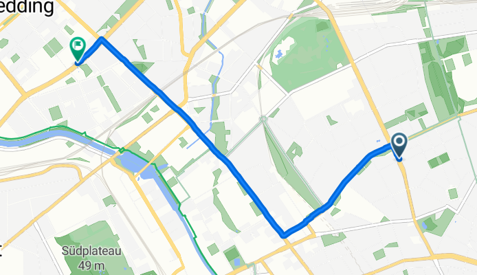
Gartenstr.50, Wedding > Seestr., Osramhöfe, McFit
Cycling route in Gesundbrunnen, State of Berlin, Germany
- 3.1 km
- Distance
- 8 m
- Ascent
- 5 m
- Descent

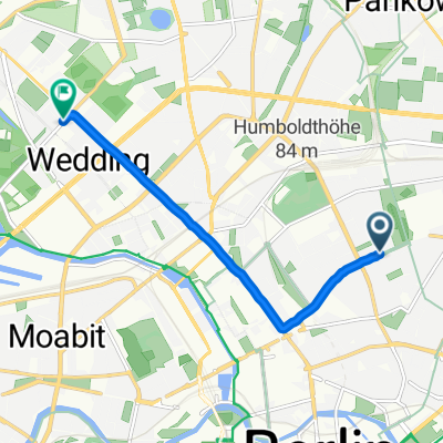
Hochstraße 42, Berlin nach Mitte, Berlin
Cycling route in Gesundbrunnen, State of Berlin, Germany
- 1 km
- Distance
- 0 m
- Ascent
- 3 m
- Descent
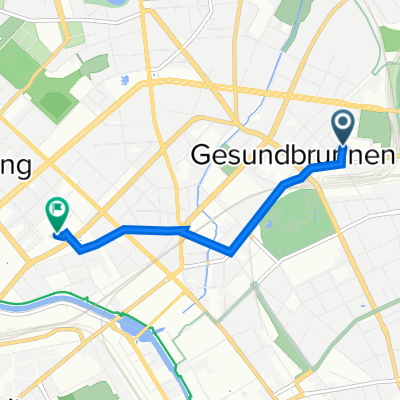
Brunnenstraße, Berlin nach Luxemburger Straße, Berlin
Cycling route in Gesundbrunnen, State of Berlin, Germany
- 4.4 km
- Distance
- 5 m
- Ascent
- 37 m
- Descent

Brunnenstraße 107, Berlin nach Oudenarder Straße 16, Berlin
Cycling route in Gesundbrunnen, State of Berlin, Germany
- 2.7 km
- Distance
- 3 m
- Ascent
- 13 m
- Descent
Bernauer Straße, Berlin nach Sansibarstraße, Berlin
Cycling route in Gesundbrunnen, State of Berlin, Germany
- 5.6 km
- Distance
- 18 m
- Ascent
- 28 m
- Descent

Jülicher Straße 9A, Berlin to Luxemburger Straße 10, Berlin
Cycling route in Gesundbrunnen, State of Berlin, Germany
- 3.3 km
- Distance
- 8 m
- Ascent
- 16 m
- Descent

Jasmunder Straße 9, Berlin nach Föhrer Brücke, Berlin
Cycling route in Gesundbrunnen, State of Berlin, Germany
- 3.6 km
- Distance
- 29 m
- Ascent
- 35 m
- Descent

Bastianstraße 23, Berlin nach Reinickendorfer Straße 61, Berlin
Cycling route in Gesundbrunnen, State of Berlin, Germany
- 1.9 km
- Distance
- 5 m
- Ascent
- 6 m
- Descent

Kopenhagener Straße 11, Berlin nach Otawistraße 1, Berlin
Cycling route in Gesundbrunnen, State of Berlin, Germany
- 6.3 km
- Distance
- 11 m
- Ascent
- 26 m
- Descent

230603 Stephan ebike
Cycling route in Gesundbrunnen, State of Berlin, Germany
- 13.2 km
- Distance
- 204 m
- Ascent
- 244 m
- Descent

Sunday at Rehberge Park
Cycling route in Gesundbrunnen, State of Berlin, Germany
- 4.9 km
- Distance
- 23 m
- Ascent
- 33 m
- Descent

Getting to plotzensee from prenzlauer berg
Cycling route in Gesundbrunnen, State of Berlin, Germany
- 6 km
- Distance
- 0 m
- Ascent
- 20 m
- Descent
Discover more routes
 Bernauer Straße, Berlin nach Sansibarstraße, Berlin
- Distance
- 5.6 km
- Ascent
- 18 m
- Descent
- 28 m
- Location
- Gesundbrunnen, State of Berlin, Germany
 Jülicher Straße 9A, Berlin to Luxemburger Straße 10, Berlin
- Distance
- 3.3 km
- Ascent
- 8 m
- Descent
- 16 m
- Location
- Gesundbrunnen, State of Berlin, Germany
 Jasmunder Straße 9, Berlin nach Föhrer Brücke, Berlin
- Distance
- 3.6 km
- Ascent
- 29 m
- Descent
- 35 m
- Location
- Gesundbrunnen, State of Berlin, Germany
 Bastianstraße 23, Berlin nach Reinickendorfer Straße 61, Berlin
- Distance
- 1.9 km
- Ascent
- 5 m
- Descent
- 6 m
- Location
- Gesundbrunnen, State of Berlin, Germany
 Kopenhagener Straße 11, Berlin nach Otawistraße 1, Berlin
- Distance
- 6.3 km
- Ascent
- 11 m
- Descent
- 26 m
- Location
- Gesundbrunnen, State of Berlin, Germany
 230603 Stephan ebike
- Distance
- 13.2 km
- Ascent
- 204 m
- Descent
- 244 m
- Location
- Gesundbrunnen, State of Berlin, Germany
 Sunday at Rehberge Park
- Distance
- 4.9 km
- Ascent
- 23 m
- Descent
- 33 m
- Location
- Gesundbrunnen, State of Berlin, Germany
 Getting to plotzensee from prenzlauer berg
- Distance
- 6 km
- Ascent
- 0 m
- Descent
- 20 m
- Location
- Gesundbrunnen, State of Berlin, Germany
Routes from Gesundbrunnen
Quick ride by bicycle from
Gesundbrunnen to Mitte
Quick ride by bicycle from
Gesundbrunnen to Pankow
Routes to Wedding
Quick ride by bicycle from
Charlottenburg to Wedding
Quick ride by bicycle from
Kreuzberg to Wedding