
By bicycle from Gelsenkirchen to Bochum
Customize your own route based on our template or discover how our community prefers to cycle from Gelsenkirchen to Bochum.
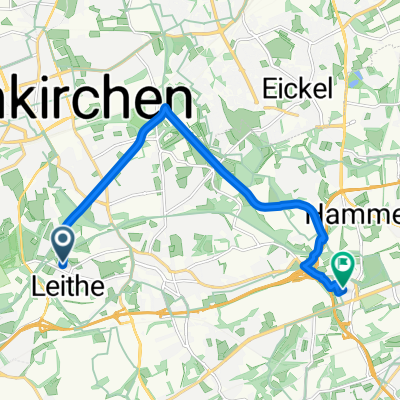
Route template
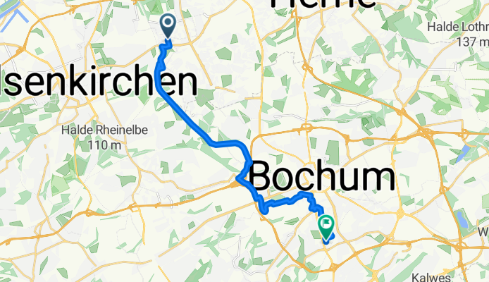
Gelsenkirchen to Bochum

- 45 min
- Duration
- 13.2 km
- Distance
- 91 m
- Ascent
- 44 m
- Descent
- 17.6 km/h
- Avg. speed
- 101 m
- Max. altitude
Set off from Gelsenkirchen, a city best known for its deep industrial roots and football pride (Schalke 04, anyone?), and head south toward Bochum on a relaxed 13 km ride. The journey is mostly smooth-sailing, with nearly all of it on nice paved surfaces—perfect for a casual spinner or a city bike.
The ride takes you predominantly along quiet paths and roads, so expect fewer cars and a more chilled experience. You’ll climb gently for parts of the route, but nothing too dramatic—just enough to keep things interesting. As you roll into Bochum, get ready to explore another key Ruhrgebiet city, famous for both its lively student scene and the iconic Deutsches Bergbau-Museum (Mining Museum).
This route is ideal for riders who want to sample North Rhine-Westphalia’s urban heartland via safe and accessible cycleways, and you’ll have plenty of excuses to take in some Ruhrpott charm along the way!
Community
Top users in this region


From our community
The best bike routes from Gelsenkirchen to Bochum

Erzbahntrasse 1
Cycling route in Gelsenkirchen, North Rhine-Westphalia, Germany
- 8.4 km
- Distance
- 57 m
- Ascent
- 17 m
- Descent

Weindorfstraße, Bochum nach Castroper Straße, Bochum
Cycling route in Gelsenkirchen, North Rhine-Westphalia, Germany
- 12.4 km
- Distance
- 92 m
- Ascent
- 54 m
- Descent


Jahrhunderthalle Bochum
Cycling route in Gelsenkirchen, North Rhine-Westphalia, Germany
- 13.4 km
- Distance
- 77 m
- Ascent
- 44 m
- Descent
Home - TÜV
Cycling route in Gelsenkirchen, North Rhine-Westphalia, Germany
- 6.3 km
- Distance
- 56 m
- Ascent
- 37 m
- Descent

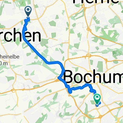
Espenloh 33, Bochum nach Yorckstraße 36, Bochum
Cycling route in Gelsenkirchen, North Rhine-Westphalia, Germany
- 9.6 km
- Distance
- 55 m
- Ascent
- 27 m
- Descent

Oma F.
Cycling route in Gelsenkirchen, North Rhine-Westphalia, Germany
- 9.3 km
- Distance
- 86 m
- Ascent
- 50 m
- Descent


An der Luthenburg 27, Gelsenkirchen nach Universitätsstraße 150, Bochum
Cycling route in Gelsenkirchen, North Rhine-Westphalia, Germany
- 17 km
- Distance
- 186 m
- Ascent
- 87 m
- Descent
Ruhige Fahrt zum Hospiz
Cycling route in Gelsenkirchen, North Rhine-Westphalia, Germany
- 14.2 km
- Distance
- 114 m
- Ascent
- 43 m
- Descent

Erzbahntrasse Start Bo-Jahrhunderthalle
Cycling route in Gelsenkirchen, North Rhine-Westphalia, Germany
- 6.3 km
- Distance
- 66 m
- Ascent
- 35 m
- Descent
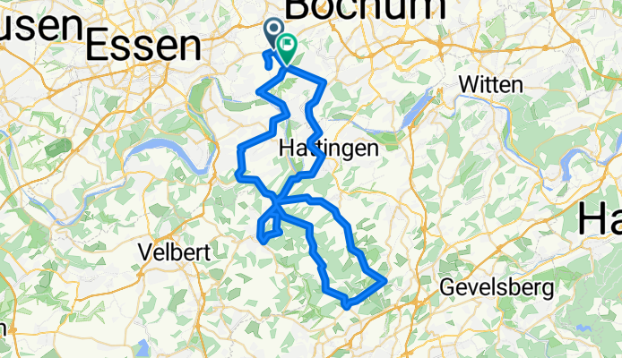
Wattenscheid-Langenberg-Felderbachtal-Wodantal-Hattingen-Wattenscheid
Cycling route in Gelsenkirchen, North Rhine-Westphalia, Germany
- 63 km
- Distance
- 972 m
- Ascent
- 933 m
- Descent

Rüsternhagen - Zoom
Cycling route in Gelsenkirchen, North Rhine-Westphalia, Germany
- 18.4 km
- Distance
- 137 m
- Ascent
- 42 m
- Descent

Bertramstraße nach Vereinsstraße
Cycling route in Gelsenkirchen, North Rhine-Westphalia, Germany
- 10.7 km
- Distance
- 50 m
- Ascent
- 83 m
- Descent
Discover more routes
 Espenloh 33, Bochum nach Yorckstraße 36, Bochum
- Distance
- 9.6 km
- Ascent
- 55 m
- Descent
- 27 m
- Location
- Gelsenkirchen, North Rhine-Westphalia, Germany
 Oma F.
- Distance
- 9.3 km
- Ascent
- 86 m
- Descent
- 50 m
- Location
- Gelsenkirchen, North Rhine-Westphalia, Germany
 An der Luthenburg 27, Gelsenkirchen nach Universitätsstraße 150, Bochum
- Distance
- 17 km
- Ascent
- 186 m
- Descent
- 87 m
- Location
- Gelsenkirchen, North Rhine-Westphalia, Germany
 Ruhige Fahrt zum Hospiz
- Distance
- 14.2 km
- Ascent
- 114 m
- Descent
- 43 m
- Location
- Gelsenkirchen, North Rhine-Westphalia, Germany
 Erzbahntrasse Start Bo-Jahrhunderthalle
- Distance
- 6.3 km
- Ascent
- 66 m
- Descent
- 35 m
- Location
- Gelsenkirchen, North Rhine-Westphalia, Germany
 Wattenscheid-Langenberg-Felderbachtal-Wodantal-Hattingen-Wattenscheid
- Distance
- 63 km
- Ascent
- 972 m
- Descent
- 933 m
- Location
- Gelsenkirchen, North Rhine-Westphalia, Germany
 Rüsternhagen - Zoom
- Distance
- 18.4 km
- Ascent
- 137 m
- Descent
- 42 m
- Location
- Gelsenkirchen, North Rhine-Westphalia, Germany
 Bertramstraße nach Vereinsstraße
- Distance
- 10.7 km
- Ascent
- 50 m
- Descent
- 83 m
- Location
- Gelsenkirchen, North Rhine-Westphalia, Germany
Routes from Gelsenkirchen
Cycling day trip from
Gelsenkirchen to Bottrop
Cycling day trip from
Gelsenkirchen to Hattingen
By bicycle from
Gelsenkirchen to Herten
By bicycle from
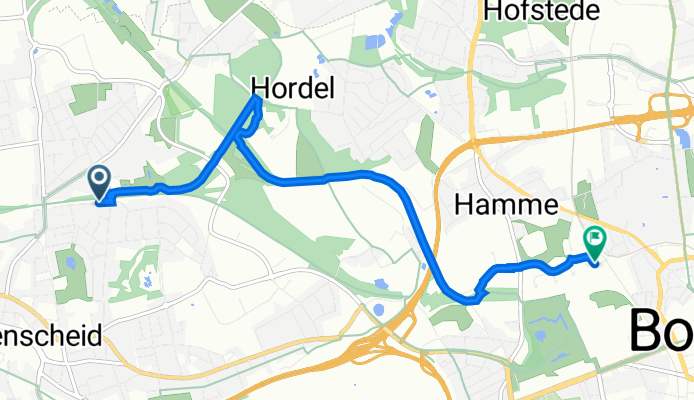
Gelsenkirchen to Bochum-Hordel
Routes to Bochum
Cycling day trip from
Essen to Bochum
Cycling day trip from
Schwerte to Bochum
By bicycle from
Herne to Bochum
By bicycle from
Castrop-Rauxel to Bochum