
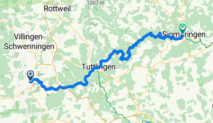
Cycling day trip from Donaueschingen to Sigmaringen
Customize your own route based on our template or discover how our community prefers to cycle from Donaueschingen to Sigmaringen.
Route template
Donaueschingen to Sigmaringen
- 5 h 6 min
- Duration
- 87.1 km
- Distance
- 759 m
- Ascent
- 866 m
- Descent
- 17.1 km/h
- Avg. speed
- 784 m
- Max. altitude
This picturesque cycling route takes you from Donaueschingen to Sigmaringen, with about 87 km of mostly smooth, paved surfaces and just enough uphill (about 760 meters of climbing) to keep things interesting. You’ll roll out from Donaueschingen, famously known as the “source of the Danube” — a perfect spot to start a river journey! The route follows the scenic upper Danube valley, weaving past tranquil forests and dramatic limestone cliffs.
You’ll mostly stick to quiet country roads and gentle tracks, so it’s a great ride if you prefer less traffic and more landscape. There's a bit of gravel, but nothing too gnarly, and the route generally trends downhill toward Sigmaringen. Once you arrive, you’ll be greeted by Sigmaringen’s stunning hilltop castle, perched above the Danube, and a lively old town.
Take it easy, soak up the Danube’s early journey, and don’t forget your camera — this ride is as much about the views as the kilometers.
Community
Top users in this region


From our community
The best bike routes from Donaueschingen to Sigmaringen

Donauradweg
Cycling route in Donaueschingen, Baden-Wurttemberg, Germany
- 86.1 km
- Distance
- 246 m
- Ascent
- 370 m
- Descent

Donautour 1.Etappe
Cycling route in Donaueschingen, Baden-Wurttemberg, Germany
- 99.3 km
- Distance
- 311 m
- Ascent
- 407 m
- Descent

doanueschingen (donauquelle) - sigmaringen
Cycling route in Donaueschingen, Baden-Wurttemberg, Germany
- 96.1 km
- Distance
- 222 m
- Ascent
- 322 m
- Descent

Follow the flow
Cycling route in Donaueschingen, Baden-Wurttemberg, Germany
- 91.5 km
- Distance
- 282 m
- Ascent
- 385 m
- Descent

1. Donaueschingen - Sigmaringen 93
Cycling route in Donaueschingen, Baden-Wurttemberg, Germany
- 92.8 km
- Distance
- 172 m
- Ascent
- 307 m
- Descent

Donaueschingen-Tuttlingen-Sigmaringen
Cycling route in Donaueschingen, Baden-Wurttemberg, Germany
- 92.3 km
- Distance
- 181 m
- Ascent
- 282 m
- Descent
1 Donaueschingen - Sigmaringen
Cycling route in Donaueschingen, Baden-Wurttemberg, Germany
- 91.3 km
- Distance
- 911 m
- Ascent
- 1,029 m
- Descent

1 Etappe Donauradweg
Cycling route in Donaueschingen, Baden-Wurttemberg, Germany
- 91.7 km
- Distance
- 175 m
- Ascent
- 281 m
- Descent

Donau Teil 1
Cycling route in Donaueschingen, Baden-Wurttemberg, Germany
- 92.1 km
- Distance
- 193 m
- Ascent
- 303 m
- Descent

Ziua 1:Donaueschingen-Sigmaringen
Cycling route in Donaueschingen, Baden-Wurttemberg, Germany
- 91.2 km
- Distance
- 168 m
- Ascent
- 277 m
- Descent

Drumul Dunarii 2013, ziua a doua, Donaueschingen - Sigmaringen
Cycling route in Donaueschingen, Baden-Wurttemberg, Germany
- 92.6 km
- Distance
- 397 m
- Ascent
- 502 m
- Descent

doanueschingen-sigmaringen
Cycling route in Donaueschingen, Baden-Wurttemberg, Germany
- 85.3 km
- Distance
- 282 m
- Ascent
- 389 m
- Descent
Discover more routes
 1. Donaueschingen - Sigmaringen 93
- Distance
- 92.8 km
- Ascent
- 172 m
- Descent
- 307 m
- Location
- Donaueschingen, Baden-Wurttemberg, Germany
 Donaueschingen-Tuttlingen-Sigmaringen
- Distance
- 92.3 km
- Ascent
- 181 m
- Descent
- 282 m
- Location
- Donaueschingen, Baden-Wurttemberg, Germany
 1 Donaueschingen - Sigmaringen
- Distance
- 91.3 km
- Ascent
- 911 m
- Descent
- 1,029 m
- Location
- Donaueschingen, Baden-Wurttemberg, Germany
 1 Etappe Donauradweg
- Distance
- 91.7 km
- Ascent
- 175 m
- Descent
- 281 m
- Location
- Donaueschingen, Baden-Wurttemberg, Germany
 Donau Teil 1
- Distance
- 92.1 km
- Ascent
- 193 m
- Descent
- 303 m
- Location
- Donaueschingen, Baden-Wurttemberg, Germany
 Ziua 1:Donaueschingen-Sigmaringen
- Distance
- 91.2 km
- Ascent
- 168 m
- Descent
- 277 m
- Location
- Donaueschingen, Baden-Wurttemberg, Germany
 Drumul Dunarii 2013, ziua a doua, Donaueschingen - Sigmaringen
- Distance
- 92.6 km
- Ascent
- 397 m
- Descent
- 502 m
- Location
- Donaueschingen, Baden-Wurttemberg, Germany
 doanueschingen-sigmaringen
- Distance
- 85.3 km
- Ascent
- 282 m
- Descent
- 389 m
- Location
- Donaueschingen, Baden-Wurttemberg, Germany
Routes from Donaueschingen
Cycling day trip from
Donaueschingen to Fridingen an der Donau
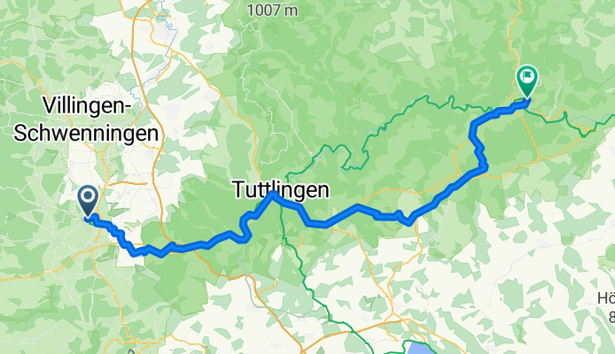
Cycling day trip from
Donaueschingen to Tuttlingen
Routes to Sigmaringen
Cycling day trip from
Tuttlingen to Sigmaringen
Cycling day trip from
Fridingen an der Donau to Sigmaringen