
Cycling day trip from Bad Schandau to Sebnitz
Customize your own route based on our template or discover how our community prefers to cycle from Bad Schandau to Sebnitz.
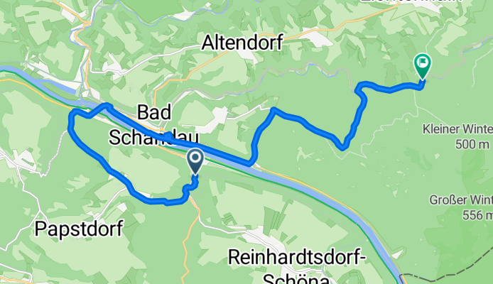
Route template
Bad Schandau to Sebnitz

- 2 h 16 min
- Duration
- 34.7 km
- Distance
- 742 m
- Ascent
- 553 m
- Descent
- 15.3 km/h
- Avg. speed
- 468 m
- Max. altitude
Pedal out of picturesque Bad Schandau—right on the banks of the Elbe and a gateway into Saxon Switzerland National Park—heading north toward Sebnitz. This 35 km ride is a real treat for nature lovers and offers a good workout, with about 740 meters of climbing as you roll through lush forested hills and charming villages of the Sächsische Schweiz region.
The road is mostly smooth asphalt, so it’s well-suited for road bikes, and much of the journey is on quiet, peaceful routes. Watch for glimpses of the Elbe sandstone landscapes and possible stops for scenic photos or quick refreshments in local cafés.
Arriving in Sebnitz, you’ll find a town famous for its century-old tradition of handmade silk flowers—so much so that it’s often called the “City of Silk Flowers.” Treat yourself to a stroll through its quaint town center or check out the Sebnitz Flower Factory Museum before hopping back on your bike or grabbing a coffee. All in all, this route gives you a perfect slice of Saxon countryside with a bit of climbing to keep things lively!
Community
Top users in this region


From our community
The best bike routes from Bad Schandau to Sebnitz

27_Großer Winterberg - Kirnitzschtal
Cycling route in Bad Schandau, Saxony, Germany
- 10 km
- Distance
- 617 m
- Ascent
- 550 m
- Descent

Vorschlag MBWE, 25.8.2018
Cycling route in Bad Schandau, Saxony, Germany
- 16.8 km
- Distance
- 549 m
- Ascent
- 569 m
- Descent

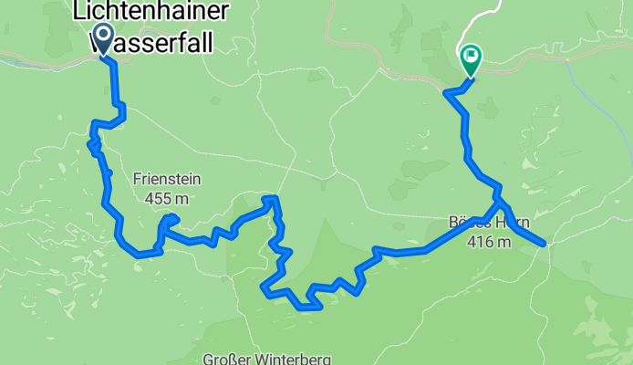
AugustusTours Rundwanderung 6: Bad Schandau - Lichtenhainer Wasserfall
Cycling route in Bad Schandau, Saxony, Germany
- 13.2 km
- Distance
- 336 m
- Ascent
- 263 m
- Descent

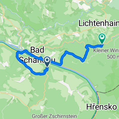
Kirnitzschtalbahn
Cycling route in Bad Schandau, Saxony, Germany
- 7.9 km
- Distance
- 164 m
- Ascent
- 102 m
- Descent

Schmilka - Winterstein - Endlerkuppe - Ottendorf
Cycling route in Bad Schandau, Saxony, Germany
- 17.2 km
- Distance
- 631 m
- Ascent
- 454 m
- Descent

Etappe 8 einmal durch Sächsische Schweiz und zurück
Cycling route in Bad Schandau, Saxony, Germany
- 19.7 km
- Distance
- 263 m
- Ascent
- 125 m
- Descent
Wanderung Beuthenfall Häntzschelstiege Buschmühle
Cycling route in Bad Schandau, Saxony, Germany
- 13.3 km
- Distance
- 564 m
- Ascent
- 532 m
- Descent


Schmilka - Prebischtor - H'h'dorf
Cycling route in Bad Schandau, Saxony, Germany
- 31.7 km
- Distance
- 1,029 m
- Ascent
- 780 m
- Descent

Roter-Bus-Schrammstein
Cycling route in Bad Schandau, Saxony, Germany
- 13.6 km
- Distance
- 378 m
- Ascent
- 365 m
- Descent

Sächsische Schweiz
Cycling route in Bad Schandau, Saxony, Germany
- 13.4 km
- Distance
- 513 m
- Ascent
- 455 m
- Descent
Bächelweg, Bad Schandau nach Kirnitzschtalstraße, Sebnitz
Cycling route in Bad Schandau, Saxony, Germany
- 16.5 km
- Distance
- 433 m
- Ascent
- 362 m
- Descent
Discover more routes
 Schmilka - Winterstein - Endlerkuppe - Ottendorf
- Distance
- 17.2 km
- Ascent
- 631 m
- Descent
- 454 m
- Location
- Bad Schandau, Saxony, Germany
 Etappe 8 einmal durch Sächsische Schweiz und zurück
- Distance
- 19.7 km
- Ascent
- 263 m
- Descent
- 125 m
- Location
- Bad Schandau, Saxony, Germany
 Wanderung Beuthenfall Häntzschelstiege Buschmühle
- Distance
- 13.3 km
- Ascent
- 564 m
- Descent
- 532 m
- Location
- Bad Schandau, Saxony, Germany
 BSch_HiHeDo
- Distance
- 18.6 km
- Ascent
- 592 m
- Descent
- 355 m
- Location
- Bad Schandau, Saxony, Germany
 Schmilka - Prebischtor - H'h'dorf
- Distance
- 31.7 km
- Ascent
- 1,029 m
- Descent
- 780 m
- Location
- Bad Schandau, Saxony, Germany
 Roter-Bus-Schrammstein
- Distance
- 13.6 km
- Ascent
- 378 m
- Descent
- 365 m
- Location
- Bad Schandau, Saxony, Germany
 Sächsische Schweiz
- Distance
- 13.4 km
- Ascent
- 513 m
- Descent
- 455 m
- Location
- Bad Schandau, Saxony, Germany
 Bächelweg, Bad Schandau nach Kirnitzschtalstraße, Sebnitz
- Distance
- 16.5 km
- Ascent
- 433 m
- Descent
- 362 m
- Location
- Bad Schandau, Saxony, Germany
Routes from Bad Schandau
Cycling day trip from
Bad Schandau to Dresden
Cycling day trip from
Bad Schandau to Děčín