
Quick ride by bicycle from Bad Homburg to Bad Vilbel
Customize your own route based on our template or discover how our community prefers to cycle from Bad Homburg to Bad Vilbel.
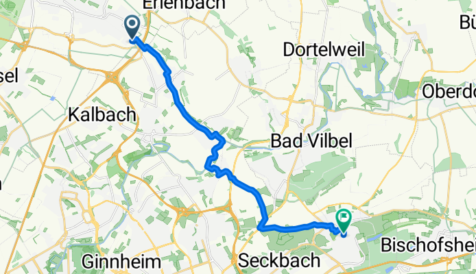
Route template
Bad Homburg to Bad Vilbel

- 53 min
- Duration
- 15 km
- Distance
- 59 m
- Ascent
- 131 m
- Descent
- 17.1 km/h
- Avg. speed
- 187 m
- Max. altitude
This scenic bike ride takes you from the spa town of Bad Homburg to Bad Vilbel, just northeast of Frankfurt, cruising through 15 km of mostly paved paths and tranquil side roads. Starting in Bad Homburg, known for its elegant Kurpark and historic casino, you’ll roll along routes with gentle climbs (about 60 meters of ascent) and a pleasant overall descent into the Nidda river valley.
The route is super rider-friendly—think smooth asphalt, the occasional stretch of paving stones, and only brief bits of gravel to add a hint of adventure. Most of your ride travels along bike paths and quiet roads, making it perfect for a relaxing pace. As you get closer to Bad Vilbel, you might catch a whiff of fresh spring water—the town is famous for its mineral springs and the annual Quellenfest (Spring Festival).
In just around an hour, this ride is a perfect way to link two charming towns, take in some river scenery, and enjoy a taste of the Taunus foothills, all without breaking too much of a sweat!
Community
Top users in this region


From our community
The best bike routes from Bad Homburg to Bad Vilbel

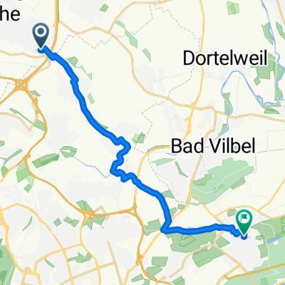
Bad-Homb - Bad-Vilbel
Cycling route in Bad Homburg, Hesse, Germany
- 13.4 km
- Distance
- 32 m
- Ascent
- 103 m
- Descent

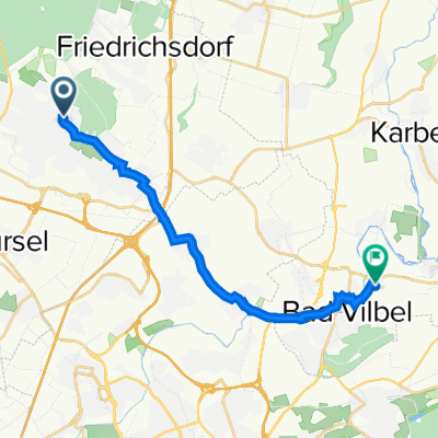
Feldberg Tour über Nebenstraßen zur Hohe Mark
Cycling route in Bad Homburg, Hesse, Germany
- 54.9 km
- Distance
- 770 m
- Ascent
- 789 m
- Descent

Fußgasse 5, Bad Homburg vor der Höhe nach Am Riedsteg, Frankfurt am Main
Cycling route in Bad Homburg, Hesse, Germany
- 10.1 km
- Distance
- 61 m
- Ascent
- 120 m
- Descent


Gonzenheim - Flugplatz Bonames
Cycling route in Bad Homburg, Hesse, Germany
- 7.2 km
- Distance
- 25 m
- Ascent
- 64 m
- Descent

Berner Straße 10, Frankfurt am Main nach Paul-Gerhardt-Straße 1, Bad Vilbel
Cycling route in Bad Homburg, Hesse, Germany
- 7.1 km
- Distance
- 193 m
- Ascent
- 151 m
- Descent

Louisenstraße 10, Bad Homburg vor der Höhe nach Zum Schäferköppel 6, Frankfurt am Main
Cycling route in Bad Homburg, Hesse, Germany
- 8.9 km
- Distance
- 63 m
- Ascent
- 102 m
- Descent


An der Leimenkaut 37, Bad Homburg vor der Höhe nach August-Schanz-Straße 12, Frankfurt am Main
Cycling route in Bad Homburg, Hesse, Germany
- 8.7 km
- Distance
- 44 m
- Ascent
- 64 m
- Descent
Von Bad Homburg vor der Höhe bis Frankfurt am Main
Cycling route in Bad Homburg, Hesse, Germany
- 14.1 km
- Distance
- 96 m
- Ascent
- 138 m
- Descent

Höllsteinstraße 28A, Bad Homburg vor der Höhe nach Matthias-Claudius-Straße 6, Bad Vilbel
Cycling route in Bad Homburg, Hesse, Germany
- 14.6 km
- Distance
- 23 m
- Ascent
- 83 m
- Descent
Discover more routes
 Casi-IM
- Distance
- 88.8 km
- Ascent
- 452 m
- Descent
- 448 m
- Location
- Bad Homburg, Hesse, Germany
 Gonzenheim - Flugplatz Bonames
- Distance
- 7.2 km
- Ascent
- 25 m
- Descent
- 64 m
- Location
- Bad Homburg, Hesse, Germany
 Berner Straße 10, Frankfurt am Main nach Paul-Gerhardt-Straße 1, Bad Vilbel
- Distance
- 7.1 km
- Ascent
- 193 m
- Descent
- 151 m
- Location
- Bad Homburg, Hesse, Germany
 Louisenstraße 10, Bad Homburg vor der Höhe nach Zum Schäferköppel 6, Frankfurt am Main
- Distance
- 8.9 km
- Ascent
- 63 m
- Descent
- 102 m
- Location
- Bad Homburg, Hesse, Germany
 Kronenhof
- Distance
- 12.6 km
- Ascent
- 19 m
- Descent
- 93 m
- Location
- Bad Homburg, Hesse, Germany
 An der Leimenkaut 37, Bad Homburg vor der Höhe nach August-Schanz-Straße 12, Frankfurt am Main
- Distance
- 8.7 km
- Ascent
- 44 m
- Descent
- 64 m
- Location
- Bad Homburg, Hesse, Germany
 Von Bad Homburg vor der Höhe bis Frankfurt am Main
- Distance
- 14.1 km
- Ascent
- 96 m
- Descent
- 138 m
- Location
- Bad Homburg, Hesse, Germany
 Höllsteinstraße 28A, Bad Homburg vor der Höhe nach Matthias-Claudius-Straße 6, Bad Vilbel
- Distance
- 14.6 km
- Ascent
- 23 m
- Descent
- 83 m
- Location
- Bad Homburg, Hesse, Germany
Routes from Bad Homburg
Quick ride by bicycle from
Bad Homburg to Oberursel
Quick ride by bicycle from
Bad Homburg to Friedrichsdorf
Routes to Bad Vilbel
Quick ride by bicycle from
Karben to Bad Vilbel
Quick ride by bicycle from
Eschborn to Bad Vilbel