
Quick ride by bicycle from Sarlat-la-Canéda to Carsac-Aillac
Customize your own route based on our template or discover how our community prefers to cycle from Sarlat-la-Canéda to Carsac-Aillac.
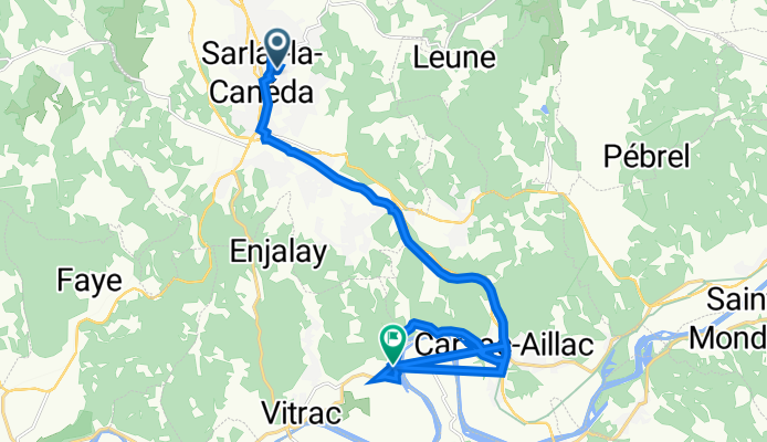
Route template
Sarlat-la-Canéda to Carsac-Aillac

- 35 min
- Duration
- 9.3 km
- Distance
- 178 m
- Ascent
- 216 m
- Descent
- 16.2 km/h
- Avg. speed
- 195 m
- Max. altitude
Kick off your ride in the heart of Sarlat-la-Canéda, a medieval gem famous for its winding lanes, golden stone buildings, and of course, mouthwatering markets. Head south on mostly quiet, undulating country roads—think shaded stretches and lush Dordogne countryside—offering a pretty gentle vibe with a few punchy climbs (you’ll gain about 178 meters along the way, but you’ll also enjoy a bit more descent).
The ride is just over 9 km, perfect for a relaxed pace, with the majority paved and super manageable for any type of bike. You’ll skirt a mix of sleepy villages and fields before rolling into charming Carsac-Aillac, known for its proximity to the Dordogne River and the start of the legendary Sarlat-Grolejac greenway—an old railway line turned family-friendly cycle path.
This route’s mostly quiet, with just a few quick hops onto busier stretches. Take time to stop for a photo or to grab a pastry on arrival—you’ll have definitely earned it!
Community
Top users in this region


From our community
The best bike routes from Sarlat-la-Canéda to Carsac-Aillac


Liberty Cycle - Château de Fénelon
Cycling route in Sarlat-la-Canéda, Nouvelle-Aquitaine, France
- 20.8 km
- Distance
- 283 m
- Ascent
- 253 m
- Descent


Liberty Cycle - Les Jardins d'eau
Cycling route in Sarlat-la-Canéda, Nouvelle-Aquitaine, France
- 7.5 km
- Distance
- 54 m
- Ascent
- 113 m
- Descent

sarlat naar Vitrac
Cycling route in Sarlat-la-Canéda, Nouvelle-Aquitaine, France
- 8.4 km
- Distance
- 130 m
- Ascent
- 203 m
- Descent

sarlat naar Vitrac
Cycling route in Sarlat-la-Canéda, Nouvelle-Aquitaine, France
- 8.4 km
- Distance
- 93 m
- Ascent
- 165 m
- Descent

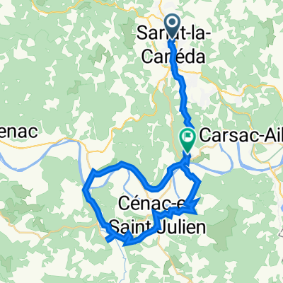
ride from Sarlat-la-Canéda to Carsac-Aillac
Cycling route in Sarlat-la-Canéda, Nouvelle-Aquitaine, France
- 10.3 km
- Distance
- 120 m
- Ascent
- 182 m
- Descent

voie verte sarlat - Cazoulès
Cycling route in Sarlat-la-Canéda, Nouvelle-Aquitaine, France
- 44.2 km
- Distance
- 324 m
- Ascent
- 380 m
- Descent

11 Allée du Majoral Jean Monestier, Sarlat-la-Canéda à 384 Les Bories, Vitrac
Cycling route in Sarlat-la-Canéda, Nouvelle-Aquitaine, France
- 8.5 km
- Distance
- 164 m
- Ascent
- 219 m
- Descent

CIRCUIT 27F
Cycling route in Sarlat-la-Canéda, Nouvelle-Aquitaine, France
- 89.4 km
- Distance
- 531 m
- Ascent
- 594 m
- Descent

sarlat vitrac
Cycling route in Sarlat-la-Canéda, Nouvelle-Aquitaine, France
- 7.9 km
- Distance
- 139 m
- Ascent
- 191 m
- Descent

1 Place de la Petite Rigaudie, Sarlat-la-Canéda to 11 Place Marc Trefeil, Vitrac
Cycling route in Sarlat-la-Canéda, Nouvelle-Aquitaine, France
- 33.7 km
- Distance
- 644 m
- Ascent
- 676 m
- Descent
vitrac
Cycling route in Sarlat-la-Canéda, Nouvelle-Aquitaine, France
- 18.8 km
- Distance
- 229 m
- Ascent
- 298 m
- Descent

carte 132
Cycling route in Sarlat-la-Canéda, Nouvelle-Aquitaine, France
- 99.4 km
- Distance
- 606 m
- Ascent
- 606 m
- Descent
Discover more routes
 ride from Sarlat-la-Canéda to Carsac-Aillac
- Distance
- 10.3 km
- Ascent
- 120 m
- Descent
- 182 m
- Location
- Sarlat-la-Canéda, Nouvelle-Aquitaine, France
 voie verte sarlat - Cazoulès
- Distance
- 44.2 km
- Ascent
- 324 m
- Descent
- 380 m
- Location
- Sarlat-la-Canéda, Nouvelle-Aquitaine, France
 11 Allée du Majoral Jean Monestier, Sarlat-la-Canéda à 384 Les Bories, Vitrac
- Distance
- 8.5 km
- Ascent
- 164 m
- Descent
- 219 m
- Location
- Sarlat-la-Canéda, Nouvelle-Aquitaine, France
 CIRCUIT 27F
- Distance
- 89.4 km
- Ascent
- 531 m
- Descent
- 594 m
- Location
- Sarlat-la-Canéda, Nouvelle-Aquitaine, France
 sarlat vitrac
- Distance
- 7.9 km
- Ascent
- 139 m
- Descent
- 191 m
- Location
- Sarlat-la-Canéda, Nouvelle-Aquitaine, France
 1 Place de la Petite Rigaudie, Sarlat-la-Canéda to 11 Place Marc Trefeil, Vitrac
- Distance
- 33.7 km
- Ascent
- 644 m
- Descent
- 676 m
- Location
- Sarlat-la-Canéda, Nouvelle-Aquitaine, France
 vitrac
- Distance
- 18.8 km
- Ascent
- 229 m
- Descent
- 298 m
- Location
- Sarlat-la-Canéda, Nouvelle-Aquitaine, France
 carte 132
- Distance
- 99.4 km
- Ascent
- 606 m
- Descent
- 606 m
- Location
- Sarlat-la-Canéda, Nouvelle-Aquitaine, France
Routes to Carsac-Aillac
Cycling day trip from
Eyvigues-et-Eybènes to Carsac-Aillac