


Telegraph-Galibier-D'Huez
- 90.9 km
- 3,279 m
- 2,243 m
- Saint-Michel-de-Maurienne, Auvergne-Rhône-Alpes, France

Customize your own route based on our template or discover how our community prefers to cycle from Saint-Michel-de-Maurienne to Huez.
Route template

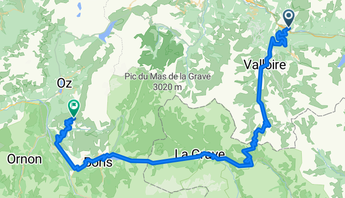
Get ready for a legendary ride! Starting out in Saint-Michel-de-Maurienne, a classic cycling town tucked at the foot of the Alps, you’ll pedal toward Huez – home of the iconic Alpe d’Huez climb, famed for its 21 hairpin bends featured in the Tour de France.
This route packs a punch: around 78 km long, but the real kicker is the climbing—nearly 4000 meters of ascent! You’ll be weaving through quiet mountain roads and hidden alpine paths, so expect some epic scenery (and plenty of chances to catch your breath).
The ride isn’t all smooth sailing, though. About a third is fully paved or asphalt, but much is on quieter, mixed-surface roads, making for an even more adventurous route. Check your tires, bring some snacks, and prepare for big-mountain vibes.
Once in Huez, treat yourself: you’ve just tackled some of the Alps’ finest terrain! This one's for your cycling memory book.
Community
From our community
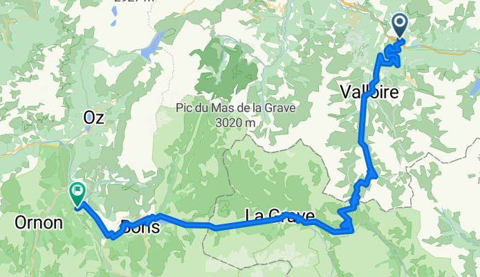
Cycling route in Saint-Michel-de-Maurienne, Auvergne-Rhône-Alpes, France
Cycling route in Saint-Michel-de-Maurienne, Auvergne-Rhône-Alpes, France
Cycling route in Saint-Michel-de-Maurienne, Auvergne-Rhône-Alpes, France
Cycling route in Saint-Michel-de-Maurienne, Auvergne-Rhône-Alpes, France
Cycling route in Saint-Michel-de-Maurienne, Auvergne-Rhône-Alpes, France
Cycling route in Saint-Michel-de-Maurienne, Auvergne-Rhône-Alpes, France
Cycling route in Saint-Michel-de-Maurienne, Auvergne-Rhône-Alpes, France
Cycling route in Saint-Michel-de-Maurienne, Auvergne-Rhône-Alpes, France
Cycling route in Saint-Michel-de-Maurienne, Auvergne-Rhône-Alpes, France
Cycling route in Saint-Michel-de-Maurienne, Auvergne-Rhône-Alpes, France
Cycling route in Saint-Michel-de-Maurienne, Auvergne-Rhône-Alpes, France
Cycling route in Saint-Michel-de-Maurienne, Auvergne-Rhône-Alpes, France
Cycling day trip from
By bicycle from
Cycling day trip from
Cycling day trip from


