
Cycling day trip from Saint-Girons to Tarascon-sur-Ariège
Customize your own route based on our template or discover how our community prefers to cycle from Saint-Girons to Tarascon-sur-Ariège.
Route template
Saint-Girons to Tarascon-sur-Ariège

- 5 h 34 min
- Duration
- 75.4 km
- Distance
- 1,778 m
- Ascent
- 1,696 m
- Descent
- 13.5 km/h
- Avg. speed
- 950 m
- Max. altitude
This cycling route is a real adventure across the Pyrenees, starting in the charming market town of Saint-Girons and winding its way to the historic Tarascon-sur-Ariège. You’ll pedal about 75 km through a mix of rolling countryside, forest tracks, and scenic gravel paths—this isn’t your average paved ride! Prepare for some solid climbing, with nearly 1,800 meters of ascent along the way, reaching elevations around 950 meters.
The first half of the journey is dominated by backcountry gravel and unpaved paths, perfect if you love getting off the beaten track. Don’t forget to soak in the amazing mountain views and maybe spot some wildlife! The route stays mostly quiet, steering clear of traffic—just the way we like it.
Once you arrive, Tarascon-sur-Ariège rewards your efforts with a picturesque old town, Romanesque churches, and a healthy dose of local history. Both towns are gateways to adventure in the Ariège region, making this route a must for anyone who loves a challenge and some seriously beautiful scenery. Bring your gravel bike and plenty of snacks!
Community
Top users in this region


From our community
The best bike routes from Saint-Girons to Tarascon-sur-Ariège

Tour de France 2017 Stage 14
Cycling route in Saint-Girons, Occitanie, France
- 96.6 km
- Distance
- ---
- Ascent
- ---
- Descent

Bethmale - Auzat
Cycling route in Saint-Girons, Occitanie, France
- 72.5 km
- Distance
- 2,574 m
- Ascent
- 2,613 m
- Descent

audressein- col de portech-col d'agnes-col de lers-les cabannes
Cycling route in Saint-Girons, Occitanie, France
- 102.2 km
- Distance
- 1,736 m
- Ascent
- 1,727 m
- Descent

audressein-st. girons-massat-col de lers-les cabannes
Cycling route in Saint-Girons, Occitanie, France
- 91.4 km
- Distance
- 1,170 m
- Ascent
- 1,169 m
- Descent

Pyrenees - Day 8
Cycling route in Saint-Girons, Occitanie, France
- 83.6 km
- Distance
- 1,928 m
- Ascent
- 1,976 m
- Descent

Day 1, 29 May, Castillon - Tarascon
Cycling route in Saint-Girons, Occitanie, France
- 87.4 km
- Distance
- 1,919 m
- Ascent
- 1,994 m
- Descent

Door to Door last day Seix - Auzat 28th Sept
Cycling route in Saint-Girons, Occitanie, France
- 56 km
- Distance
- 2,545 m
- Ascent
- 2,316 m
- Descent

Traversée Pyrénées, Jour 11
Cycling route in Saint-Girons, Occitanie, France
- 136.4 km
- Distance
- 2,787 m
- Ascent
- 2,972 m
- Descent
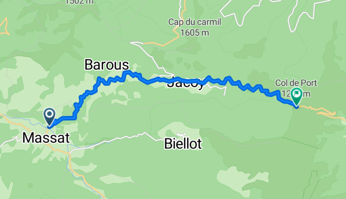
PORT, por Massat
Cycling route in Saint-Girons, Occitanie, France
- 12.5 km
- Distance
- 886 m
- Ascent
- 271 m
- Descent

PYH 2012 dag 6
Cycling route in Saint-Girons, Occitanie, France
- 85.7 km
- Distance
- 1,705 m
- Ascent
- 1,668 m
- Descent

audressein-st girons-aulus les bains-col agnes-col lers-les cabannes
Cycling route in Saint-Girons, Occitanie, France
- 98.6 km
- Distance
- 1,423 m
- Ascent
- 1,397 m
- Descent

Mur de peguerre circle
Cycling route in Saint-Girons, Occitanie, France
- 64.4 km
- Distance
- 1,610 m
- Ascent
- 1,302 m
- Descent
Discover more routes
 Pyrenees - Day 8
- Distance
- 83.6 km
- Ascent
- 1,928 m
- Descent
- 1,976 m
- Location
- Saint-Girons, Occitanie, France
 Day 1, 29 May, Castillon - Tarascon
- Distance
- 87.4 km
- Ascent
- 1,919 m
- Descent
- 1,994 m
- Location
- Saint-Girons, Occitanie, France
 Door to Door last day Seix - Auzat 28th Sept
- Distance
- 56 km
- Ascent
- 2,545 m
- Descent
- 2,316 m
- Location
- Saint-Girons, Occitanie, France
 Traversée Pyrénées, Jour 11
- Distance
- 136.4 km
- Ascent
- 2,787 m
- Descent
- 2,972 m
- Location
- Saint-Girons, Occitanie, France
 PORT, por Massat
- Distance
- 12.5 km
- Ascent
- 886 m
- Descent
- 271 m
- Location
- Saint-Girons, Occitanie, France
 PYH 2012 dag 6
- Distance
- 85.7 km
- Ascent
- 1,705 m
- Descent
- 1,668 m
- Location
- Saint-Girons, Occitanie, France
 audressein-st girons-aulus les bains-col agnes-col lers-les cabannes
- Distance
- 98.6 km
- Ascent
- 1,423 m
- Descent
- 1,397 m
- Location
- Saint-Girons, Occitanie, France
 Mur de peguerre circle
- Distance
- 64.4 km
- Ascent
- 1,610 m
- Descent
- 1,302 m
- Location
- Saint-Girons, Occitanie, France
Routes from Saint-Girons
Cycling day trip from
Saint-Girons to Ax-les-Thermes
Cycling day trip from
Saint-Girons to Bagnères-de-Luchon