
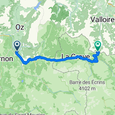
Route template
Huez to Valloire

- 11 h 13 min
- Duration
- 85.4 km
- Distance
- 4,876 m
- Ascent
- 4,971 m
- Descent
- 7.6 km/h
- Avg. speed
- 2,469 m
- Max. altitude
Looking for a big day out in the French Alps? This route takes you from the famous village of Huez—yes, that Huez, at the foot of the legendary Alpe d’Huez switchbacks—all the way to the picturesque mountain town of Valloire. It’s a beast: expect about 85 km of riding, nearly 5,000 meters of climbing (and descending!), and maximum elevation just shy of 2,500 meters.
The ride is a real mix: about 73% of the surface is missing from our reports, but you’ll hit everything from quiet paved roads to gravel, ground, and alpine tracks. This means adventure—pack accordingly! You’ll find yourself high above the valleys, passing alpine meadows and likely spotting marmots (or at least hearing their whistles).
Valloire awaits at the end, a charming ski village in both summer and winter, famous for its cheese and welcoming vibe. Whether you’re aiming to conquer another big alpine classic or just soak in the mountain views, this ride truly delivers the goods.
Community
Top users in this region


From our community
The best bike routes from Huez to Valloire

Classic Climbs - Day 1b - Col Du Galibier
Cycling route in Huez, Auvergne-Rhône-Alpes, France
- 47.2 km
- Distance
- 2,437 m
- Ascent
- 550 m
- Descent

Valloire-Galibier rtu
Cycling route in Huez, Auvergne-Rhône-Alpes, France
- 146.7 km
- Distance
- 4,013 m
- Ascent
- 2,181 m
- Descent

Frankreich 2008 3.Etappe Galibier
Cycling route in Huez, Auvergne-Rhône-Alpes, France
- 47.9 km
- Distance
- 2,423 m
- Ascent
- 523 m
- Descent

lidl-tour-2015-2-3-2
Cycling route in Huez, Auvergne-Rhône-Alpes, France
- 94.7 km
- Distance
- 2,826 m
- Ascent
- 2,187 m
- Descent

T4: Alpe de Huez - Valloire
Cycling route in Huez, Auvergne-Rhône-Alpes, France
- 102.3 km
- Distance
- 2,831 m
- Ascent
- 3,218 m
- Descent

2019 - 7a
Cycling route in Huez, Auvergne-Rhône-Alpes, France
- 96.4 km
- Distance
- 2,342 m
- Ascent
- 1,652 m
- Descent

2019 - 7a - ok
Cycling route in Huez, Auvergne-Rhône-Alpes, France
- 97.1 km
- Distance
- 2,364 m
- Ascent
- 1,680 m
- Descent

BOURG D OISANS - COL DU GALIBIER
Cycling route in Huez, Auvergne-Rhône-Alpes, France
- 47.6 km
- Distance
- 2,360 m
- Ascent
- 450 m
- Descent

TdF 2009 (3) Le Bourg d'Oisans - Col du Galibier
Cycling route in Huez, Auvergne-Rhône-Alpes, France
- 47.7 km
- Distance
- 2,567 m
- Ascent
- 661 m
- Descent

oz~garibie
Cycling route in Huez, Auvergne-Rhône-Alpes, France
- 98.6 km
- Distance
- 3,637 m
- Ascent
- 1,725 m
- Descent

Bourg d'Oisans-Col du Lautaret-Col du Galibier
Cycling route in Huez, Auvergne-Rhône-Alpes, France
- 46.9 km
- Distance
- 2,537 m
- Ascent
- 623 m
- Descent

Bourg d' Oisans - Valloire
Cycling route in Huez, Auvergne-Rhône-Alpes, France
- 48.9 km
- Distance
- 2,197 m
- Ascent
- 1,331 m
- Descent
Discover more routes
 T4: Alpe de Huez - Valloire
- Distance
- 102.3 km
- Ascent
- 2,831 m
- Descent
- 3,218 m
- Location
- Huez, Auvergne-Rhône-Alpes, France
 2019 - 7a
- Distance
- 96.4 km
- Ascent
- 2,342 m
- Descent
- 1,652 m
- Location
- Huez, Auvergne-Rhône-Alpes, France
 2019 - 7a - ok
- Distance
- 97.1 km
- Ascent
- 2,364 m
- Descent
- 1,680 m
- Location
- Huez, Auvergne-Rhône-Alpes, France
 BOURG D OISANS - COL DU GALIBIER
- Distance
- 47.6 km
- Ascent
- 2,360 m
- Descent
- 450 m
- Location
- Huez, Auvergne-Rhône-Alpes, France
 TdF 2009 (3) Le Bourg d'Oisans - Col du Galibier
- Distance
- 47.7 km
- Ascent
- 2,567 m
- Descent
- 661 m
- Location
- Huez, Auvergne-Rhône-Alpes, France
 oz~garibie
- Distance
- 98.6 km
- Ascent
- 3,637 m
- Descent
- 1,725 m
- Location
- Huez, Auvergne-Rhône-Alpes, France
 Bourg d'Oisans-Col du Lautaret-Col du Galibier
- Distance
- 46.9 km
- Ascent
- 2,537 m
- Descent
- 623 m
- Location
- Huez, Auvergne-Rhône-Alpes, France
 Bourg d' Oisans - Valloire
- Distance
- 48.9 km
- Ascent
- 2,197 m
- Descent
- 1,331 m
- Location
- Huez, Auvergne-Rhône-Alpes, France
Routes from Huez
Cycling day trip from
Huez to Les Deux Alpes
Cycling day trip from
Huez to Saint-Jean-de-Maurienne
Routes to Valloire
Bikepacking from
Val d'Isère to Valloire
Cycling day trip from
Le Monêtier-les-Bains to Valloire
Cycling day trip from
Briançon to Valloire
Quick ride by bicycle from
Saint-Michel-de-Maurienne to Valloire