
By bicycle from Briançon to Villar-Saint-Pancrace
Customize your own route based on our template or discover how our community prefers to cycle from Briançon to Villar-Saint-Pancrace.
Route template
Briançon to Villar-Saint-Pancrace

- 35 min
- Duration
- 6.3 km
- Distance
- 146 m
- Ascent
- 206 m
- Descent
- 10.9 km/h
- Avg. speed
- 1,338 m
- Max. altitude
Set off from the historic alpine town of Briançon, perched over 1,300 meters and famous for its UNESCO-listed Vauban fortifications. This scenic 6.3 km ride heads south toward Villar-Saint-Pancrace, weaving through tranquil surroundings. The route eases you out of the bustle of Briançon, giving a mix of quiet roads, cycleways, and just a touch of gravel to keep things interesting. You’ll roll slightly uphill at first (about 146 m of ascent), but enjoy more downhill (over 200 m of descent) as you approach the charming village of Villar-Saint-Pancrace, nestled in the Guisane valley. Expect mostly paved surfaces—great for any type of bike! Along the way, keep your eyes peeled for mountain vistas and maybe a marmot or two if you’re lucky. It’s a short but rewarding ramble between two classic Hautes-Alpes villages, perfect for a leisurely afternoon spin.
Community
Top users in this region


From our community
The best bike routes from Briançon to Villar-Saint-Pancrace

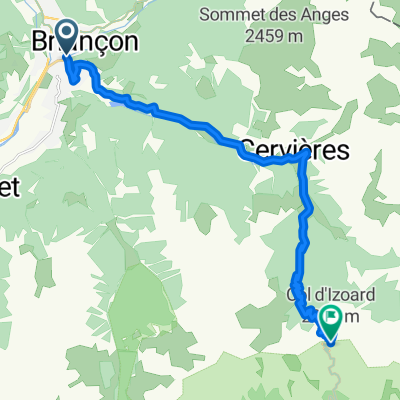
briancon-izoard
Cycling route in Briançon, Provence-Alpes-Côte d'Azur Region, France
- 20.4 km
- Distance
- 1,201 m
- Ascent
- 155 m
- Descent

Col des Ayes
Cycling route in Briançon, Provence-Alpes-Côte d'Azur Region, France
- 24.7 km
- Distance
- 1,299 m
- Ascent
- 833 m
- Descent

Etape du Tour 2017 Strava
Cycling route in Briançon, Provence-Alpes-Côte d'Azur Region, France
- 180.9 km
- Distance
- 2,964 m
- Ascent
- 1,795 m
- Descent

Etape du Tour 2017 Briançon Izoard
Cycling route in Briançon, Provence-Alpes-Côte d'Azur Region, France
- 180.1 km
- Distance
- 2,833 m
- Ascent
- 1,825 m
- Descent

11 tappa traversata alpi
Cycling route in Briançon, Provence-Alpes-Côte d'Azur Region, France
- 20.3 km
- Distance
- 1,174 m
- Ascent
- 27 m
- Descent

Izoard da Briançon
Cycling route in Briançon, Provence-Alpes-Côte d'Azur Region, France
- 19.1 km
- Distance
- 1,185 m
- Ascent
- 28 m
- Descent

Etape du Tour 2017: Briançon-Izoard
Cycling route in Briançon, Provence-Alpes-Côte d'Azur Region, France
- 182.3 km
- Distance
- 3,037 m
- Ascent
- 1,871 m
- Descent

Izoard Nord
Cycling route in Briançon, Provence-Alpes-Côte d'Azur Region, France
- 19.2 km
- Distance
- 1,167 m
- Ascent
- 20 m
- Descent

6. Tag Teil 1
Cycling route in Briançon, Provence-Alpes-Côte d'Azur Region, France
- 19.6 km
- Distance
- 1,173 m
- Ascent
- 60 m
- Descent

Briançon- Col De izoard
Cycling route in Briançon, Provence-Alpes-Côte d'Azur Region, France
- 71 km
- Distance
- 1,383 m
- Ascent
- 870 m
- Descent

Letape du Tour 2017. Bikemap version
Cycling route in Briançon, Provence-Alpes-Côte d'Azur Region, France
- 184.2 km
- Distance
- 2,946 m
- Ascent
- 1,812 m
- Descent

KD Avanturist - Izoard 2360m
Cycling route in Briançon, Provence-Alpes-Côte d'Azur Region, France
- 19.7 km
- Distance
- 1,255 m
- Ascent
- 100 m
- Descent
Discover more routes
 11 tappa traversata alpi
- Distance
- 20.3 km
- Ascent
- 1,174 m
- Descent
- 27 m
- Location
- Briançon, Provence-Alpes-Côte d'Azur Region, France
 Izoard da Briançon
- Distance
- 19.1 km
- Ascent
- 1,185 m
- Descent
- 28 m
- Location
- Briançon, Provence-Alpes-Côte d'Azur Region, France
 Etape du Tour 2017: Briançon-Izoard
- Distance
- 182.3 km
- Ascent
- 3,037 m
- Descent
- 1,871 m
- Location
- Briançon, Provence-Alpes-Côte d'Azur Region, France
 Izoard Nord
- Distance
- 19.2 km
- Ascent
- 1,167 m
- Descent
- 20 m
- Location
- Briançon, Provence-Alpes-Côte d'Azur Region, France
 6. Tag Teil 1
- Distance
- 19.6 km
- Ascent
- 1,173 m
- Descent
- 60 m
- Location
- Briançon, Provence-Alpes-Côte d'Azur Region, France
 Briançon- Col De izoard
- Distance
- 71 km
- Ascent
- 1,383 m
- Descent
- 870 m
- Location
- Briançon, Provence-Alpes-Côte d'Azur Region, France
 Letape du Tour 2017. Bikemap version
- Distance
- 184.2 km
- Ascent
- 2,946 m
- Descent
- 1,812 m
- Location
- Briançon, Provence-Alpes-Côte d'Azur Region, France
 KD Avanturist - Izoard 2360m
- Distance
- 19.7 km
- Ascent
- 1,255 m
- Descent
- 100 m
- Location
- Briançon, Provence-Alpes-Côte d'Azur Region, France
Routes from Briançon
Cycling day trip from
Briançon to Jausiers
Cycling day trip from
Briançon to Huez
By bicycle from
Briançon to Le Monêtier-les-Bains
By bicycle from
Briançon to Villeneuve
Routes to Villar-Saint-Pancrace
Cycling day trip from
Guillestre to Villar-Saint-Pancrace