
Cycling day trip from Szombathely to Vasvár
Customize your own route based on our template or discover how our community prefers to cycle from Szombathely to Vasvár.
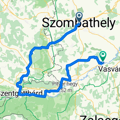
Route template
Szombathely to Vasvár

- 5 h 5 min
- Duration
- 70.4 km
- Distance
- 351 m
- Ascent
- 368 m
- Descent
- 13.9 km/h
- Avg. speed
- 239 m
- Max. altitude
Ready for a scenic adventure between two gems in western Hungary? Hop on your bike in Szombathely, a lively city known for its Roman roots (check out the ancient Savaria ruins if you have time), and head south towards Vasvár—a charming small town rich in medieval history.
The route is about 70 km—so it’s a solid day ride. You’ll climb just over 350 meters and descend slightly more, which means some gentle ups and downs but nothing too intense. A good chunk of the route is on tracks (expect a mix of paved and rougher ground), so a gravel or mountain bike will feel right at home. About a third of the way is paved or asphalt, but be ready for some gravel and unpaved sections, giving your ride a bit of adventure.
You’ll cruise along quiet roads and cycleways for most of the journey with hardly any busy traffic. When you roll into Vasvár, take a stroll through its peaceful main square and soak in its small-town vibe—it’s the perfect finish for a memorable day in the saddle!
Community
Top users in this region


From our community
The best bike routes from Szombathely to Vasvár

Jeli Arborétum oda- vissza
Cycling route in Szombathely, Vas County, Hungary
- 28 km
- Distance
- 69 m
- Ascent
- 49 m
- Descent

Szombathely- Kám- Jeli Arborétum
Cycling route in Szombathely, Vas County, Hungary
- 29.2 km
- Distance
- 59 m
- Ascent
- 45 m
- Descent
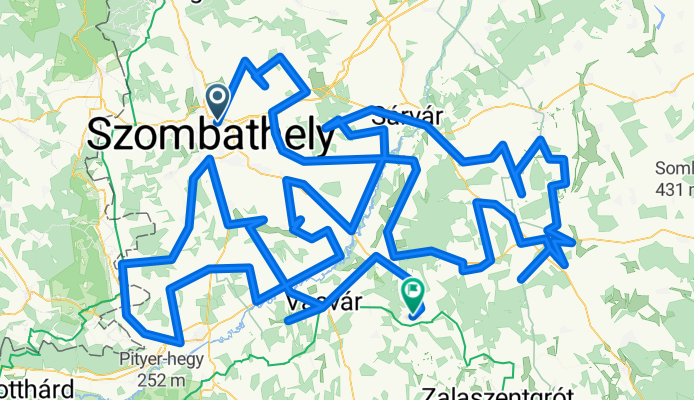
Vas megye összes települése 2. nap
Cycling route in Szombathely, Vas County, Hungary
- 367.8 km
- Distance
- 395 m
- Ascent
- 435 m
- Descent

Kenyérvíz utca 2, Szombathely - Arany János utca 12, Rábatöttös
Cycling route in Szombathely, Vas County, Hungary
- 23.2 km
- Distance
- 31 m
- Ascent
- 63 m
- Descent

Kenyérvíz utca 2, Szombathely - Arany János utca 12, Rábatöttös
Cycling route in Szombathely, Vas County, Hungary
- 23.2 km
- Distance
- 21 m
- Ascent
- 54 m
- Descent

From Szombathely to Rábahídvég
Cycling route in Szombathely, Vas County, Hungary
- 112 km
- Distance
- 735 m
- Ascent
- 774 m
- Descent

Pázmány Péter körút 4, Szombathely - Arany János utca 12, Rábatöttös
Cycling route in Szombathely, Vas County, Hungary
- 24 km
- Distance
- 39 m
- Ascent
- 71 m
- Descent

Pázmány Péter körút 4, Szombathely - Arany János utca 12, Rábatöttös
Cycling route in Szombathely, Vas County, Hungary
- 23.6 km
- Distance
- 30 m
- Ascent
- 114 m
- Descent

Pázmány Péter körút 6, Szombathely - Arany János utca 12, Rábatöttös
Cycling route in Szombathely, Vas County, Hungary
- 24 km
- Distance
- 44 m
- Ascent
- 82 m
- Descent

Hunyadi János út 57, Szombathely - Arany János utca 10, Rábatöttös
Cycling route in Szombathely, Vas County, Hungary
- 23.2 km
- Distance
- 55 m
- Ascent
- 81 m
- Descent

Pázmány Péter körút 4, Szombathely - Arany János utca 12, Rábatöttös
Cycling route in Szombathely, Vas County, Hungary
- 23.5 km
- Distance
- 137 m
- Ascent
- 170 m
- Descent

Kenyérvíz utca 2, Szombathely - Arany János utca 12, Rábatöttös
Cycling route in Szombathely, Vas County, Hungary
- 23.1 km
- Distance
- 17 m
- Ascent
- 88 m
- Descent
Discover more routes
 Kenyérvíz utca 2, Szombathely - Arany János utca 12, Rábatöttös
- Distance
- 23.2 km
- Ascent
- 21 m
- Descent
- 54 m
- Location
- Szombathely, Vas County, Hungary
 From Szombathely to Rábahídvég
- Distance
- 112 km
- Ascent
- 735 m
- Descent
- 774 m
- Location
- Szombathely, Vas County, Hungary
 Pázmány Péter körút 4, Szombathely - Arany János utca 12, Rábatöttös
- Distance
- 24 km
- Ascent
- 39 m
- Descent
- 71 m
- Location
- Szombathely, Vas County, Hungary
 Pázmány Péter körút 4, Szombathely - Arany János utca 12, Rábatöttös
- Distance
- 23.6 km
- Ascent
- 30 m
- Descent
- 114 m
- Location
- Szombathely, Vas County, Hungary
 Pázmány Péter körút 6, Szombathely - Arany János utca 12, Rábatöttös
- Distance
- 24 km
- Ascent
- 44 m
- Descent
- 82 m
- Location
- Szombathely, Vas County, Hungary
 Hunyadi János út 57, Szombathely - Arany János utca 10, Rábatöttös
- Distance
- 23.2 km
- Ascent
- 55 m
- Descent
- 81 m
- Location
- Szombathely, Vas County, Hungary
 Pázmány Péter körút 4, Szombathely - Arany János utca 12, Rábatöttös
- Distance
- 23.5 km
- Ascent
- 137 m
- Descent
- 170 m
- Location
- Szombathely, Vas County, Hungary
 Kenyérvíz utca 2, Szombathely - Arany János utca 12, Rábatöttös
- Distance
- 23.1 km
- Ascent
- 17 m
- Descent
- 88 m
- Location
- Szombathely, Vas County, Hungary
Routes from Szombathely
Cycling day trip from
Szombathely to Kőszeg
By bicycle from
Szombathely to Gencsapáti
By bicycle from
Szombathely to Ják