
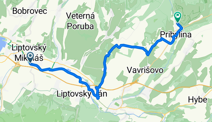
Cycling day trip from Liptovský Mikuláš to Pribylina
Customize your own route based on our template or discover how our community prefers to cycle from Liptovský Mikuláš to Pribylina.
Route template
Liptovský Mikuláš to Pribylina

- 1 h 20 min
- Duration
- 20.4 km
- Distance
- 244 m
- Ascent
- 55 m
- Descent
- 15.4 km/h
- Avg. speed
- 769 m
- Max. altitude
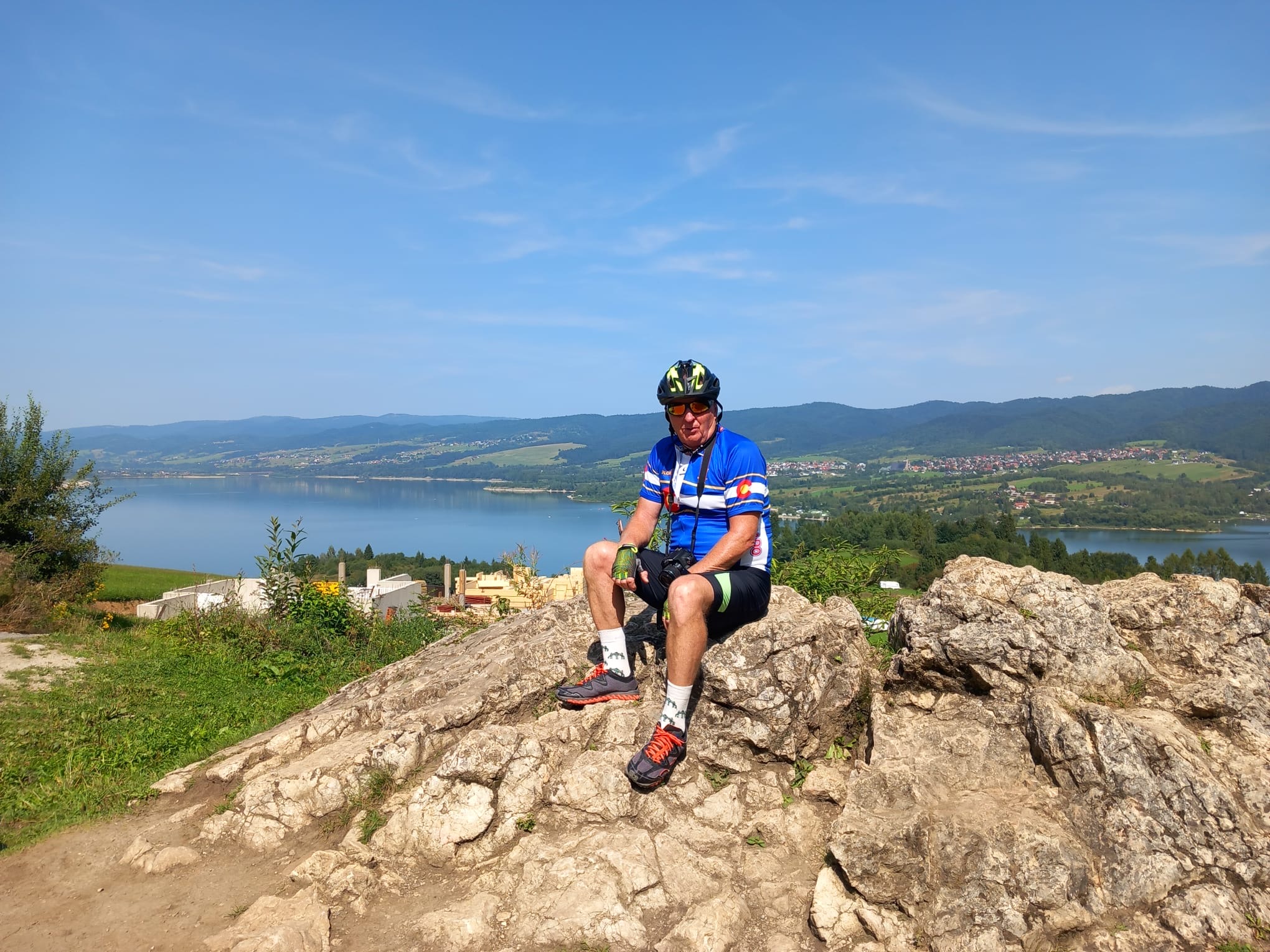
This scenic cycling route takes you from the lively town of Liptovský Mikuláš—famous as the gateway to the Tatra Mountains and a hub for outdoor adventure—to the picturesque mountain village of Pribylina.
The journey covers just over 20 km and is perfect for a half-day ride. You’ll leave the Low Tatras behind, rolling through a mix of quiet roads, rural tracks, and stretches of pretty decent asphalt. Expect a gentle but steady climb of around 240 meters, with a few short gravel or unpaved sections that add a dash of adventure (but most bikes will handle it fine).
Along the way, you’ll catch glimpses of the lush Liptov countryside, dotted with sheep pastures and views of the surrounding hills. Pribylina, your destination, is known for its open-air museum showcasing traditional Slovak rural life—a great place to unwind and explore if you have time.
Tip: Pack a snack and enjoy a laid-back pace; this route is less about speed and more about soaking up classic Slovak nature and village charm!
Community
Top users in this region


From our community
The best bike routes from Liptovský Mikuláš to Pribylina
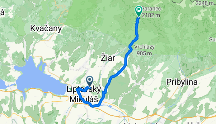
From Liptovsky Mikulas to Žiar
Cycling route in Liptovský Mikuláš, Žilina Region, Slovakia
- 22.8 km
- Distance
- 804 m
- Ascent
- 191 m
- Descent
LM- Podtureň- Jamník- Pribilina
Cycling route in Liptovský Mikuláš, Žilina Region, Slovakia
- 23 km
- Distance
- 3,715 m
- Ascent
- 3,498 m
- Descent

LM- Žiar- Pod Holým vrchom - Úzka / Račková dolina
Cycling route in Liptovský Mikuláš, Žilina Region, Slovakia
- 18.4 km
- Distance
- 6,016 m
- Ascent
- 5,684 m
- Descent

Vlasky->Ziarska chata
Cycling route in Liptovský Mikuláš, Žilina Region, Slovakia
- 38.3 km
- Distance
- 859 m
- Ascent
- 95 m
- Descent

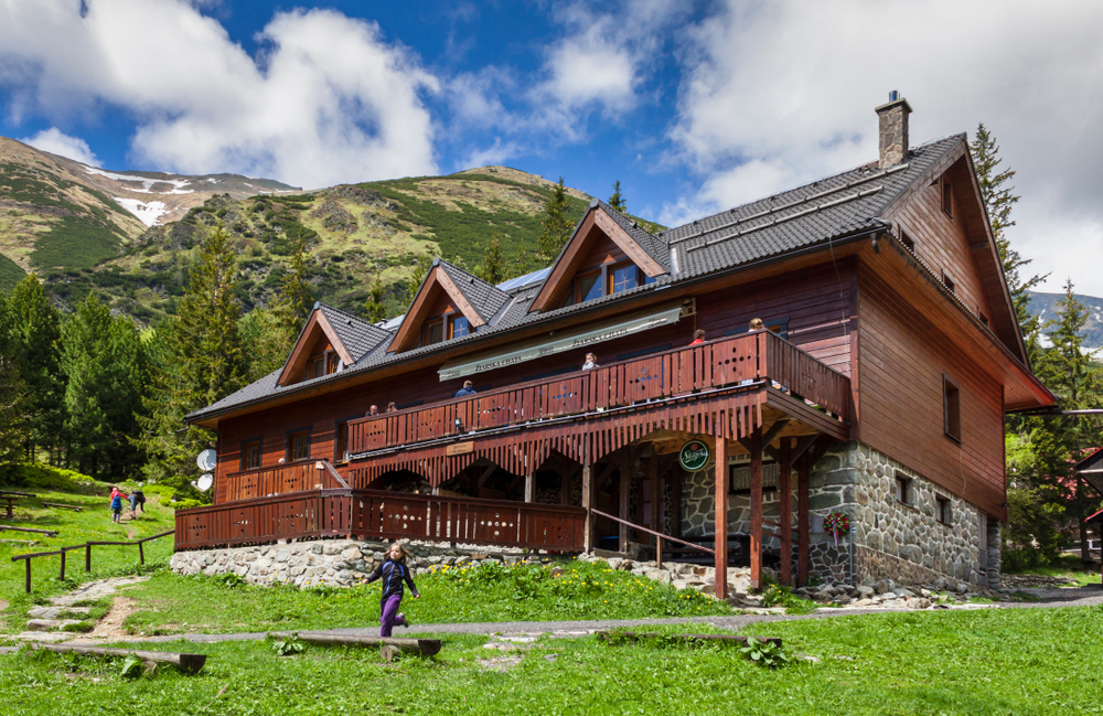
Žiarska Chata
Cycling route in Liptovský Mikuláš, Žilina Region, Slovakia
- 33.1 km
- Distance
- 982 m
- Ascent
- 669 m
- Descent

Liptovský Mikuláš - Jamník - Račkova Dolina
Cycling route in Liptovský Mikuláš, Žilina Region, Slovakia
- 18.3 km
- Distance
- 365 m
- Ascent
- 39 m
- Descent

Žiarska chata
Cycling route in Liptovský Mikuláš, Žilina Region, Slovakia
- 14.7 km
- Distance
- 687 m
- Ascent
- 0 m
- Descent

Lipt.Mikuláš-Jakubovany -Pod Holým vrchom
Cycling route in Liptovský Mikuláš, Žilina Region, Slovakia
- 15 km
- Distance
- 355 m
- Ascent
- 4 m
- Descent

Liptovský Mikuláš - Jamník - Pribilina
Cycling route in Liptovský Mikuláš, Žilina Region, Slovakia
- 18 km
- Distance
- 262 m
- Ascent
- 69 m
- Descent

LM - Bývalá Ťatliakova chata
Cycling route in Liptovský Mikuláš, Žilina Region, Slovakia
- 47.9 km
- Distance
- 1,349 m
- Ascent
- 556 m
- Descent

Lipt.Mikuláš - Lipt.Hrádok - Podbanské
Cycling route in Liptovský Mikuláš, Žilina Region, Slovakia
- 29.9 km
- Distance
- 406 m
- Ascent
- 51 m
- Descent

Liptovský Mikuláš - Jamník - Pribilina
Cycling route in Liptovský Mikuláš, Žilina Region, Slovakia
- 18 km
- Distance
- 265 m
- Ascent
- 73 m
- Descent
Discover more routes
 Žiarska Chata
- Distance
- 33.1 km
- Ascent
- 982 m
- Descent
- 669 m
- Location
- Liptovský Mikuláš, Žilina Region, Slovakia
 Liptovský Mikuláš - Jamník - Račkova Dolina
- Distance
- 18.3 km
- Ascent
- 365 m
- Descent
- 39 m
- Location
- Liptovský Mikuláš, Žilina Region, Slovakia
 Žiarska chata
- Distance
- 14.7 km
- Ascent
- 687 m
- Descent
- 0 m
- Location
- Liptovský Mikuláš, Žilina Region, Slovakia
 Lipt.Mikuláš-Jakubovany -Pod Holým vrchom
- Distance
- 15 km
- Ascent
- 355 m
- Descent
- 4 m
- Location
- Liptovský Mikuláš, Žilina Region, Slovakia
 Liptovský Mikuláš - Jamník - Pribilina
- Distance
- 18 km
- Ascent
- 262 m
- Descent
- 69 m
- Location
- Liptovský Mikuláš, Žilina Region, Slovakia
 LM - Bývalá Ťatliakova chata
- Distance
- 47.9 km
- Ascent
- 1,349 m
- Descent
- 556 m
- Location
- Liptovský Mikuláš, Žilina Region, Slovakia
 Lipt.Mikuláš - Lipt.Hrádok - Podbanské
- Distance
- 29.9 km
- Ascent
- 406 m
- Descent
- 51 m
- Location
- Liptovský Mikuláš, Žilina Region, Slovakia
 Liptovský Mikuláš - Jamník - Pribilina
- Distance
- 18 km
- Ascent
- 265 m
- Descent
- 73 m
- Location
- Liptovský Mikuláš, Žilina Region, Slovakia
Routes from Liptovský Mikuláš
Cycling day trip from
Liptovský Mikuláš to Ružomberok
Cycling day trip from
Liptovský Mikuláš to Vysoké Tatry
By bicycle from
Liptovský Mikuláš to Liptovský Hrádok