
Route template
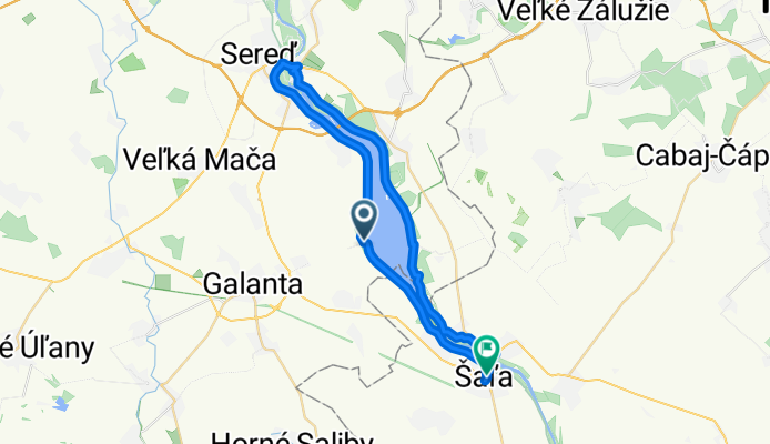
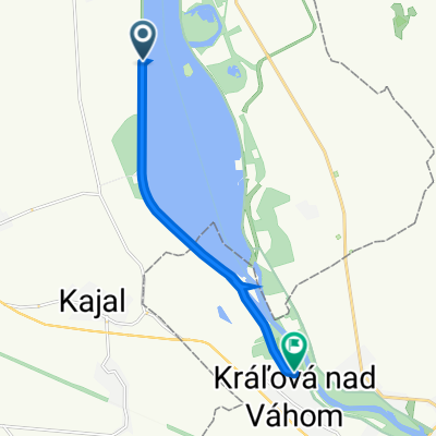
Galanta to Šaľa

- 1 h 29 min
- Duration
- 24.6 km
- Distance
- 24 m
- Ascent
- 26 m
- Descent
- 16.6 km/h
- Avg. speed
- 122 m
- Max. altitude
Ready for a relaxed ride through southwestern Slovakia? Start in Galanta, a lively town known for its historic Esterházy Palace and great Hungarian-influenced food. Pedal mostly on smooth, paved surfaces—perfect for cruising—while the route keeps things easy: just a gentle ascent and descent, so you won’t break a sweat.
About 43% of your journey is on dedicated cycle paths, and most of the rest is along quiet, low-traffic roads, offering you peaceful views of the surrounding fields and villages. You’ll cover around 25 km in under two and a half hours at a chill pace. While there’s a short stretch of unpaved and gravelly spots, it keeps things interesting without being too taxing.
You’ll finish in Šaľa, a small riverside town with a pretty center and a relaxed local vibe—perfect for a coffee or snack at the end of your ride. Enjoy the smooth countryside, fresh air, and easy-going cycling from Galanta to Šaľa!
Community
Top users in this region


From our community
The best bike routes from Galanta to Šaľa
kaskády - vodná nádrž
Cycling route in Galanta, Trnava Region, Slovakia
- 51.6 km
- Distance
- 116 m
- Ascent
- 116 m
- Descent
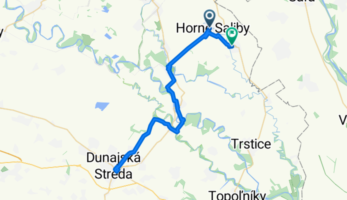
Horné Saliby - Duna Szerdahelyi - Dolné Saliby
Cycling route in Galanta, Trnava Region, Slovakia
- 52.2 km
- Distance
- 64 m
- Ascent
- 66 m
- Descent


Jesenského 55 do Cesta bez názvu, Dlhá nad Váhom
Cycling route in Galanta, Trnava Region, Slovakia
- 22.4 km
- Distance
- 14 m
- Ascent
- 34 m
- Descent

Kaskády 01
Cycling route in Galanta, Trnava Region, Slovakia
- 13.4 km
- Distance
- 15 m
- Ascent
- 19 m
- Descent


Galanta - Matúškovo - Diakovce (kúpalisko)
Cycling route in Galanta, Trnava Region, Slovakia
- 11.2 km
- Distance
- 9 m
- Ascent
- 12 m
- Descent

Sereď - Váhovce - Šaľa
Cycling route in Galanta, Trnava Region, Slovakia
- 20.4 km
- Distance
- 50 m
- Ascent
- 56 m
- Descent

Galanta - Kolónia - Kaskády (v.n. Kráľová) - Šaľa
Cycling route in Galanta, Trnava Region, Slovakia
- 14 km
- Distance
- 35 m
- Ascent
- 38 m
- Descent
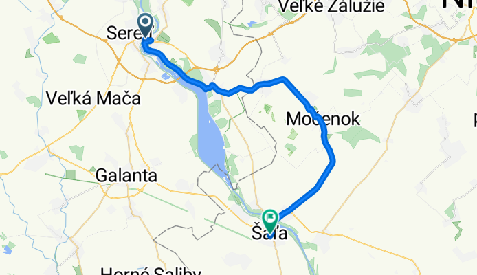
Sereď - Šoporňa - Hájske - H.Kráľová - Močenok - Šaľa
Cycling route in Galanta, Trnava Region, Slovakia
- 29.5 km
- Distance
- 90 m
- Ascent
- 94 m
- Descent

ga-cyklookruh z ga do sa
Cycling route in Galanta, Trnava Region, Slovakia
- 76.5 km
- Distance
- 23 m
- Ascent
- 25 m
- Descent
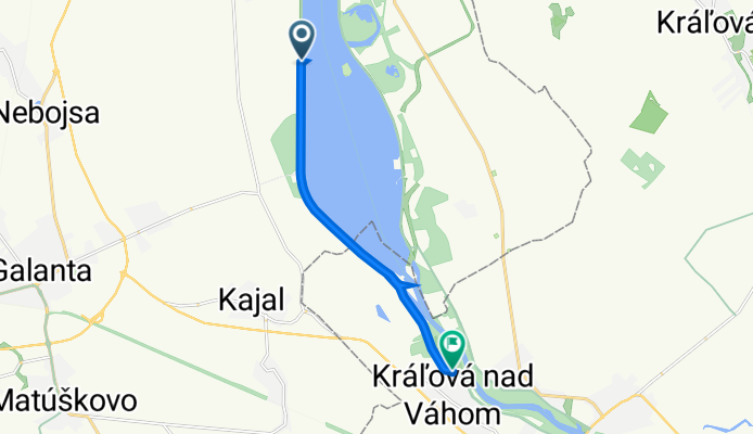
Cesta bez názvu, Váhovce do Kráľová nad Váhom
Cycling route in Galanta, Trnava Region, Slovakia
- 8.2 km
- Distance
- 4 m
- Ascent
- 67 m
- Descent

Váhovce - Pionierska
Cycling route in Galanta, Trnava Region, Slovakia
- 40.6 km
- Distance
- 89 m
- Ascent
- 99 m
- Descent
Discover more routes
 sala2018
- Distance
- 16.9 km
- Ascent
- 399 m
- Descent
- 405 m
- Location
- Galanta, Trnava Region, Slovakia
 Galanta - Matúškovo - Diakovce (kúpalisko)
- Distance
- 11.2 km
- Ascent
- 9 m
- Descent
- 12 m
- Location
- Galanta, Trnava Region, Slovakia
 Sereď - Váhovce - Šaľa
- Distance
- 20.4 km
- Ascent
- 50 m
- Descent
- 56 m
- Location
- Galanta, Trnava Region, Slovakia
 Galanta - Kolónia - Kaskády (v.n. Kráľová) - Šaľa
- Distance
- 14 km
- Ascent
- 35 m
- Descent
- 38 m
- Location
- Galanta, Trnava Region, Slovakia
 Sereď - Šoporňa - Hájske - H.Kráľová - Močenok - Šaľa
- Distance
- 29.5 km
- Ascent
- 90 m
- Descent
- 94 m
- Location
- Galanta, Trnava Region, Slovakia
 ga-cyklookruh z ga do sa
- Distance
- 76.5 km
- Ascent
- 23 m
- Descent
- 25 m
- Location
- Galanta, Trnava Region, Slovakia
 Cesta bez názvu, Váhovce do Kráľová nad Váhom
- Distance
- 8.2 km
- Ascent
- 4 m
- Descent
- 67 m
- Location
- Galanta, Trnava Region, Slovakia
 Váhovce - Pionierska
- Distance
- 40.6 km
- Ascent
- 89 m
- Descent
- 99 m
- Location
- Galanta, Trnava Region, Slovakia
Routes from Galanta
Cycling day trip from
Galanta to Trnava